USGS Coastal and Marine Geology Program

The Coastal and Marine Geology Program shares a wide range of resources to help explain and illustrate scientific concepts, our scientific activities, expertise, technology, tools, and other educational resources. Through newsletters, multimedia resources, special events, and other products, you can learn more about the many ways our science supports the Nation.
![]() Sound Waves: Bi-monthly newsletter about coastal and marine science
Sound Waves: Bi-monthly newsletter about coastal and marine science
Newswave: Quarterly newsletter about ocean, coastal and Great Lakes activities at the U.S. Department of the Interior
USGS Newsroom: Press releases, science feature stories, technical announcements, Congressional briefings, multimedia gallery, media contacts
 Multimedia resources include photograph and image galleries, graphic images, animations, videos and podcasts.
Animations, Videos, and Movies
Coastal and Marine Geology Podcast ![]()
video and audio podcasts describe USGS science and field work
Pacific Coastal and Marine Science Center (California): animated, 3-D views and live videos of the seafloor, rivers, and tsunamis; and science videos on USGS field work, tsunami preparedness, and more
Woods Hole Coastal and Marine Science Center (Massachusetts): animated, 3-D views and live videos of the seafloor; science videos on USGS field work; and more
Before and After Hurricane Photo Pairs
Pre- and post-storm photo comparisons show examples of coastal change resulting from hurricanes and extreme storms like Hurricane Sandy, Hurricane Isaac, Hurricane Katrina, and more.
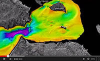
Movies and animations of tsunami and earthquake hazards
Caribbean studies: these movies describe the data collection at sea, present 3-D fly-bys through the underwater topography of the Puerto Rico trench, and discuss the scientific objectives of the mapping effort.
Global studies: Watch computer-generated animations of what a tsunami looks like, as it propagates across the ocean and hits land. Tsunamis modeled include the 2011 Honshu, Japan tsunami, the 2004 Indian Ocean tsunami, and more.
Photo Galleries
The Woods Hole Coastal and Marine Science Center Photo Archive is a collection of photographs of the seafloor and candid scenes taken during various field operations. Photos are indexed and can be searched using keywords like research activity ID, scientist's name, ship name, or type of field gear.
 Create your own map!
Ask a Geologist! Do you have a question about sea-level rise, coastal change, hurricanes, or tsunamis?
Access the collection of more than 900 educator resources suitable for use by K-12 and college level students.
Visit and explore the USGS Education site for extensive education resources, tools, and information!
Discover prospects for undergraduate, graduate students, and faculty to participate in USGS science through internships, employment opportunities, and research grants.
 Native Youth in Science
The Woods Hole Coastal and Marine Science Center partnered with the Mashpee Wampanoag Tribe to develop and deliver a summer science program for tribal youth.
Science Seminars
The public is welcome to join staff at the Pacific Coastal & Marine Science Center in Santa Cruz, CA, for scientific talks and presentations given by local scientists and researchers.
