
Damage indicates a 10-meter flow depth.
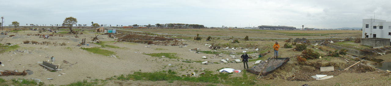
Photo from Natori, south of Sendai.
On March 11, 2011 a magnitude 9.1 “great” earthquake off the east coast of Japan generated a Pacific-wide tsunami that was catastrophic along the coast of northeastern Honshu, Japan. The first tsunami wave arrived at the Honshu coastline nearest to the epicenter within about 15 minutes of the earthquake with subsequent waves arriving in the hours that followed, in places 10m or more in height. Entire communities were flooded by the waves and substantial infrastructure was damaged.
PCMSC oceanographer Bruce Jaffe and geologist Bruce Richmond visited Japan, collecting time-sensitive data to help them determine the height of tsunami waves at various sites and the distances the waves traveled inland. They studied the transport of sediment and other debris, looked for and measured evidence of subsidence and uplift caused by the earthquake, documented erosion caused by the tsunami waves, and made other observations critical to the better understanding of tsunami impacts and processes.
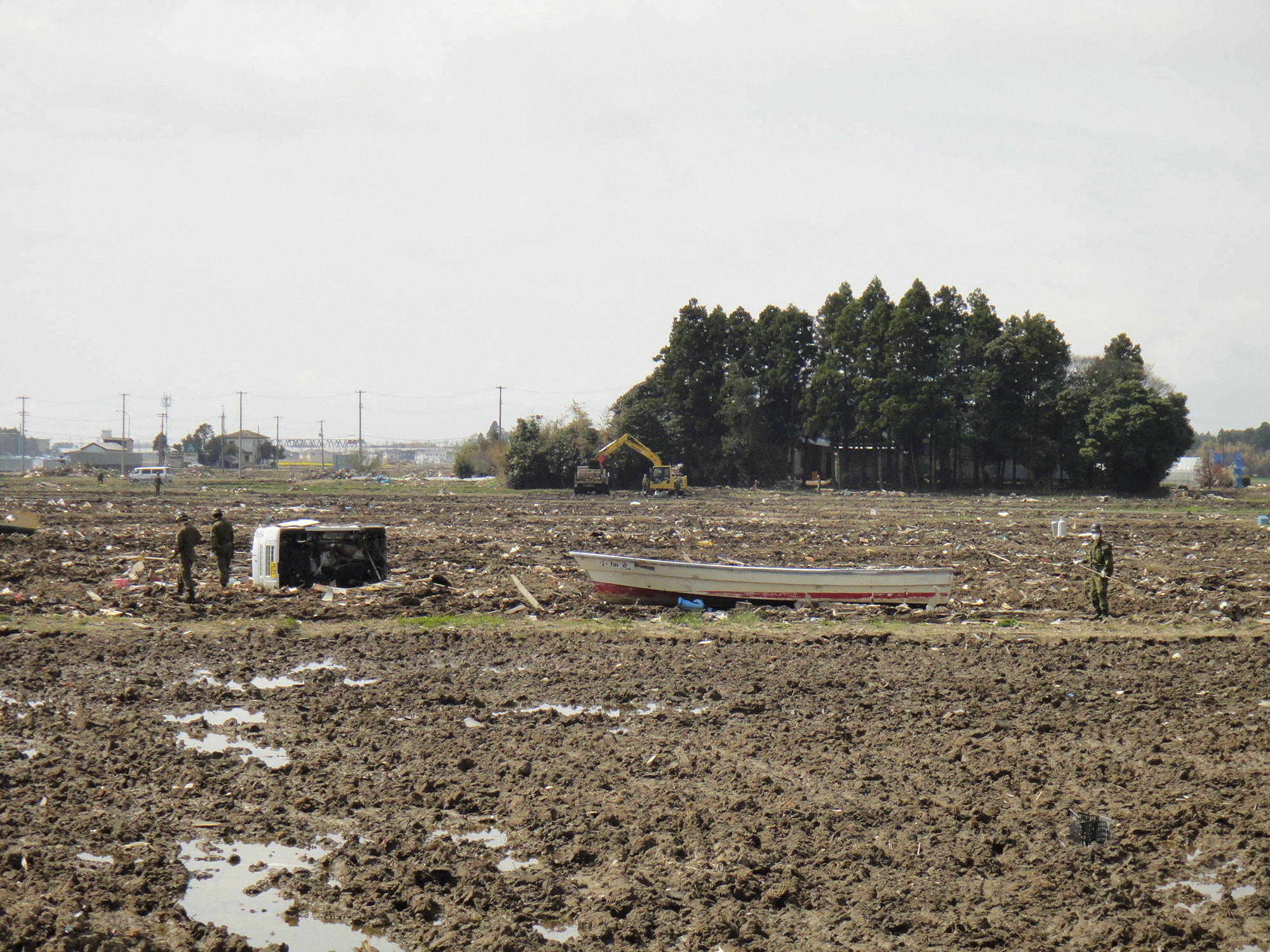
Amazing devastation- the tsunami inundated 4 km where I am working. Tsunami flow depths of 10 m near the coast. Inundation distances >4 km. Huge amounts of debris (pieces of houses, cars, etc.). More than 100,000 cars were destroyed by the tsunami in the area. That's 10% of all the cars. [It appears that] the earthquake did very little damage.
 Erosion in back of the Arahama Beach seawall, Sendai. |
 Tree snap indicating onshore flow at Arahama Beach, Sendai. |
 Scientists running a transect at the Sendai airport. |
|
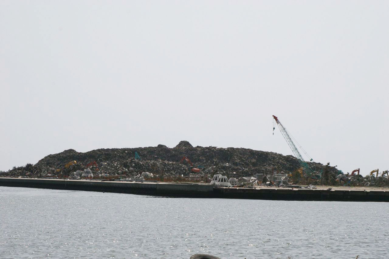 Mountain of debris cleaned out of Natori, south of Sendai. |
 Debris wrapped around structure in Natori, south of Sendai. |
 Clean-up continues near the limit of inundation in Natori, south of Sendai. |
|
 Foundations in Natori, south of Sendai. |
|
 ITST Scientist Nishimura-sensei demonstrating the tool called the “geoslicer” |
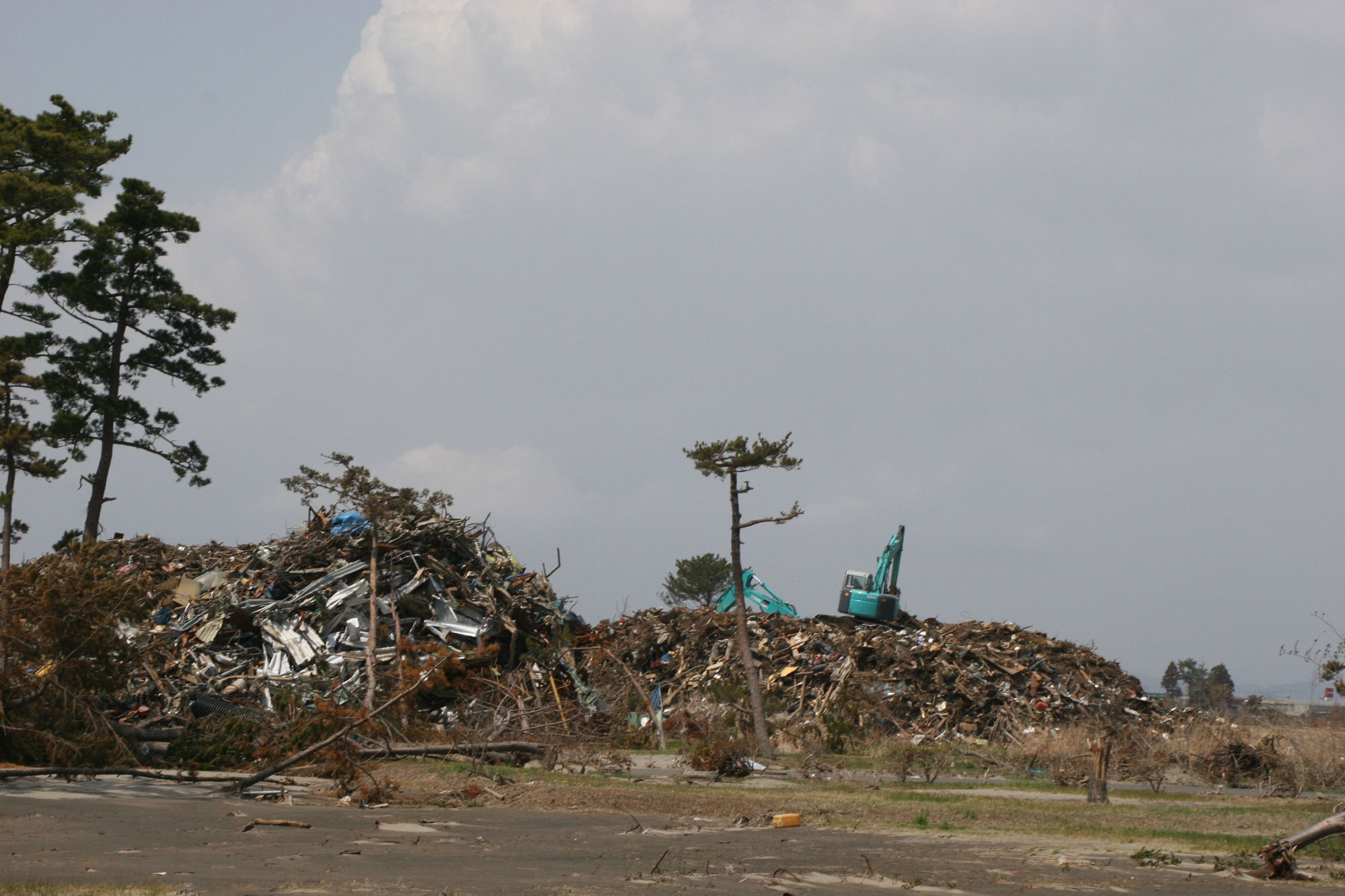 Clean-up pile at Iwanuma Seaside Park, South of Natori. |
 The tsunami also propagated across the Pacific Ocean and was measured both by oceanic buoys and by coastal tide stations. As noted by the International Tsunami Information Center (http://itic.ioc-unesco.org/):
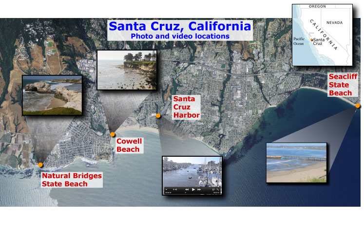
 Crowd on top of cliff at Seacliff State Beach, CA watching the tsunami waves come in. [Larger version] |
 Safe tsunami tourists waiting on top of a cliff at Seacliff Beach, CA for the tsunami to come in. [Larger version] |
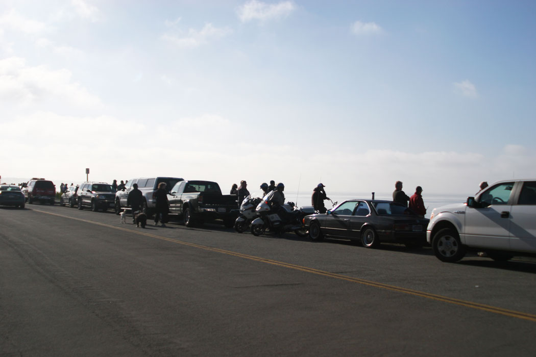
 Red paint exposed on the concrete ship Palo Alto during drawdown of the tsunami at 9:09 am. Drawdown is about 1-1.5 m. The normal low water level is at the boundary between the orange paint and gray-green biologic growth band. [Larger version] |
 Tsunami tourist walking in an unsafe zone exposed by the tsunami drawdown at 9:10 am. Fortunately, the tsunami was like a slow moving tide (not always the case, it can be a fast moving bores) and the people in this photo moved out of the danger zone before the tsunami crest came in. [Larger version] |
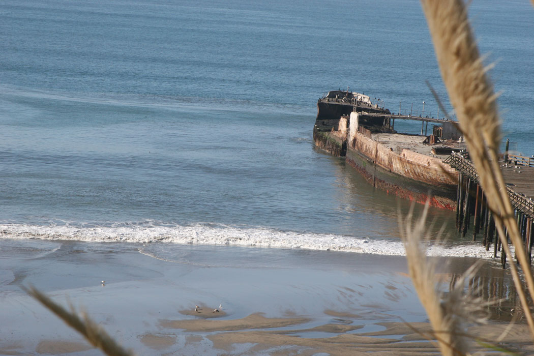
 Onlooker sees sand bar that is usually underwater exposed by the tsunami drawdown at 9:16 am. [Larger version] |
 Water level when the tsunami crest came onshore. The tsunami arrived at a low tide (about 0.3 m above mean lower low water). As a result, the tsunami did not inundate as far as it would have had the tide been high. The waves in this photograph are from a distant swell, not the tsunami. [Larger version] |
![]()
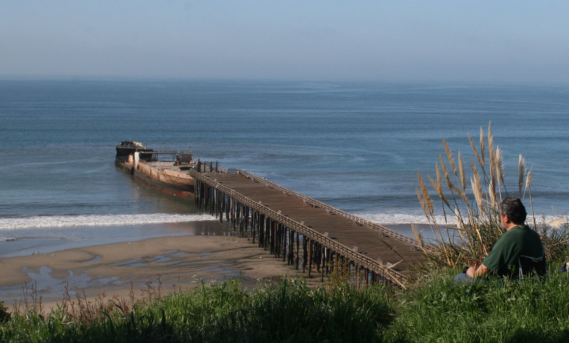
 Cement ship SS Palo Alto and pier at maximum drawdown [Larger version] |
 Palo Alto stern and pier at maximum drawdown [Larger version] |
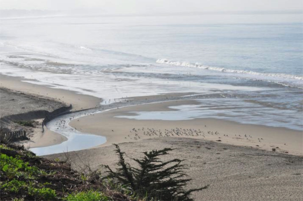 Aptos Creek mouth at maximum drawdown [Larger version] |
 Incoming wave bore at Aptos Creek [Larger version] |
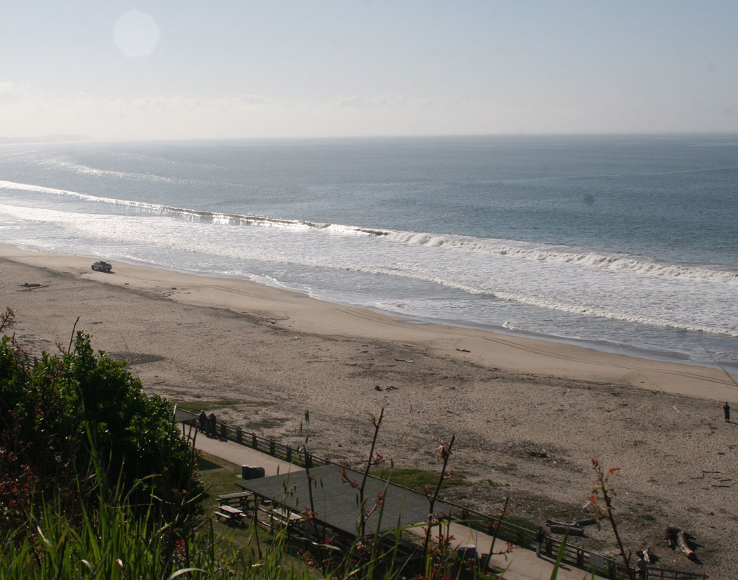
 Exposed sand bar at maximum drawdown – Seacliff State Beach [Larger version] |
 Tsunami tourist on the beach during maximum drawdown – not a recommended practice! [Larger version] |
![]()
 Photo of Santa Cruz Harbor looking seaward from the Murray Street bridge (J. Hansen) [Larger version] |
 Photo of Santa Cruz Harbor looking seaward from the Murray Street bridge (J. Hansen) [Larger version] |
 Photo in Santa Cruz Harbor looking under the Murray Street bridge (J. Hansen) [Larger version] |
|
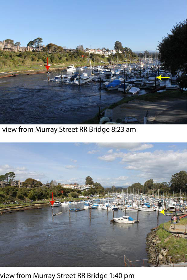 U-dock in Santa Cruz Harbor (as seen from the Murray Street railroad bridge) at 8:23am (A. Foxgrover) [Larger version] |
U-dock in Santa Cruz Harbor (as seen from the Murray Street railroad bridge) at 1:40pm (A. Foxgrover) [Larger version] |
![]()
