Other ID: none
Status: Completed
Organization(s): USGS, St. Petersburg Coastal and Marine Science Center
Funding Program(s):
Principal Investigator(s): Christopher Smith
Affiliate Investigator(s):
Information Specialist(s): Nancy DeWitt, Kyle Kelso
Data Type(s): Location-Elevation: Navigation, Sampling: Biology, Sampling: Geology
Scientific Purpose/Goals: Follow-up coring to examine short-term sedimentation
Vehicle(s): Ford F-350 Dually White (GSA)
Start Port/Location: Biloxi, MS
End Port/Location: Biloxi, MS
Start Date: 2012-09-04
End Date: 2012-09-14
Equipment Used: Ashtech Z-Xtreme DGPS, Push Corer, Global Positioning System (GPS), Bottom Grab Sampler
Information to be Derived: Grain Size, Radioisotopes
Summary of Activity and Data Gathered:
Staff: Nancy DeWitt, Kyle Kelso, Billy Reynolds
Affiliate Staff:
Notes:
Location:
Chanduleur Islands, LA
| Boundaries | |||
|---|---|---|---|
| North: 30.12332 | South: 29.54535061 | West: -89.0984 | East: -88.35818096 |
Platform(s):
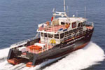 Survey Cat (Class 3) |
Marot, M.E., Adams, C.S., Richwine, K.A., Smith, C.G., Osterman, L.E., Bernier, J.C., 2014, Temporal changes in lithology and radiochemistry from the back-barrier environments along the Chandeleur Islands, Louisiana-March 2012-July 2013: U.S. Geological Survey Open-File Report 2014-1079, https://doi.org/10.3133/ofr20141079.
| Survey Equipment | Survey Info | Data Type(s) | Data Collected |
|---|---|---|---|
| Ashtech Z-Xtreme DGPS | --- | Benchmarks Navigation | |
| Push Corer | --- | Geology | Grain_Size_Run_Statistics (marsh and back-barrier push cores GRADISTAT) Physical_Parameter_Data (marsh and back-barrier push cores physical parameters) Radiochemistry_Data (marsh and back-barrier push cores radiochemistry) Grain_Size_Data (marsh and back-barrier push cores grain size analyses) Core_Location_Tables (marsh and back-barrier push cores sample locations) Core_Data_Plots (marsh and back-barrier push core plots) Foraminiferal_Data (marsh and back-barrier push cores foram counts) GIS_Core_Locations (marsh and back-barrier push cores GIS dataset) |
| Global Positioning System (GPS) | --- | Navigation | |
| Bottom Grab Sampler | --- | Biology Geology |
