Other ID: 939009, Phase I Leg C; K-2-69-GM
Status: Completed
Organization(s): USGS, Woods Hole Coastal and Marine Science Center
Funding Program(s):
Principal Investigator(s): Louis E. Garrison
Affiliate Investigator(s): Robert H. Fedden - U.S. Naval Oceanographic Office
Information Specialist(s):
Data Type(s): Location-Elevation: Navigation, Seismics: Multichannel, Seismics: Sparker, Seismics: Sub Bottom Profiler, Sonar: Single Beam
Scientific Purpose/Goals:
Vehicle(s):
Start Port/Location: Vera Cruz, Vera Cruz, Mexico
End Port/Location: Galveston, TX
Start Date: 1969-03-05
End Date: 1969-03-23
Equipment Used: 3.5 kHz, Multichannel seismics, Loran-A, Omega navigation, Sextant, Sparker , Single channel hydrophone, Echosounder
Information to be Derived: Bathymetric maps; Morphology; Sea floor map;
Summary of Activity and Data Gathered:
Staff: Henry Berryhill, Louis E. Garrison
Affiliate Staff:
Robert Fedden - co-Ch. Sci. - U.S. NavOceano; USGS-Menlo Park: Harry Hill
Jack Lee
Mike Marlow
Bob Patrick
David Scholl
Richard Tagg
Notes: Original Center People field contained: USGS-Corpus Christi: Louis Garrison - co-Ch. Sci., Henry Berryhill; USGS-Menlo Park: Harry Hill, Jack Lee, Mike Marlow, Bob Patrick, David Scholl, Richard Tagg.
Project = USGS-NAVOCEANO, USGS-NAVOCEANO.
Information about other equipment added from Foghorn: Marine Sciences-Teledyne Seismic Section Profiler with 2 200-ft streamers and Raytheon dry-paper recorder and unfiltered analog tape recorder;EDO Western 240A 3.5 kHz profiler with hull-mounted piezoelectric transducer and Raytheon PFT 193C recorder
Location:
Gulf of Campeche, Mexico, western Gulf of Mexico, United States, Sigsbee Plain, North America, North Atlantic;
| Boundaries | |||
|---|---|---|---|
| North: 29.235 | South: 18.53 | West: -96.647 | East: -90.19 |
Platform(s):
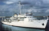 Elisha Kane |
| Survey Equipment | Survey Info | Data Type(s) | Data Collected |
|---|---|---|---|
| 3.5 kHz | --- | Sub Bottom Profiler | |
| Multichannel seismics | --- | Multichannel | |
| Loran-A | --- | Navigation | |
| Omega navigation | --- | Navigation | 1969-004-FA-LN-001 (Navigation data in InfoBank) |
| Sextant | --- | Navigation | |
| Sparker | --- | Sparker | |
| Single channel hydrophone | --- | Air Gun / Water Gun Boomer Bubble Gun Sparker Sub Bottom Profiler | 1969-004-FA-SE-001-01 (Scanned image of Line C-22) 1969-004-FA-SE-002 (analog tape of seismic data) |
| Echosounder | --- | Single Beam | 1969-004-FA-BA-001 (Bathymetric data in InfoBank) NGDC MGD77 data |
