Other ID: UGEO Leg 2; CORPUS 16/17
Status: Completed
Organization(s): USGS, Woods Hole Coastal and Marine Science Center
Funding Program(s):
Principal Investigator(s): Jack Vedder
Affiliate Investigator(s):
Information Specialist(s):
Data Type(s): Electro-Magnetic: Gravity, Electro-Magnetic: Magnetics, Location-Elevation: Navigation, Sampling: Biology, Sampling: Geology, Seismics: Sparker, Seismics: Sub Bottom Profiler
Scientific Purpose/Goals: The lack of offshore data in the area of Leg 2 of the USGS-IDOE cruise necessitated the assembly of detailed geophysical and geologic information in order to evaluate the resource potential and to resolve the tectonic framework of the continental margin. The first phase (1971) was primarily a geophysical reconnaissance designed to provide information that will help decipher the structural evolution of the continental margin east of the Yucatan Peninsula. A few dredge sites were selected as a possible means of determining the age and lithology of the rocks that form major surveyed features. The primary scientific objectives of Leg 2 (this cruise) were: (1) to investigate the evolution of the continental margin east of the Yucatan Peninsula and its relation to concepts of continental margin development; (2) to explore the possibility of structural and stratigraphic links between western Cuba and the Yucatan Peninsula; (3) to study the western terminus of the Cayman Ridge and Trench system and determine its influence on the stucture of British Honduras and Guatemala; (4) to examine the Yucatan Basin in order to interpret the origin of this distinct sea floor feature in the northwestern Caribbean; and (5) to learn more about the nature of interaction between the North American and Caribbean plates in this area.
Vehicle(s):
Start Port/Location: Veracruz, Mexico
End Port/Location: San Juan, Puerto Rico
Start Date: 1971-06-19
End Date: 1971-07-14
Equipment Used: Dredge, Sparker , Marine magnetometer, Gravity meter (wh), ITT 4007 satellite navigation, Decca radar system, 3.5 kHz
Information to be Derived:
Summary of Activity and Data Gathered: More than 4,450 km of trackline were traversed within the project area using a continous acoustic reflection profiling system, a ship-towed magnetometer, and a shipboard gravimeter. Dredging at 10 sites selected on the basis of geophysical records provided critical information on the type of rocks and sediments that form major sea floor features. Accurate positioning was established by a satellite navigational system. Cursory shipboard examination of the sub-bottom profiles indicates that the continental slope east of the Yucatan Peninsula is characterized by a steep gradient from near the shoreline to a depth of about 1,000 meters. Seaward from the narrow shelf, several elongate reefs, banks, and islands lie parallel to the coast and interrupt the slope. Farther basinward, the sea floor slopes gradually to depths of about 1,200 to 1,800 meters where another set of ridges, not evident on existing charts, projects above the regional gradient and also lies parallel to the coast. A relatively sharp declivity on the east side of this ridge system drops to the floor of the Yucatan Basin at a depth of about 4,000 meters. Dredge hauls of muscovite schist and marble from near the base of the slope in the Yucatan Channel and off Isla de Cozumel suggest that the two subparallel sets of ridges are belts of relatively resistant metamorphosed sedimentary rock bordering an elongate basin partially filled with sediments. The fill may be as thick as 1,800 m in the borderland basin east of Isla de Cozumel where the sedimentary rocks and overlying unconsolidated deposits also are broadly folded and locally faulted. The outer ridges serve as depositional barriers to sedimentation in smaller troughs developed along the east edge of the ridge-basin system. The basement ridges of the British Honduras-Yucatan continental margin probably should be considered tectonic dams (Emery, 1968); presumably they represent fault blocks formed during the large scale rifting that formed the continental margin in post-late Paleozoic to pre-late Mesozoic time. However, some recent activity also is indicated by extensional faults in the near shore basin sediments. This relatively recent movement of the blocks may have resulted from activity on the nearby border of the North America and Caribbean lithospheric plates.
Staff: William Dillon, Jack Vedder
Affiliate Staff:
Alberto Vazquez de la Cerda - Mexican Navy; Alfredo Hernandez Andres - Nat'l Univ. of Mexico
Institute of Petroleum; Jose Sandoval Ochoa - Nat'l Univ. of Mexico
Institute of Geophysics; A.E. Roberts - Geologist
B.D. Ruppel - Geophysicist
A.G. McHendrie - Geologist
P.E. Malin - Geophysicist
C.A. Rodeick - Phys. Sci. Tech.
H.R. Hill - Elect. Tech.
R.A. Patrick - Elect. Tech.
Notes: Original Center People field contained: J.G. Vedder - Ch. Sci., W.P. Dillon - Geologist, A.E. Roberts - Geologist, B.D. Ruppel - Geophysicist, A.G. McHendrie - Geologist, P.E. Malin - Geophysicist, C.A. Rodeick - Phys. Sci. Tech., H.R. Hill - Elect. Tech., R.A. Patrick - Elect. Tech.
Project = International Decade of Ocean Exploration (IDOE), International Decade of Ocean Exploration (IDOE)
Location:
east margin, Yucatan Peninsula, Yucatan Channel, Mexico, Glovers Reef, British Honduras, Cayman Ridge, Cayman Trough, Gulf of Mexico, Caribbean Sea, North America, North Atlantic;
| Boundaries | |||
|---|---|---|---|
| North: 20.7333 | South: 16.5883 | West: -87.9652 | East: -83.7483 |
Platform(s):
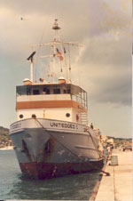 United Geo I |
Vedder, J.G., 1972, Acoustic reflection profiles, east margin, Yucatan Peninsula, International Decade of Ocean Exploration, Leg 2, 1971 cruise, UNITEDGEO I: , USGS-GD-72-003, PB-207-595. 15 p.
| Survey Equipment | Survey Info | Data Type(s) | Data Collected |
|---|---|---|---|
| Dredge | --- | Biology Geology | |
| Sparker | --- | Sparker | |
| Marine magnetometer | --- | Magnetics | NGDC MGD77 data 1971-002-FA-GP-002 (Magnetic data in InfoBank) |
| Gravity meter (wh) | --- | Gravity | NGDC MGD77 data 1971-002-FA-GP-001 (Gravity data in InfoBank) |
| ITT 4007 satellite navigation | --- | Navigation | 1971-002-FA-LN-001 (Navigation data in infoBank) |
| Decca radar system | --- | Navigation | |
| 3.5 kHz | --- | Sub Bottom Profiler | NGDC MGD77 data 1971-002-FA-BA-001 (Bathymetric data in InfoBank) |
