Other ID: ATL2 89-2; 89, Leg 2
Status: Completed
Organization(s): USGS, Woods Hole Coastal and Marine Science Center
Funding Program(s):
Principal Investigator(s): Robert N. Oldale
Affiliate Investigator(s):
Information Specialist(s): Nancy K. Soderberg
Data Type(s): Seismics: Sub Bottom Profiler, Sampling: Geology, Seismics: Air Gun / Water Gun, Seismics: Boomer, Seismics: Sparker, Electro-Magnetic: Magnetics, Location-Elevation: Navigation
Scientific Purpose/Goals: Conduct a geology and geophysics cruise along the Atlantic continental margin between Virginia and Cape Cod, concentrating on the continental shelf and slope between Virginia and Long Island where high-resolution seismic reflection profiling, vibracoring and bottom samples are needed for Bureau of Land Management (BLM) and USGS environmental impact studies in areas where petroleum lease sales are being considered. Single-channel seismic reflection profiles (airgun), gravity, and magnetics (Legs 1-3) programs for regional geologic resource assessment studies will also be conducted.
Vehicle(s):
Start Port/Location: Woods Hole, MA
End Port/Location: Norfolk, VA
Start Date: 1975-04-30
End Date: 1975-05-16
Equipment Used: GeoPulse uniboom, 3.5 kHz, Alpine Vibracorer, Raytheon 3.5 kHz sonar (CESP II) system, Seismic Engineering streamer, EG&G 234, Varian V-75 magnetometer, Magnavox satellite positioning system, Loran-C
Information to be Derived:
Summary of Activity and Data Gathered: Collected high-resolution seismic profiles (Uniboom) and airgun profiles on the shelf and slope between Virginia and Long Island.
Staff: Robert N. Oldale, Deborah Hutchinson, Frank W. Jennings, Dennis Edwards, Charles J. O'Hara, Kathleen Kent, Perry Parks, Jose R. Muniz, Rafael W. Rodriguez, Francis A. Kohout
Affiliate Staff:
Dick Edwards
Elaine Weed
Julian Soren; WHOI: Stephen Gegg
Allan Gunderson
Jane Kroll
Notes: No cruise report. Original Center People field also contained: Dick Edwards, Elaine Weed, and Julian Soren.
Project = Geophysics of the Atlantic Outer Continental Shelf, Geophysics of the Atlantic Outer Continental Shelf'
The alternate cruise designation is WHOI's name for the cruise, which represents the 89th cruise on the AII, not the year 1989.
Location:
Atlantic outer continental shelf, United States, North America, North Atlantic;
| Boundaries | |||
|---|---|---|---|
| North: 41.36031755 | South: 36.48805107 | West: -75.70326662 | East: -70.56636196 |
Platform(s):
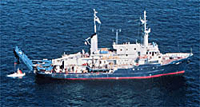 Atlantis II |
Chaytor, J.D., ten Brink, Uri S., Solow, Andrew R., and Andrews, Brian D., 2009, Size distribution of submarine landslides along the U.S. Atlantic margin: Marine Geology, v. 264 no. 1-2, doi: 10.1016/j.margeo.2008.08.007.
Foster, D.S., Brothers, L.L., Baldwin, W.E., and Pendleton, E.A., 2023, Geospatial data layers of shallow geology from the inner continental shelf of the Delmarva Peninsula, including Maryland and Virginia state waters: U.S. Geological Survey data release, https://doi.org/10.5066/P9GQY0ZN.
Geist, E.L., Lynett, Patrick J., and Chaytor, Jason D., 2009, Hydrodynamic modeling of tsunamis from the Currituck landslide: Marine Geology, v. 264 no. 1-2, doi: 10.1016/j.margeo.2008.09.005.
ten Brink, U.S., Barkan, R., Andrews, B.D., and Chaytor, J.D., 2009, Size distributions and failure initiation of submarine and subaerial landslides: Earth and Planetary Science Letters, v. 287 no. 1-2, doi: 10.1016/j.epsl.2009.07.031.
Twichell, D.C., Chaytor, Jason D., ten Brink, Uri S., and Buczkowski, Brian, 2009, Morphology of late Quaternary submarine landslides along the U.S. Atlantic continental margin: Marine Geology, v. 264 no. 1-2, doi: 10.1016/j.margeo.2009.01.009.
| Survey Equipment | Survey Info | Data Type(s) | Data Collected |
|---|---|---|---|
| GeoPulse uniboom | --- | Boomer | |
| 3.5 kHz | --- | Sub Bottom Profiler | 1975-003-FA-BA-001 (Digital tape(s) of NV, NV,GR,BT,MG, NV,BT, GR,MG, GR-O/P FTCOPY, ) |
| Alpine Vibracorer | --- | Geology | |
| Raytheon 3.5 kHz sonar (CESP II) system | --- | Sub Bottom Profiler | |
| Seismic Engineering streamer | --- | Air Gun / Water Gun Boomer Sparker | 1975-003-FA-SE-001 ( Collection of paper record displays of seismic data( AIR) for lines ) 1975-003-FA-SE-002 (microfilm of ) 1975-003-FA-SE-003 (analog tape of seismic data) |
| EG&G 234 | --- | Boomer | |
| Varian V-75 magnetometer | --- | Magnetics | 1975-003-FA-GP-001-01 (Gravity and Magnetic data) |
| Magnavox satellite positioning system | --- | Navigation | |
| Loran-C | --- | Navigation | 1975-003-FA-LN-001 (Navigation trackline plot for field activity 75003) 1975-003-FA-LN-001-02 (Trackmap for ATL2 89 Legs 1, 2 and 3 with dates and hour marks: .pdf format.) 1975-003-FA-LN-001-03 (Trackmap for ATL2 89 Leg 2 with dates and hour marks: .pdf format; Inv. # TK00016.) 1975-003-FA-LN-001-01 (Field Track Map for ATL2 89 Legs 1, 2 and 3 (pdf file) Field track map with irregular ticks.) 1975-003-FA-LN-002-01 (Navigation data) |
