Other ID: FAY 013, Leg Charlie; CORPUS 31/39
Status: Completed
Organization(s): USGS, Woods Hole Coastal and Marine Science Center
Funding Program(s):
Principal Investigator(s): Gary W. Hill
Affiliate Investigator(s):
Information Specialist(s):
Data Type(s): Sampling: Geology, Seismics: Sparker, Seismics: Sub Bottom Profiler, Sampling: Biology, Biological Field Study: Experiments (biological), Imagery: Photo, Environmental Data: Dissolved Oxygen, Environmental Data: Temperature, Location-Elevation: Navigation
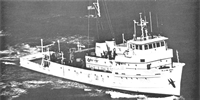
Scientific Purpose/Goals: General objective of the Gulf of Mexico Continental Slope project is to define the possible extent of unstable sediments on the slope and estimate the degree of instability in selected areas. The first phase of the slope project involved acquisition and interpretation of 11,233 statute miles of high-resolution seismic data throughout the study area. Western Geophysical Company of America collected the geophysical data incuding fathometer profiles, 3.5 kHz sub-bottom profiles and 1000 joule sparker profiles. From these data, a map of the shallow surface geological features of the slope was produced. Using this information, specific sites were chosen for deep gulf cruises aboard the FAY. High density seismic profiling was done at each site followed by a sediment sampling program.
Vehicle(s):
Start Port/Location: New Orleans, LA
End Port/Location: Corpus Christi, TX
Start Date: 1976-04-18
End Date: 1976-05-05
Equipment Used: Single channel hydrophone, Hydroplastic corer, EG&G sparker, 3.5 kHz, Smith-MacIntyre grab, Gravity corer, Benthos model 372 camera and strobe, InterOceans temperature, depth and dissolved oxygen profiling instrument, Integrated Navigation System, Piston corer
Information to be Derived: Sea floor map; Morphology;
Summary of Activity and Data Gathered: Minisparker profiles: 1579 km; 3.5 kHz EDO profiles: 398 km; Piston cores: 17; Hydroplastic cores: 16; Smith-MacIntyre samples: 20; Core logs: 39A, B, C; Bottom photo stations: 17; Oxygen traces: 0; Gravity cores: 0.
Staff: Gary W. Hill, Ronald J. Miller, Carroll Pyle, Kenneth Roberts, Michael Dorsey, Robert Vitaglione, Stanley Lindquist
Affiliate Staff:
Jim Woods
Scott Heald
Dee Haines
Tom Tatum; Texas A&I Univ.: Ronald C. Circe; Texas A&M Univ.: Charles Katherman
Marty Robinson
Bruce Sidner; Western Geophysical: Paul Bereznak
Notes: Original Center People field contained: Gary W. Hill - Ch. Sci., Ronald Miller, Jim Woods, Jack Kindinger, Cary Pyle, Ken Roberts, Mike Dorsey, Bob Vitaglione, Scott Heald, Dee Haines, Tom Tatum, and Stan Linquist.
Project = Gulf of Mexico Continental Slope, Gulf of Mexico Continental Slope
Information from Foghorn: EG&G minisparker;EDO Western 3.5 kHz sub-bottom profiler;Smith-MacIntyre grab sampler;Piston corer;Gravity corer;Benthos underwater camera;InterOceans temperature, depth and dissolved oxygen profiling instrument;
Location:
outer continental shelf, Texas, Louisiana, Mississippi, United States, Gulf of Mexico, North America, North Atlantic;
| Boundaries | |||
|---|---|---|---|
| North: 29 | South: 27 | West: -96 | East: -89 |
Platform(s):
 Fay |
| Title | Survey Equipment | Description |
|---|---|---|
| Cruise report | (document not focused on specific equipment) | Chief Scientist's daily log of ship movement, equipment and data acquisition notes, personnel, track maps. The information applies to field activities 1976-005-FA, 1976-007-FA, 1076-011-FA, and 1976-013-FA. |
| Cruise report | (document not focused on specific equipment) | Manual for successive Fay cruises conducted between March and June 1976 in the Gulf of Mexico including daily log of ship movement, equipment and data acquisition notes, personnel, track maps. Very extensive report including figures of data with explanations. Includes information for the following field activities: 1976-004-FA, 1976-005-FA, 1976-007-FA, 1976-011-FA, 1976-013-FA, 1976-015-FA. |
| Survey Equipment | Survey Info | Data Type(s) | Data Collected |
|---|---|---|---|
| Single channel hydrophone | --- | Air Gun / Water Gun Boomer Bubble Gun Sparker Sub Bottom Profiler | 1976-011-FA-SE-001 (microfilm of GULF SEISMIC PROFILES) |
| Hydroplastic corer | --- | Geology | |
| EG&G sparker | --- | Sparker | |
| 3.5 kHz | --- | Sub Bottom Profiler | |
| Smith-MacIntyre grab | --- | Biology Geology | |
| Gravity corer | --- | Geology | |
| Benthos model 372 camera and strobe | --- | Photo | |
| InterOceans temperature, depth and dissolved oxygen profiling instrument | --- | Dissolved Oxygen Temperature | |
| Integrated Navigation System | --- | Navigation | 1976-011-FA-LN-001-03 (Track Map Charlie XI-XII (pdf file) Plotted track map for Charlie XI-XII, Lines 1 through 11 with shotpoints.) 1976-011-FA-LN-001-01 (Track Map Charlie IXA (pdf file) Plotted track map for area Charlie IXA, Lines 1 through 12 with shotpoints.) 1976-011-FA-LN-001-04 (Track Map Charlie XIII (pdf file) Plotted track map for area Charlie XIII, Lines 1 through 13 with shotpoints.) 1976-011-FA-LN-001-02 (Track Map Charlie X (pdf file) Plotted track map for Charlie X, Lines 1 through 7 with shotpoints.) |
| Piston corer | --- | Geology |