Other ID: none
Status: Completed
Organization(s): USGS, Woods Hole Coastal and Marine Science Center
Funding Program(s):
Principal Investigator(s): Deborah Hutchinson
Affiliate Investigator(s):
Information Specialist(s):
Data Type(s): Electro-Magnetic: Magnetics, Location-Elevation: Navigation, Seismics: Boomer, Sonar: Single Beam
Scientific Purpose/Goals: The Lake Ontario cruise of the ARGUE MARTIN grew from a proposal to investigate the possible continuation of the Clarendon-Linden fault structure in western New York into Lake Ontario. Marine seismic profiling was used to determine the areal extent of the structure in the lake, and to delineate major structural features in the bedrock and any near surface features in the overlying sediment that could indicate recent movement on the fault.
Vehicle(s):
Start Port/Location: Rochester, NY
End Port/Location: Rochester, NY
Start Date: 1976-04-19
End Date: 1976-04-30
Equipment Used: Boomer, Marine magnetometer, Loran-C, Single channel hydrophone, Echosounder
Information to be Derived: Morphology;
Summary of Activity and Data Gathered: Active data collection was restricted to a daytime operation; base ports were Rochester Port Authority, New York side, and Cobourg Harbor, Ontario side. Windy weather conditions >15 mph curtailed the operation for 4.5 days out of 9 available. Two additional days were alloted for travelling to and from Rochester and loading/off-loading the ARGUE MARTIN. Total track length measures 440 km with 7 perpendicular crossings of the main proposed extension of the fault structure (10-15 km spacing) and at least 9 perpendicular crossings of proposed adjoining fault structures.
Staff: Deborah Hutchinson, Kenneth F. Parolski, Charles Paull, Phil Shea, Richard E. Sylwester
Affiliate Staff:
Michael Kirkmann; Jeffrey Pferd - NYSGS
Notes: Original Center People field contained: Debbie Hutchinson - Ch. Sci., Michael Kirkmann, Kenneth Parolski, Charles Paull, Phil Shea, and Richard Sylwester.
Location:
Lake Ontario, New York, United States, Ontario, Canada, Great Lakes, North America;
| Boundaries | |||
|---|---|---|---|
| North: 44 | South: 43 | West: -79 | East: -77 |
Platform(s):
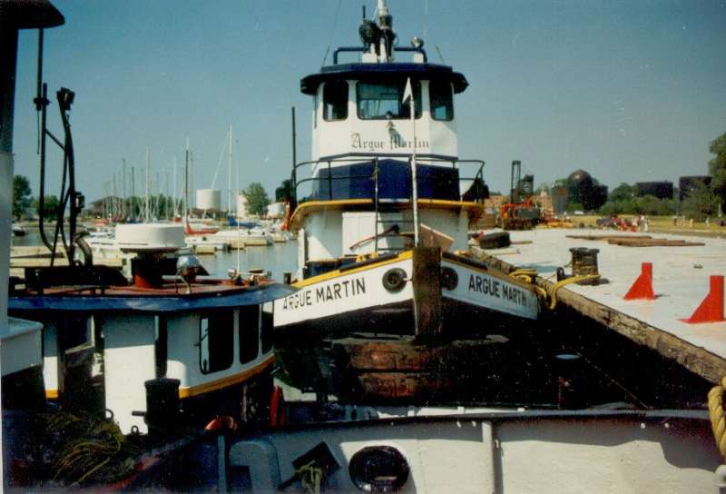 Argue Martin |
| Survey Equipment | Survey Info | Data Type(s) | Data Collected |
|---|---|---|---|
| Boomer | --- | Boomer | |
| Marine magnetometer | --- | Magnetics | 1976-012-FA-GP-001-01 (Magnetic and Gravity data recovered from 9 track tape) |
| Loran-C | --- | Navigation | 1976-012-FA-LN-002-01 (Navigation data recovered from 9 track tape) 1976-012-FA-LN-001-01 (Track line plot) |
| Single channel hydrophone | --- | Air Gun / Water Gun Boomer Bubble Gun Sparker Sub Bottom Profiler | 1976-012-FA-SE-001 ( Collection of paper record displays of seismic data( MIXD) for lines ) 1976-012-FA-SE-002 (microfilm of LINES 1-29,13-28,1-299) 1976-012-FA-SE-003 (analog tape of seismic data) |
| Echosounder | --- | Single Beam | 1976-012-FA-BA-001 (Digital tape(s) of NV-MG LAKE ONT, BT LAKE ONT, NV LAKE ONT, NV,MG LAKE ONT, ) |
