Other ID: FAY 022
Status: Completed
Organization(s): USGS, Woods Hole Coastal and Marine Science Center
Funding Program(s):
Principal Investigator(s): Richard E. Sylwester
Affiliate Investigator(s):
Information Specialist(s):
Data Type(s): Electro-Magnetic: Gravity, Location-Elevation: Navigation, Sonar: Sidescan
Scientific Purpose/Goals: Attempt to locate drill pipe equipment left on the ocean floor by drill ship GLOMAR CONCEPTION (FA 76027 AMCOR project) using sidescan sonar sweeps.
Vehicle(s):
Start Port/Location: Woods Hole, MA
End Port/Location: Woods Hole, MA
Start Date: 1976-09-08
End Date: 1976-09-10
Equipment Used: Western Geophysical Integrated Navigation System, Gravity meter (wh), Klein 531 sidescan
Information to be Derived: Sea floor map;
Summary of Activity and Data Gathered: Survey encompassed a 3 mile x 3 mile area where pipe assembly was lost at site #6013. Analysis of data aboard the vessel suggested possible targets but further analysis was necessary to confirm whether pipe had been located. Sidescan sonar: 140 km.
Staff: N. Terence Edgar, Alan Goodman, Kathleen Kent, Ralph Lewis, Richard E. Sylwester
Affiliate Staff:
Nicholas Lefteriou
Ralph Lewis
Donald Moller
Lin Morse; Charles Finklestein - Klein Assoc.
Notes: Original Center People field contained: Richard Sylwester - Ch. Sci.; Alan Goodman, Kathleen Kent, Nicholas Lefteriou, Ralph Lewis, Donald Moller, Lin Morse, Terence Edgar.
Project = AMCOR Pipe Search Survey, AMCOR Pipe Search Survey
Location:
Lydonia Canyon, North Atlantic outer continental shelf, United States, North America, North Atlantic;
| Boundaries | |||
|---|---|---|---|
| North: 40.5 | South: 40.25 | West: -67.75 | East: -67.5 |
Platform(s):
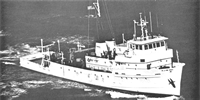
 Fay |
Paskevich, V.F., and Soderberg, N.K., 1997, Navigation and geophysical data collected onboard the R/V Fay from 1975-1976: U.S. Geological Survey Open-File Report 97-512, CD-ROM, URL: https://doi.org/10.3133/ofr97512.
| Title | Survey Equipment | Description |
|---|---|---|
| Cruise report | (document not focused on specific equipment) | Single page cruise memo describing survey and listing scientific party. |
| Survey Equipment | Survey Info | Data Type(s) | Data Collected |
|---|---|---|---|
| Western Geophysical Integrated Navigation System | --- | Navigation | 1976-035-FA-LN-001 (Navigation trackline plot for field activity 76035) 1976-035-FA-LN-002-01 (Navigation data) |
| Gravity meter (wh) | --- | Gravity | 1976-035-FA-GP-001 (Digital tape(s) of NV1-2, GR-FINAL, NV-INS-FINAL, NV-FINAL, ) |
| Klein 531 sidescan | --- | Sidescan |