Other ID: none
Status: Completed
Organization(s): USGS, Woods Hole Coastal and Marine Science Center
Funding Program(s):
Principal Investigator(s): Charles J. O'Hara
Affiliate Investigator(s):
Information Specialist(s):
Data Type(s): Location-Elevation: Navigation, Seismics: Boomer
Scientific Purpose/Goals: The cooperative marine program is intended to provide the Commonwealth of Massachusetts a detailed accounting and geological evaluation of the lands that lie submerged beneath its coastal waters. Principal objectives include detailed mapping of geological features, assessment of potential mineral resources, feasibility and enviromental impact studies related to offshore mining of sand and gravel, and environmental considerations relative to offshore disposal of solid waste material.
Vehicle(s):
Start Port/Location: Woods Hole, MA
End Port/Location: Woods Hole, MA
Start Date: 1976-10-04
End Date: 1976-10-09
Equipment Used: EG&G 234, Epsco LORAN-C , Single channel hydrophone
Information to be Derived: Sea floor map; Morphology;
Summary of Activity and Data Gathered: Uniboom: 250 km.
Staff: Robert F. Commeau, Wayne Ferrebee, Frank W. Jennings, Charles J. O'Hara
Affiliate Staff:
Notes: Original Center People field contained: Chuck O'Hara (Ch. Sci.); Wayne Mac Ferrebee (Geologist); Robert Commeau (Geologist); Frank Jennings (Electronic Technician).
Project = Massachusetts Co-op, Massachusetts Co-op
Location:
eastern Nantucket Sound, Massachusetts, United States, North America, North Atlantic;
| Boundaries | |||
|---|---|---|---|
| North: 41.75 | South: 41.25 | West: -70.6 | East: -70 |
Platform(s):
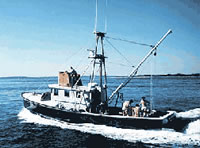
 Asterias |
O'Hara, C.J., and Oldale, R.N., 1987, Maps showing geology, shallow structure, and bedform morphology of Nantucket Sound, Massachusetts: U.S. Geological Survey Miscellaneous Field Studies Map MF-1911, 4 sheets, URL: https://doi.org/10.3133/mf1911.
| Title | Survey Equipment | Description |
|---|---|---|
| Cruise report | (document not focused on specific equipment) | Chief Scientist's cruise report and daily log of ship movement, equipment and data acquisition notes, scientific results and personnel. Includes trackmap. |
| Uniboom log | (document not focused on specific equipment) | Uniboom log containing line numbers, date, time, latitude, longitude, equipment performance and data acquisition notes. |
| Survey Equipment | Survey Info | Data Type(s) | Data Collected |
|---|---|---|---|
| EG&G 234 | --- | Boomer | |
| Epsco LORAN-C | --- | Navigation | 1976-039-FA-LN-001-02 (Composite Track Map (pdf file) Composite Nantucket Sound trackline map from ASTERIAS June (FA 76021) and October (FA 76039) 1976 and July (FA 77024) 1977 containing ship movement with times and line numbers.) 1976-039-FA-LN-001-01 (Navigation Track Map (pdf file) Trackline map of ship movement with times and line numbers.) |
| Single channel hydrophone | --- | Air Gun / Water Gun Boomer Bubble Gun Sparker Sub Bottom Profiler | 1976-039-FA-SE-002-02 (Line information) 1976-039-FA-SE-001 (microfilm of LINES 18-25) 1976-039-FA-SE-002-01 (scanned seismic record sections) 1976-039-FA-NL-001-02 (Uniboom log containing line numbers, date, time, latitude, longitude, equipment performance and data acquisition notes, etc.) |