Other ID: none
Status: Completed
Organization(s): USGS, Woods Hole Coastal and Marine Science Center
Funding Program(s):
Principal Investigator(s): David Twichell
Affiliate Investigator(s):
Information Specialist(s):
Data Type(s): Location-Elevation: Navigation, Seismics: Boomer, Sonar: Sidescan
Scientific Purpose/Goals: Map the surface character, thickness and extent of the Mud Patch sediment lens to define the origin and present processes responsible for the development of this anomalous sediment deposit.
Vehicle(s):
Start Port/Location: Atlantic City, NJ
End Port/Location: Atlantic City, NJ
Start Date: 1978-05-15
End Date: 1978-05-20
Equipment Used: Klein 531 sidescan, Loran-C, Boomer, Single channel hydrophone
Information to be Derived: Sea floor map;
Summary of Activity and Data Gathered: No sidescan lines 1-5; equipment problems. Huntec boomer: 941 km; Klein sidescan sonar: 673 km; EDO Western 60 kHz echo sounder: 941 km.
Staff: Barry Irwin, David Twichell
Affiliate Staff:
Univ. Delaware students: Dennis Bebel
Tom Crosby
Kathy Kent
Gary Snyder
Marion Swincki; Offshore Navigation
Inc. technicians: John Barnard
Mike Coster
Larry Matson; Huntec technician: Dave Tullett; US Navy engineer: Nathan (Bing) Fuller
Notes: Original Center People field contained: Dave Twichell - Ch. Sci., Barry Irwin.
Location:
Block Canyon, Atlantis Canyon, Mud Patch, southern New England continental shelf, United States, North America, North Atlantic;
| Boundaries | |||
|---|---|---|---|
| North: 40.8 | South: 39.9 | West: -71.95 | East: -69.95 |
Platform(s):
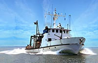
 Cape Henlopen |
Twichell, D.C., 1980, Single-channel seismic-reflection profiles and sidescan sonar records collected during May 15-20, 1978, on the southern New England continental shelf: U.S. Geological Survey Open-File Report 80-177, https://doi.org/10.3133/ofr80177.
Twichell, D.C., McClennen, C.E., Butman, B., 1981, Morphology and processes associated with the accumulation of the fine-grained sediment deposit on the southern New England shelf: Journal of Sedimentary Petrology, v. 51 no. 1, doi: 10.1306/212F7C6B-2B24-11D7-8648000102C1865D.
| Title | Survey Equipment | Description |
|---|---|---|
| Cruise report | (document not focused on specific equipment) | Chief Scientist's cruise report listing personnel, equipment, including a seismic line summary and a trackmap. |
| Data log | (document not focused on specific equipment) | Chief Scientist's handwritten cruise log. Has a data log of data on the paper rolls for Huntec, side scan and echo sounder. |
| Geophysics log | (document not focused on specific equipment) | Log of geophysics line acquisition information, primarily associated navigation. |
| Bridge log | (document not focused on specific equipment) | Navigation Log (pdf file) Bridge Loran log. |
| Survey Equipment | Survey Info | Data Type(s) | Data Collected |
|---|---|---|---|
| Klein 531 sidescan | --- | Sidescan | 1978-012-FA-SO-001 ( Collection of paper record displays of sidescan sonar data for lines ) 1978-012-FA-SO-002 (microfilm of ) |
| Loran-C | --- | Navigation | 1978-012-FA-NL-001-04 (Navigation Log (pdf file) Bridge Loran log.) 1978-012-FA-LN-001-01 (Track map with tracklines, dates and times.) 1978-012-FA-LN-001 (Navigation trackline plot for field activity 78012) |
| Boomer | --- | Boomer | |
| Single channel hydrophone | --- | Air Gun / Water Gun Boomer Bubble Gun Sparker Sub Bottom Profiler | 1978-012-FA-SE-001 (microfilm of ) 1978-012-FA-NL-001-03 (Seismics log.) |