Other ID: none
Status: Completed
Organization(s): USGS, Woods Hole Coastal and Marine Science Center
Funding Program(s):
Principal Investigator(s): John Grow
Affiliate Investigator(s):
Information Specialist(s):
Data Type(s): Location-Elevation: Navigation, Seismics: Multichannel
Scientific Purpose/Goals: Acquire seismic reflection profiles along the continental margin between North Carolina and Maine. This field work was contracted to Geophysical Services, Inc.
Vehicle(s):
Start Port/Location:
End Port/Location:
Start Date: 1978-05-29
End Date: 1978-11-06
Equipment Used: Loran-C, Multichannel seismics
Information to be Derived: Morphology;
Summary of Activity and Data Gathered: No USGS personnel participated in field activities. CDP multichannel seismic profiles: 4813 km, 21 lines (#18-38).
Staff:
Affiliate Staff:
Geophysical Services
Inc.
Notes:
Location:
Atlantic continental margin, North Carolina to Maine, United States, North America, North Atlantic;
| Boundaries | |||
|---|---|---|---|
| North: 42.49550141 | South: 31.94801758 | West: -78.13960123 | East: -65.59584608 |
Platform(s):
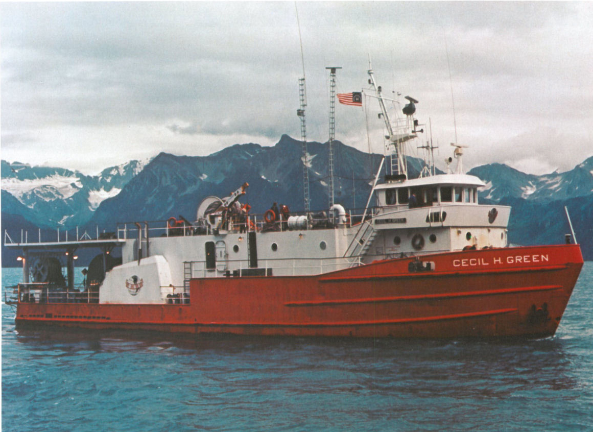 Cecil H. Green | Carino |
Grow, J.A., Schlee, J.S., and Dillon, W.P., 1980, Multichannel seismic-reflection profiles collected along the U. S. Continental Margin in 1978: U.S. Geological Survey Open-File Report 80-834, 3 p., https://doi.org/10.3133/ofr80834.
Hutchinson, D.R., Poag, C.W., Johnson, A.H., Popenoe, P. and Wright, C., 1997, Geophysical database of the east coast of the United States; southern Atlantic margin, stratigraphy and velocity in map grids: U.S. Geological Survey Open-File Report 96-55, https://doi.org/10.3133/ofr9655.
Hutchinson, D.R., Poag, C.W., and Popenoe, P., 1995, Geophysical database of the east coast of the United States; southern Atlantic margin, stratigraphy and velocity from multichannel seismic profiles: U.S. Geological Survey Open-File Report 95-27, https://doi.org/10.3133/ofr9527.
Klitgord, K.D., Poag, C.W., Schneider, C.M., and North, L., 1994, Geophysical database of the East Coast of the United States northern Atlantic margin—Cross sections and gridded database (Georges Bank Basin, Long Island Platform, and Baltimore Canyon Trough): U.S. Geological Survey Open-File Report 94-637, https://doi.org/10.3133/ofr94637.
Klitgord, K.D., and Schneider, C.M., Geophysical database of the east coast of the United States northern Atlantic margin—Velocity analyses: U.S. Geological Survey Open-File Report 94-192, https://doi.org/10.3133/ofr94192.
| Title | Survey Equipment | Description |
|---|---|---|
| Observer log | (document not focused on specific equipment) | Observer logs in individual folders based on survey line. |
| Survey Equipment | Survey Info | Data Type(s) | Data Collected |
|---|---|---|---|
| Loran-C | --- | Navigation | 1978-015-FA-LN-002-01 (Navigation for Lines 18-38 (txt file) Navigation points in decimal degrees for every 10 shotpoints for Lines 18-38.) 1978-015-FA-LN-001-01 (Contracted Atlantic Marine Multichannel Seismic Reflection Data Tracklines (pdf file) Generalized track map depicting several data sets including Lines 18-38 collected by Geophysical Services aboard the CARINO/CECIL GREEN.) 1978-015-FA-LN-001 (CDP navigation trackline plot for field activity 78015) 1978-015-FA-LN-002 (Digital tape(s) of NV-CDP-78-SP, ) 1978-015-FA-LN-002-02 (Navigation for Lines 18-38 (txt file) broken down to data for each line) |
| Multichannel seismics | --- | Multichannel | 1978-015-FA-SE-001-30 (Line 23 STACK SEGY seismic data) 1978-015-FA-SE-001-31 (Line 24 STACK SEGY seismic data) 1978-015-FA-SE-001-01 (film collection of VEL ANAL LINES 35-38) 1978-015-FA-SE-001-24 (Line 38 DEMUX SEGY seismic data) 1978-015-FA-SE-001-22 (Line 36 DEMUX SEGY seismic data) 1978-015-FA-SE-001-35 (Line 28 STACK SEGY seismic data) 1978-015-FA-SE-001-13 (Line 27 DEMUX SEGY seismic data) 1978-015-FA-SE-001-29 (Line 22 STACK SEGY seismic data) 1978-015-FA-SE-001-36 (Line 29 STACK SEGY seismic data) 1978-015-FA-SE-001-40 (Line 33 STACK SEGY seismic data) 1978-015-FA-SE-001-42 (Line 35 STACK SEGY seismic data) 1978-015-FA-SE-001-26 (Line 19 STACK SEGY seismic data) 1978-015-FA-SE-001-18 (Line 32 DEMUX SEGY seismic data) 1978-015-FA-SE-001-23 (Line 37 DEMUX SEGY seismic data) 1978-015-FA-SE-001-37 (Line 30 STACK SEGY seismic data) 1978-015-FA-SE-002 ( Collection of paper record displays of seismic data( AIR) for lines ) 1978-015-FA-SE-001-09 (Line 23 DEMUX SEGY seismic data) 1978-015-FA-SE-001-27 (Line 20 STACK SEGY seismic data) 1978-015-FA-SE-001-04 (Line 18 DEMUX SEGY seismic data) 1978-015-FA-SE-001-07 (Line 21 DEMUX SEGY seismic data) 1978-015-FA-SE-001-12 (Line 26 DEMUX SEGY seismic data) 1978-015-FA-SE-001-10 (Line 24 DEMUX SEGY seismic data) 1978-015-FA-SE-001-43 (Line 36 STACK SEGY seismic data) 1978-015-FA-SE-001-34 (Line 27 STACK SEGY seismic data) 1978-015-FA-SE-001-08 (Line 22 DEMUX SEGY seismic data) 1978-015-FA-SE-001-06 (Line 20 DEMUX SEGY seismic data) 1978-015-FA-SE-001-44 (Line 37 STACK SEGY seismic data) 1978-015-FA-SE-001-25 (Line 18 STACK SEGY seismic data) 1978-015-FA-SE-001-21 (Line 35 DEMUX SEGY seismic data) 1978-015-FA-SE-001-16 (Line 30 DEMUX SEGY seismic data) 1978-015-FA-SE-001-38 (Line 31 STACK SEGY seismic data) 1978-015-FA-SE-001-05 (Line 19 DEMUX SEGY seismic data) 1978-015-FA-SE-001-02 (Paper record section of Lines 26, 27, 28, 29, 32, 18, 25, 37B, 36B, 37A, 21, 24, 37C, 23, 22, 38, 31, 19A, 20A, 30, 33A, 34, 35, ) 1978-015-FA-SE-001-45 (Line 38 STACK SEGY seismic data) 1978-015-FA-SE-001-41 (Line 34 STACK SEGY seismic data) 1978-015-FA-SE-001-39 (Line 32 STACK SEGY seismic data) 1978-015-FA-SE-001-15 (Line 29 DEMUX SEGY seismic data) 1978-015-FA-SE-001-20 (Line 34 DEMUX SEGY seismic data) 1978-015-FA-SE-001-28 (Line 21 STACK SEGY seismic data) 1978-015-FA-SE-001-14 (Line 28 DEMUX SEGY seismic data) 1978-015-FA-SE-001-11 (Line 25 DEMUX SEGY seismic data) 1978-015-FA-SE-001-19 (Line 33 DEMUX SEGY seismic data) 1978-015-FA-SE-001-17 (Line 31 DEMUX SEGY seismic data) 1978-015-FA-SE-001-33 (Line 26 STACK SEGY seismic data) 1978-015-FA-SE-001-32 (Line 25 STACK SEGY seismic data) |
