Other ID: CI 7-78-3
Status: Completed
Organization(s): USGS, Woods Hole Coastal and Marine Science Center
Funding Program(s):
Principal Investigator(s): Peter Popenoe
Affiliate Investigator(s):
Information Specialist(s):
Data Type(s): Location-Elevation: Navigation, Seismics: Sparker, Seismics: Sub Bottom Profiler, Sonar: Sidescan
Scientific Purpose/Goals: Assess types and frequencies of environmental hazards that may be encountered on the northern Blake Plateau; study the shallow geologic section to define these geologic hazards using high-resolution geophysical profiling gear on a 28-km grid; and test the shipboard gravity system to obtain gravity coverage of the northern Blake Plateau.
Vehicle(s):
Start Port/Location: Woods Hole, MA
End Port/Location: Miami, FL
Start Date: 1978-09-29
End Date: 1978-10-19
Equipment Used: Teledyne single-channel 300-500J 40-tip minisparker, ORE 140 transceiver/1036 transducer sub-bottom profiler, Northstar 6000 LORAN-C, Single channel hydrophone, ORE sidescan
Information to be Derived:
Summary of Activity and Data Gathered: Airgun: 3570 km; Minisparker: 3487 km; 3.5 kHz: 3565 km.
Staff: Janet B. Burke, Elizabeth Coward, James E. Dodd, David Egelson, Alan Goodman, Barry Irwin, Charles Paull, Peter Popenoe
Affiliate Staff:
Timothy Bishop
Charles McCreery; Tom O'Brien - WHOI
David Mason - WHOI
Notes: Original Center People field contained: Peter Popenoe - Ch. Sci.; Alan Goodman, Charles Paull, Barry Irwin, Timothy Bishop, David Egelson, Charles McCreery, James Dodd, Janet Burke, Elizabeth Coward.
Project = South Atlantic OCS Environmental Assessment (BLM), South Atlantic OCS Environmental Assessment (BLM)
Location:
northern Blake Plateau, United States, North America, North Atlantic;
| Boundaries | |||
|---|---|---|---|
| North: 32.57047652 | South: 29.06150385 | West: -79.81226056 | East: -76.38431308 |
Platform(s):
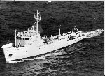 Columbus Iselin |
Bothner, M.H., Johnson, P.P., 1981, 210 Pb in sediment cores from the Atlantic continental shelf: estimates of rates of sediment mixing, chapter 3 in Popenoe, P.,ed., Environmental geologic studies on the southeastern United States Atlantic outer continental shelf, 1977-1978: U.S. Geological Survey Open-File Report (81-582-A), https://doi.org/10.3133/ofr81582A.
Popenoe, P., 1981, A summary of environmental geologic studies on the southeastern United States Atlantic outer continental shelf, 1977-1978: U.S. Geological Survey Open-File Report (81-583), 45 p., https://doi.org/10.3133/ofr81583.
Popenoe, P., 1980, Single-channel seismic-reflection profiles collected on the northern Blake Plateau, 29 September to 19 October 1978: U.S. Geological Survey Open-File Report 80-1265, https://doi.org/10.3133/ofr801265.
Popenoe, P., and Manheim, F.T., 2001, Origin and history of the Charleston Bump--geological formations, currents, bottom conditions, and their relationship to Wreckfish habitats on the Blake Plateau, in Sedberry, G.R., ed., Island in the Stream--Oceanography and Fisheries of the Charleston Bump: American Fisheries Society Symposium, v. 25.
Popenoe, P., ed., 1981, Appendices of environmental geologic studies on the southeastern United States Atlantic outer continental shelf, 1977-1978: U.S. Geological Survey Open-File Report 81-582-B, https://doi.org/10.3133/ofr81582B.
Popenoe, P., ed., 1981, Environmental geologic studies on the southeastern United States Atlantic outer continental shelf, 1977-1978: U.S. Geological Survey Open-File Report 81-582-A, 15 maps, scale 1:250,000, https://doi.org/10.3133/ofr81582A.
| Title | Survey Equipment | Description |
|---|---|---|
| Cruise report | (document not focused on specific equipment) | Chief Scientist's cruise report, track chart, and daily log. Includes personnel list, equipment list and cruise narrative. |
| Survey Equipment | Survey Info | Data Type(s) | Data Collected |
|---|---|---|---|
| Teledyne single-channel 300-500J 40-tip minisparker | --- | Sparker | |
| ORE 140 transceiver/1036 transducer sub-bottom profiler | --- | Sub Bottom Profiler | |
| Northstar 6000 LORAN-C | --- | Navigation | 1978-032-FA-LN-001-02 (Northern track chart with dates and hourly tic marks.) 1978-032-FA-LN-001 (Navigation trackline plot for field activity 78032) 1978-032-FA-LN-002-01 (Navigation data recovered from 9 track tape) 1978-032-FA-LN-001-03 (Middle track chart with dates and hourly tic marks.) 1978-032-FA-LN-002 (Digital tapes of NV, NV-INS, and NV-NSTAR-FINAL data: inv. # 0939, 1781 thru 1799, 1801 thru 1804, 1816 thru 1824, 1826, and 2810.) 1978-032-FA-LN-001-01 (Southern track chart with dates and hourly tic marks.) |
| Single channel hydrophone | --- | Air Gun / Water Gun Boomer Bubble Gun Sparker Sub Bottom Profiler | 1978-032-FA-SE-002 ( Collection of paper record displays of seismic data( MSP) for lines ) 1978-032-FA-SE-004 (analog tape of seismic data) 1978-032-FA-SE-003 (microfilm of ) 1978-032-FA-SE-001 (film collection of MSP,AIR,3.5) |
| ORE sidescan | --- | Sidescan | 1978-032-FA-SO-001 (microfilm of ) |
