Other ID: 79-2
Status: Completed
Organization(s): USGS, Woods Hole Coastal and Marine Science Center
Funding Program(s):
Principal Investigator(s): James V. A. Trumbull
Affiliate Investigator(s):
Information Specialist(s):
Data Type(s): Location-Elevation: Navigation, Sampling: Geology, Seismics: Boomer
Scientific Purpose/Goals: Luquillo area - determine suitability of method and map potential sand deposit. Escollo de Arenas - collect sand samples, determine suitability of method and map potential sand deposit. Cabo Rojo area - collect sand and surficial samples in potential sand deposit area, to evaluate both method and sand deposit. Mayaguez area - complete bathymetry of Mayaguez-Boqueron area w/echo sounding. Aguadilla-Isabela area - collect surface samples and two profiles to supplement previous coverage and determine shallow structure of area being geologically mapped.
Vehicle(s):
Start Port/Location:
End Port/Location:
Start Date: 1979-02-05
End Date: 1979-02-14
Equipment Used: Boomer, Shipek grab, Raytheon radar, Single channel hydrophone
Information to be Derived: Samples and chemical analysis; Sea floor map;
Summary of Activity and Data Gathered: Luquillo area - 448 km of 12 kHz echo sounding on upper slope to map canyons; 42 km of Uniboom lines.
Staff: Alan Goodman, Kurt Grove, James V. A. Trumbull
Affiliate Staff:
Nelson Espinell
Puerto Rico Dept. of Natural Resources; Jose Muniz
Puerto Rico Dept. of Natural Resources
Notes: Project = Puerto Rico Marine Geology Co-op, Puerto Rico Marine Geology Co-op
Location:
Puerto Rican shelf including Luquillo, Escollo de Arenas, Cobo Rojo, Mayaguez, and Aguadilla-Isabela, Puerto Rico, Caribbean Sea, United States, North America, North Atlantic;
| Boundaries | |||
|---|---|---|---|
| North: 18.6 | South: 18 | West: -67.4 | East: -65.55 |
Platform(s):
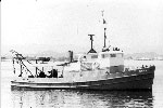
 Jean A |
Shideler, G.L., 1980, Maps showing composition of surficial sediments on the insular shelf of southwestern Puerto Rico: U.S. Geological Survey Miscellaneous Field Studies Map 1258, 1 sheet, URL: https://pubs.er.usgs.gov/publication/mf1258.
| Title | Survey Equipment | Description |
|---|---|---|
| Cruise report | (document not focused on specific equipment) | Chief Scientist's report including personnel, purpose and accomplishments, equipment, and comments. |
| Survey Equipment | Survey Info | Data Type(s) | Data Collected |
|---|---|---|---|
| Boomer | --- | Boomer | |
| Shipek grab | --- | Geology | |
| Raytheon radar | --- | Navigation | |
| Single channel hydrophone | --- | Air Gun / Water Gun Boomer Bubble Gun Sparker Sub Bottom Profiler | 1979-001-FA-SE-001 (analog tape of seismic data) |