Other ID: 79-3
Status: Completed
Organization(s): USGS, Woods Hole Coastal and Marine Science Center
Funding Program(s):
Principal Investigator(s): Gerald L. Shideler, James V. A. Trumbull
Affiliate Investigator(s):
Information Specialist(s):
Data Type(s): Sampling: Geology, Location-Elevation: Navigation
Scientific Purpose/Goals: Obtain core samples in sand bodies, sand wave deposits, and related strata of the Cabo Rojo West and Bahia Sucia areas.
Vehicle(s):
Start Port/Location:
End Port/Location:
Start Date: 1979-04-08
End Date: 1979-04-13
Equipment Used: Hydraulic drill, Motorola Mini-Ranger III
Information to be Derived: Samples and chemical analysis;
Summary of Activity and Data Gathered: 13 locations successfully cored.
Staff: Ronald C. Circe, Ronald J. Miller, Gerald L. Shideler, James V. A. Trumbull, John West, Neal Lillard, Kurt Grove
Affiliate Staff:
Puerto Rico Geological Survey: Nelson Espinell
Jose Muniz
Ramon Alonso (in charge of shore party/logistical support)
Julio Ortiz (shore party)
Hector Berrios (shore party)
Notes: Original Center People field contained: Jim Trumbull, Co-Chief Scientist; Gerry Shideler, Co-Chief Scientist; Kurt Grove (thru April 11 only); Jack Kindinger, Chief Diver; Ron Circe; Ron Miller; Neal Lillard; John West (shore party).
Project = Puerto Rico Marine Geology Co-op, Puerto Rico Marine Geology Co-op
Location:
Cabo Rojo West and Bahia Sucia, Puerto Rico, Caribbean Sea, United States, North America, North Atlantic;
| Boundaries | |||
|---|---|---|---|
| North: 18.2 | South: 17.8 | West: -67.7 | East: -67.3 |
Platform(s):
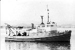
 Jean A |
Shideler, G.L., 1980, Maps showing composition of surficial sediments on the insular shelf of southwestern Puerto Rico: U.S. Geological Survey Miscellaneous Field Studies Map 1258, 1 sheet, URL: https://pubs.er.usgs.gov/publication/mf1258.
| Title | Survey Equipment | Description |
|---|---|---|
| Cruise report | (document not focused on specific equipment) | Cruise report listing personnel, purpose and accomplishments, equipment and comments. |
| Survey Equipment | Survey Info | Data Type(s) | Data Collected |
|---|---|---|---|
| Hydraulic drill | --- | Geology | |
| Motorola Mini-Ranger III | --- | Navigation |