Other ID: NE-3-79
Status: Completed
Organization(s): USGS, Woods Hole Coastal and Marine Science Center
Funding Program(s):
Principal Investigator(s): Harley J. Knebel
Affiliate Investigator(s):
Information Specialist(s): Sally Needell
Data Type(s): Location-Elevation: Navigation, Seismics: Air Gun / Water Gun, Seismics: Sub Bottom Profiler, Sonar: Sidescan
Scientific Purpose/Goals: Conduct an acoustic survey of the Potomac River to define areas of sediment accumulation, areas of sediment erosion or scour, the thickness of Holocene sediments, the internal structure of the near-surface sediments, the types of bottom topography, and the general geologic history and environmental framework of the estuary.
Vehicle(s):
Start Port/Location: Coltons Point, MD
End Port/Location: Alexandria, VA
Start Date: 1979-05-14
End Date: 1979-05-30
Equipment Used: Sidescan sonar, 2.5 kHz system (batfish), Air gun, Loran-C, Raytheon radar, Visual navigation, Single channel hydrophone
Information to be Derived:
Summary of Activity and Data Gathered: The acoustic study of the Potomac River was quite successful. The boat and equipment functioned quite well and we were able to gather all the data that we set out to get. Sidescan sonar: 481 km; 7 kHz: 481 km; Airgun: 481 km; 2.5 kHz: 246 km.
Staff: Frank W. Jennings, Harley J. Knebel, Paul Loud, Sally Needell, Kenneth F. Parolski
Affiliate Staff:
Jerry Glenn - Scientist
USGS WRD-Denver; Visitors from USGS-Reston: Jim Bennett
Doug Black
Terry Edgar
Ward Hickman
Jack Reed
Robert Rowland
Wayne Webb
Wayne Newell; Visitors from Johns Hopkins University: Andy Miller
Charles Richmond
Notes: Original Center People field contained: Harley Knebel - Chief Scientist, Sally Wood - Cruise Curator, Frank Jennings - Ops Manager, Ken Parolski - Electronics Technician, Paul Loud - Captain.
Project = Small Boat Surveys, Small Boat Surveys
Information from Foghorn: Sidescan sonar;2.5 kHz system (batfish);Airgun system (1 cu. in.);
Location:
Potomac River, Washington D.C. to Chesapeake Bay, Maryland, Virginia, United States, North America;
| Boundaries | |||
|---|---|---|---|
| North: 39.3 | South: 38.3 | West: -77.5 | East: -76.75 |
Platform(s):
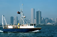
 Neecho |
Knebel, H.J., 1981, Seismic-reflection and sidescan-sonar data collected on the Potomac River, Maryland and Virginia, during May 1979: U.S. Geological Survey Open-File Report 81-174, 6 p., https://doi.org/10.3133/ofr81174.
| Title | Survey Equipment | Description |
|---|---|---|
| Cruise report | (document not focused on specific equipment) | Chief Scientist’s report with a description of the cruise (when, where, vessel), personnel listing, equipment, data acquired, and comments. Also includes trackmaps. |
| Geophysics data log | (document not focused on specific equipment) | Cruise Curator's chronological listing of seismic analog records from the 7.5 kHz, sidescan sonar, airgun, and batfish systems. |
| Navigation log | (document not focused on specific equipment) | Watchstanders' field log describing navigation and data acquisition from 7.5 kHz, sidescan sonar, airgun, and batfish systems. |
| Survey Equipment | Survey Info | Data Type(s) | Data Collected |
|---|---|---|---|
| Sidescan sonar | --- | Sidescan | 1979-008-FA-SO-001 (microfilm of ) |
| 2.5 kHz system (batfish) | --- | Sub Bottom Profiler | |
| Air gun | --- | Air Gun / Water Gun | |
| Loran-C | --- | Navigation | 1979-008-FA-LN-001-01 (Four cruise trackline maps including seismic line numbers, dates and times.) 1979-008-FA-LN-001 (Navigation trackline plot for field activity 79008) |
| Raytheon radar | --- | Navigation | |
| Visual navigation | --- | Navigation | |
| Single channel hydrophone | --- | Air Gun / Water Gun Boomer Bubble Gun Sparker Sub Bottom Profiler | 1979-008-FA-SE-001 ( Collection of paper record displays of seismic data( AIR) for lines ) 1979-008-FA-SE-002 (microfilm of ) |