Other ID: GS 7903-1
Status: Completed
Organization(s): USGS, Woods Hole Coastal and Marine Science Center
Funding Program(s):
Principal Investigator(s): Richard E. Sylwester
Affiliate Investigator(s):
Information Specialist(s):
Data Type(s): Electro-Magnetic: Magnetics, Imagery: Photo, Location-Elevation: Navigation, Seismics: Multichannel, Seismics: Sonobuoy, Seismics: Sparker, Seismics: Sub Bottom Profiler
Scientific Purpose/Goals: Test and evaluate geophysical systems to be used during the summer field season, including integrated navigation system, marine gravimeter; 3.5 kHz array, sparker, airguns, multichannel streamer, magnetometer, and refraction equipment.
Vehicle(s):
Start Port/Location: Miami, FL
End Port/Location: Woods Hole, MA
Start Date: 1979-05-23
End Date: 1979-05-30
Equipment Used: Sparker , Multichannel seismics, Marine magnetometer, Seismic refraction, 3.5 kHz, Integrated Navigation System, 35 mm camera, Single channel hydrophone
Information to be Derived:
Summary of Activity and Data Gathered: Discontinuous data due to testing equipment under various conditions.
Staff: Robert F. Bowles, James E. Dodd, David W. Folger, Alan Goodman, Barry Irwin, John Larson, Richard E. Sylwester
Affiliate Staff:
Gerard McCarthy
James Sullivan; D&M: Ian Watson; EPC LABS: George O'Keefe; WHOI: David Gever
Keith Van der Heidt
David Mason
Tom O'Brien
Daniel Shaughnessey; SEI: Lee Stihl.
Notes: Original Center People field contained: Richard Sylwester - Ch. Sci.; Robert Bowles, James Dodd, Dave Folger, Alan Goodman, Barry Irwin, John Larson, Gerard McCarthy, James Sullivan.
Project = Test Cruise, Test Cruise
Location:
Atlantic continental shelf, Miami, Florida to Woods Hole, Massachusetts, United States, North America, North Atlantic;
| Boundaries | |||
|---|---|---|---|
| North: 41.5 | South: 25.75 | West: -80.25 | East: -70.6 |
Platform(s):
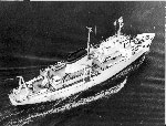 James M Gilliss |
| Title | Survey Equipment | Description |
|---|---|---|
| Cruise report | (document not focused on specific equipment) | Chief Scientist’s report with a description of the cruise (when, where, vessel), personnel listing, equipment and trackmap. |
| Survey Equipment | Survey Info | Data Type(s) | Data Collected |
|---|---|---|---|
| Sparker | --- | Sparker | |
| Multichannel seismics | --- | Multichannel | |
| Marine magnetometer | --- | Magnetics | |
| Seismic refraction | --- | Sonobuoy | |
| 3.5 kHz | --- | Sub Bottom Profiler | |
| Integrated Navigation System | --- | Navigation | 1979-011-FA-LN-001-01 (Navigation data) 1979-011-FA-LN-001 (Digital tape(s) of NV-INS, NV-FINAL, NV-INS-FINAL, ) |
| 35 mm camera | --- | Photo | 1979-011-FA-PH-001 (Gillis shipyard photo) |
| Single channel hydrophone | --- | Air Gun / Water Gun Boomer Bubble Gun Sparker Sub Bottom Profiler | 1979-011-FA-SE-004-01 (Paper record section of Lines 1, ) 1979-011-FA-SE-003 (analog tape of seismic data) 1979-011-FA-SE-001 ( Collection of paper record displays of seismic data( AIR) for lines ) 1979-011-FA-SE-002 (microfilm of ) |
