Other ID: NE-06
Status: Completed
Organization(s): USGS, Woods Hole Coastal and Marine Science Center
Funding Program(s):
Principal Investigator(s): David Twichell
Affiliate Investigator(s): David Aubrey - WHOI
Information Specialist(s):
Data Type(s): Location-Elevation: Navigation, Sampling: Biology, Sampling: Geology, Seismics: Boomer, Seismics: Sub Bottom Profiler, Sonar: Sidescan, Sonar: Single Beam
Scientific Purpose/Goals: Sidescan sonar and high-resolution seismic profiling were done in the nearshore zone (3-30 m water depth) off Nauset Inlet and Coast Guard Beach to map the types and extent of nearshore bedforms and to define the late Pleistocene and Holocene history of the area.
Vehicle(s):
Start Port/Location: Chatham, MA
End Port/Location: Chatham, MA
Start Date: 1979-09-27
End Date: 1979-10-03
Equipment Used: EG&G 234, Edo Western Sidescan and 2.5 kHz sub-bottom system, 12 kHz, Grab sampler, Northstar 6000 LORAN-C, Motorola Mini-Ranger III, Single channel hydrophone
Information to be Derived:
Summary of Activity and Data Gathered: Dates of the cruise were Sep. 27 and 28, and Oct. 2 and 3, 1979. Returned each night to Chatham, MA. Collected 32 lines of seismic and sidescan profiles. Uniboom data: 153 km; Sidescan sonar data: 153 km; Echo-sounder data: 153 km; Grab samples: 27.
Staff: Frank W. Jennings, Paul Loud, David Twichell
Affiliate Staff:
WHOI: David Aubrey - Ch. Sci.
John Trobridge - Scientist
Paul Speer - Scientist
Notes: Original Center People field contained: Dave Twichell (Ch. Sci.), Frank Jennings (Technician), Paul Loud (Skipper).
Project = Nauset Inlet Survey - Small Boat Project, Nauset Inlet Survey - Small Boat Project
Location:
Nauset Inlet, Chatham Inlet, Coast Guard Beach, Massachusetts, United States, North America, North Atlantic;
| Boundaries | |||
|---|---|---|---|
| North: 41.91667 | South: 41.75 | West: -70 | East: -69.88333 |
Platform(s):
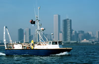
 Neecho |
Twichell, D.C., 1981, Single-channel seismic-reflection profiles and sidescan-sonar records collected by the R/V Neecho, cruise NE 79-06, on the inner shelf east of Cape Cod, Massachusetts: U.S. Geological Survey Open-File Report 81-375, https://doi.org/10.3133/ofr81375.
| Title | Survey Equipment | Description |
|---|---|---|
| Cruise report | (document not focused on specific equipment) | Chief Scientist's cruise report and daily log of ship movement, personnel, equipment and data acquisition notes, sample locations, and trackmap. |
| Survey Equipment | Survey Info | Data Type(s) | Data Collected |
|---|---|---|---|
| EG&G 234 | --- | Boomer | |
| Edo Western Sidescan and 2.5 kHz sub-bottom system | --- | Sub Bottom Profiler Sidescan | 1979-031-FA-SO-001 - Collection of paper record displays of sidescan sonar data (Analog paper records) 1979-031-FA-SO-002 (microfilm of ) |
| 12 kHz | --- | Single Beam | |
| Grab sampler | --- | Biology Geology | |
| Northstar 6000 LORAN-C | --- | Navigation | 1979-031-FA-LN-001 (Navigation trackline plot for field activity 79031) 1979-031-FA-LN-002 (Digital tape(s) of NV-NSTAR-FINAL, NV-MR, ) |
| Motorola Mini-Ranger III | --- | Navigation | |
| Single channel hydrophone | --- | Air Gun / Water Gun Boomer Bubble Gun Sparker Sub Bottom Profiler | 1979-031-FA-SE-002 (microfilm of ) 1979-031-FA-SE-001 (film collection of E/S,UNI,SSS) |