Other ID: OC 70
Status: Completed
Organization(s): USGS, Woods Hole Coastal and Marine Science Center
Funding Program(s):
Principal Investigator(s): Bradford Butman
Affiliate Investigator(s): John Vermersch, Jr. - WHOI
Information Specialist(s):
Data Type(s): Time Series: Mooring (physical oceanography)
Scientific Purpose/Goals: This cruise will consist of field operations in support of a Nantucket Shoals flux experiment being conducted jointly by WHOI, USGS, NMFS, and Univ. New Hampshire. Cruise objectives include: recover acoustically released bottom pressure gauges at sites N1, N2, N4, and N5; reset gauges at original positions, with the exception of N2 gauge which is to be reset south of Montauk Point; recover and reset a subsurface current meter mooring at N3; recover two surface moorings at N2 and reset one; make at least one CTD section along the mooring track; and attempt to recover a USGS mooring by dragging 10 miles northeast of N2. Deploy mooring 181 on Georges Bank.
Vehicle(s):
Start Port/Location: Woods Hole, MA
End Port/Location: Woods Hole, MA
Start Date: 1979-09-17
End Date: 1979-09-21
Equipment Used: Bottom platform
Information to be Derived: Time series data;
Summary of Activity and Data Gathered: USGS Mooring 181 (previously deployed) was located so that surface VACM could be added. Mooring deployed: 1 (#181 partial, recovered FA 79035 OCEANUS 77, Dec. 13-20, 1979).
Staff: Bradford Butman
Affiliate Staff:
WHOI: John Vermersch
Jr.
Robert Beardsley; Univ. New Hampshire: Wendell Brown
James Irish
Edward LaCoursiere
Mark Woodbury
Richard Trask
Jonathan Oakes
Karen Leavitt
Notes: Project = Nantucket Shoals Flux Experiment, Nantucket Shoals Flux Experiment
Location:
Nantucket Shoals and Georges Bank areas, United States, North America, North Atlantic;
| Boundaries | |||
|---|---|---|---|
| North: 38.72712607 | South: 38.603397 | West: -73.69299363 | East: -73.55690002 |
Platform(s):
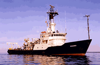
 Oceanus |
| Survey Equipment | Survey Info | Data Type(s) | Data Collected |
|---|---|---|---|
| Bottom platform | --- | Mooring (physical oceanography) | 1979-037-FA-OM-001 (Georges Bank Sediment mooring data) |