Other ID: none
Status: Completed
Organization(s): USGS, Woods Hole Coastal and Marine Science Center
Funding Program(s):
Principal Investigator(s): John Grow, George B. Tirey
Affiliate Investigator(s):
Information Specialist(s):
Data Type(s): Seismics: Multichannel
Scientific Purpose/Goals: Conduct a 12-channel high-resolution multichannel CDP survey to determine whether or not the physical characteristics of the rock and overburden, as well as the location of anomalous conditions such as faults, could be determined above the mines which extend underwater in the area.
Vehicle(s):
Start Port/Location: Rend Lake, IL
End Port/Location: Rend Lake, IL
Start Date: 1980-11-14
End Date: 1980-12-05
Equipment Used: Multichannel seismics
Information to be Derived: Morphology;
Summary of Activity and Data Gathered: Multichannel seismic reflection and seismic refraction data sent to Denver for analysis.
Staff: John Grow, Frank W. Jennings, Paul Loud, David Nichols, George B. Tirey
Affiliate Staff:
Al Balch (USGS-Denver)
John Miller (USGS-Denver)
Tom O'Brien (WHOI)
Bob Spier (Bur. Mines-Denver)
Joe Condon (Bur. Mines-Denver)
Notes: This survey was carried out in cooperation with the Bureau of Mines and completes an effort that began more than four years ago. Data analysis is being done in Denver prior to interpretation at Woods Hole. Information derived from pre-cruise report and branch report; no post-cruise report found.
Location:
Rend Lake, Illinois, United States, North America;
| Boundaries | |||
|---|---|---|---|
| North: 38.22308 | South: 37.99183 | West: -89.0799 | East: -88.86841 |
Platform(s):
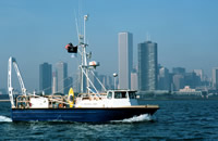
 Neecho |
| Survey Equipment | Survey Info | Data Type(s) | Data Collected |
|---|---|---|---|
| Multichannel seismics | --- | Multichannel |