Other ID: NE-81-2
Status: Completed
Organization(s): USGS, Woods Hole Coastal and Marine Science Center
Funding Program(s):
Principal Investigator(s): John Grow, Deborah Hutchinson
Affiliate Investigator(s):
Information Specialist(s):
Data Type(s): Electro-Magnetic: Magnetics, Location-Elevation: Navigation, Seismics: Multichannel, Sonar: Single Beam
Scientific Purpose/Goals: Determine whether the Connecticut Valley Triassic grabens extend south of New Haven into Long Island Sound. Determine whether sub-basement reflectors can be identified, especially in the vicinity of the gravity maximum which crosses western Long Island Sound and which is part of a major gravity anomaly extending from Georgia to Newfoundland.
Vehicle(s):
Start Port/Location: Noank, CT
End Port/Location: Woods Hole, MA
Start Date: 1981-06-02
End Date: 1981-06-12
Equipment Used: Varian V-75 magnetometer, Raytheon DE-719 precision echo sounder, Northstar 6000 LORAN-C, Multichannel seismics
Information to be Derived:
Summary of Activity and Data Gathered: 12-channel Seismic data: 301 km; Magnetics: 301 km; Fathometer: 157.3 km.
Staff: John Grow, Deborah Hutchinson, Frank W. Jennings, David Nichols
Affiliate Staff:
Scott Chalker
Shore Coordinator
Notes: Original Center People field contained: John Grow, Co-Chief Scientist; Debbie Hutchinson, Co-Chief Scientist; Frank Jennings, Chief Technician; Dave Nichols, DFS V Technician; Scott Chalker, Shore Coordinator.
Project = Mid Atlantic Resources, Mid Atlantic Resources
Location:
Long Island Sound, New York, Connecticut, United States, North America, North Atlantic,
| Boundaries | |||
|---|---|---|---|
| North: 41.25 | South: 40.58333 | West: -73.5 | East: -72.16667 |
Platform(s):
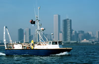
 Neecho |
| Title | Survey Equipment | Description |
|---|---|---|
| Cruise report | (document not focused on specific equipment) | Chief Scientist's cruise report of ship movement, equipment and data acquisition notes, equipment configurations, data tabulations, personnel, track chart. Also has 2 photos of operations. |
| Geophysics log | Multichannel seismics | Geophysics Logbook containing pre-cruise plan; data acquisition notes for multichannel air gun and streamer systems and navigation; technician's DFS V observer's daily report; configuration of ship, air and water guns, streamer, magnetometer, and fathometer; streamer monitor; and line summary containing start and end times, positions, length, and tape numbers. |
| Survey Equipment | Survey Info | Data Type(s) | Data Collected |
|---|---|---|---|
| Varian V-75 magnetometer | --- | Magnetics | |
| Raytheon DE-719 precision echo sounder | --- | Single Beam | |
| Northstar 6000 LORAN-C | --- | Navigation | 1981-016-FA-LN-001 (Navigation trackline plot for field activity 81016) |
| Multichannel seismics | --- | Multichannel | 1981-016-FA-SE-001 ( Collection of paper record displays of seismic data( AIR) for lines ) 1981-016-FA-SO-001 (microfilm of *MAG,NEAR TRACE MONITER) 1981-016-FA-SE-003-01 (SEGY seismic data recovered from 9track tape) 1981-016-FA-SE-002 (microfilm of *MAG,NEAR TRACE MONITER) |