Other ID: AST 83-2
Status: Completed
Organization(s): USGS, Woods Hole Coastal and Marine Science Center
Funding Program(s):
Principal Investigator(s): Robert N. Oldale
Affiliate Investigator(s): Ralph Lewis - CT DEP
Information Specialist(s):
Data Type(s): Location-Elevation: Navigation, Seismics: Boomer, Seismics: Sub Bottom Profiler, Sonar: Sidescan
Scientific Purpose/Goals: (1) Define geology and shallow structure of central Long Island Sound; (2) determine geologic framework and Quaternary development of the study area; and (3) identify and map potential geologic hazards.
Vehicle(s):
Start Port/Location: Woods Hole, MA
End Port/Location: Woods Hole, MA
Start Date: 1983-05-23
End Date: 1983-06-04
Equipment Used: EG&G 234, Edo Western Sidescan and 2.5 kHz sub-bottom system, Loran-C, Single channel hydrophone
Information to be Derived: Sea floor map; Morphology;
Summary of Activity and Data Gathered: Uniboom data were very good (excellent penetration and good resolution) except in areas where the acoustic signal was attenuated by gas in the sediments. Sidescan sonar records were satisfactory. Uniboom: 656 km; Sidescan sonar: 422 km.
Staff: Jack Connell, Robert N. Oldale
Affiliate Staff:
Ralph Lewis - CT DEP
Ch. Sci.; Stewart Richards
GFA (May 27 - June 2)
Notes: Original Center People field contained: Bob Oldale, geologist (May 26); Stewart Richards, GFA (May 27 - June 2); Jack Connell - ET.
Project = Rhode Island Sound Co-op; New England Coastal Geology, Rhode Island Sound Co-op; New England Coastal Geology
Location:
central Long Island Sound, Clinton to New Haven, Connecticut, United States, North America, North Atlantic;
| Boundaries | |||
|---|---|---|---|
| North: 41.25440906 | South: 40.95927491 | West: -72.96692046 | East: -72.52212524 |
Platform(s):
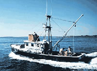
 Asterias |
Poppe, L.J., Williams, S. J., Moser, M. S., Forfinski, N. A., Stewart, H. F., and Doran, E. F., 2008, Quaternary geology and sedimentary processes in the vicinity of Six Mile Reef, eastern Long Island Sound: Journal of Coastal Research, v. 24 no. 1, doi: 10.2112/06-0743.1.
Poppe, L.J., Denny, J.F., Williams, S.J., Moser, M.S., Forfinski, N.A., Stewart, H.F., and Doran, E.F., 2007, The geology of Six Mile Reef, Eastern Long Island Sound: U.S. Geological Survey Open-File Report 2007-1191, https://doi.org/10.3133/ofr20071191.
Poppe, L.J., Paskevich, V.F., Lewis, R.S., and DiGiacomo-Cohen, M.L., 2002, Geological framework data from Long Island Sound, 1981-1990—A digital data release: U.S. Geological Survey Open-File Report 2002-002,
| Title | Survey Equipment | Description |
|---|---|---|
| Cruise report | (document not focused on specific equipment) | Chief Scientist's cruise report including personnel, equipment list, operation procedures and a brief cruise narrative. Also included are 2 track charts. |
| Survey Equipment | Survey Info | Data Type(s) | Data Collected |
|---|---|---|---|
| EG&G 234 | --- | Boomer | |
| Edo Western Sidescan and 2.5 kHz sub-bottom system | --- | Sub Bottom Profiler Sidescan | 1983-002-FA-SO-001 ( Collection of paper record displays of sidescan sonar data for lines ) 1983-002-FA-SO-002 (microfilm of ) |
| Loran-C | --- | Navigation | 1983-002-FA-LN-001 (Navigation trackline plot for field activity 83002) 1983-002-FA-LN-002-01 (Navigation data) 1983-002-FA-LN-002 (Digital tape(s) of NV, ) |
| Single channel hydrophone | --- | Air Gun / Water Gun Boomer Bubble Gun Sparker Sub Bottom Profiler | 1983-002-FA-SE-002 (analog tape of seismic data) 1983-002-FA-SE-001 (microfilm of ) 1983-002-FA-SE-003 (Scanned Profiles - 25 scanned record sections in TIFF format.) |