Other ID: DSDP Leg 95
Status: Completed
Organization(s): USGS, Woods Hole Coastal and Marine Science Center
Funding Program(s):
Principal Investigator(s): Claude (Wylie) Poag
Affiliate Investigator(s): Anthony B. Watts - LDGO, Palisades, NY
Information Specialist(s):
Data Type(s): Sonar: Single Beam, Sampling: Geology
Scientific Purpose/Goals: The principal scientific objective of Leg 95 was to document the Cenozoic and Latest Cretaceous depositional history of the New Jersey continental slope and upper rise. Geological and geophysical analysis of continuously cored strata from these sites would allow us to establish the composition, stratigraphic framework, and depositional environments of sediments constituting shelf/rise transition; accurately date the biostratigraphic gaps and major seismic reflectors (both conformable and unconformable) in the section; document lateral variability in bio- and lithofacies and compare the facies observed with analogues from the modern slope and rise; establish paleoenvironmental cycles, detailed biostratigraphic zonations, and stable-isotopic stratigraphy; calibrate poorly known siliceous planktonic and benthic biozones with the widely applied calcareous microfossil zonations; identify depositional sequences and evaluate their relationships with seismic sequences, sea-level changes, tectonism, oceanic current patterns, water-mass composition, and sediment provenance and accumulation rates; compare and correlate the geological and geophysical record of the slope and upper rise with that of the adjacent shelf and lower rise (especially that at Site 603) and with other passive margins such as the Goban Spur on the Irish Continental Slope (drilled on Leg 80); and determine the detailed subsidence history at Site 612 by "backstripping" techniques and compare the resulting tectonic subsidence with predictions based on thermal and mechanical models for the development of passive margins.
Vehicle(s):
Start Port/Location: St. John's, Newfoundland, Canada
End Port/Location: Ft. Lauderdale, FL
Start Date: 1983-08-17
End Date: 1983-09-26
Equipment Used: Echosounder, Gravity corer, Well drilling
Information to be Derived: Samples and chemical analysis; Grain size analysis; Morphology;
Summary of Activity and Data Gathered: Site 612: 72 cores; Site 613: 52 cores. Seismic lines were run between the sites.
Staff: Page Valentine, Claude (Wylie) Poag
Affiliate Staff:
Anthony B. Watts - co-Chief Scientist
LDGO
Notes: Original Center People field contained: C. Wylie Poag - co-Chief Scientist, Page Valentine - paleontologist.
Project = Deep Sea Drilling Program (DSDP), Deep Sea Drilling Program (DSDP)
Location:
New Jersey margin, Baltimore Canyon Trough, United States, middle Atlantic outer continental shelf and slope, North America, North Atlantic;
| Boundaries | |||
|---|---|---|---|
| North: 38.82017 | South: 38.82 | West: -72.7738 | East: -72.77333 |
Platform(s):
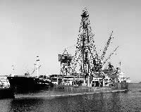 Glomar Challenger |
Poag, C.W., Watts, A. B., Cousin, M., Goldberg, D., Hart, M. B., Miller, K. G., Mountain, G. S., Nakamura, Y., Palmer, A. A., Schiffelbein, P. A., Schreiber, B. C., Tarafa, M. E., Thein, J. E., Valentine, P. C., Wilkens, R. H., and Turner, K. L., 1987, Initial reports of the Deep Sea Drilling Project covering Leg 95 of the cruises of the drilling vessel GLOMAR CHALLENGER, St. John's, Newfoundland, to Ft. Lauderdale, Florida, August-September 1983: , Initial Reports of the Deep Sea Drilling Project. , 817 p., http://www.deepseadrilling.org/95/dsdp_toc.htm.
| Survey Equipment | Survey Info | Data Type(s) | Data Collected |
|---|---|---|---|
| Echosounder | --- | Single Beam | |
| Gravity corer | --- | Geology | |
| Well drilling | --- | Geology |
