Other ID: 84-2
Status: Completed
Organization(s): USGS, Woods Hole Coastal and Marine Science Center
Funding Program(s):
Principal Investigator(s): David W. Folger
Affiliate Investigator(s): Eugene A. Shinn - USGS-St. Petersburg; R.A. Slater - GEOCUBIC, Inc.
Information Specialist(s):
Data Type(s): Imagery: Video, Sampling: Biology, Sampling: Geology, Sampling: Chemistry, Imagery: Photo, Location-Elevation: Navigation
Scientific Purpose/Goals: Geologic investigations of two nuclear craters.
Vehicle(s):
Start Port/Location:
End Port/Location:
Start Date: 1984-07-14
End Date: 1984-08-12
Equipment Used: VHS Video camera, Grab sampler, SCUBA, Hydraulic drill, Nikonos camera, Honeywell Hydrostar, Motorola Falcon IV Microwave relay Mini-Ranger
Information to be Derived: Samples and chemical analysis; Photos and Observations;
Summary of Activity and Data Gathered: Samples: 246; Cores; Photos; Video and audio recordings of observations; 16 mm films.
Staff: Gregory Miller, James M. Robb, Kenneth F. Parolski, David Nichols, Dann Blackwood, Thomas O'Brien
Affiliate Staff:
USGS-St. Pete: E.A. Shinn - Ch. Sci.
R.B. Halley
J.H. Hudson
J.L. Kindinger; Geocubic Inc.: R.A. Slater - co-Ch. Sci. and submersible operator; MARFAB: D.N. Privitt - submersible operator; Defense Nuclear Agency (DNA): B.L. Ristvet - observer; Meridian Ocean Systems
Inc. (MOS): R.C. Hollar - navigator
R.F. Johnson - navigator
S.L. Thoresen - navigator; Wilson; James; Meyers; Nunes; Trumbore; Sevin; Jones; Dai; Kreyenhagen; Schenker; Brown; Matthewman; Bramlette
Notes: No pre- or post-cruise report found; information derived from USGS Bulletin 1678. Submitted 04/28/2009 by A. Orton for Dave Folger and E. Shinn. Original Center People field contained: M.W. Hempenius, D.W. Folger, D.J. Roddy. Original Submitted By field contained: A. Orton for Dave Folger.
Project = Pacific Enewetak Atoll Crater Exploration (PEACE), Pacific Enewetak Atoll Crater Exploration (PEACE)
Location:
Enewetak Atoll, Enewetok, Marshall Islands, Trust Territory of the Pacific Islands (TTPI), North Pacific;
| Boundaries | |||
|---|---|---|---|
| North: 11.8 | South: 11.2 | West: 161.9 | East: 162.5 |
Platform(s):
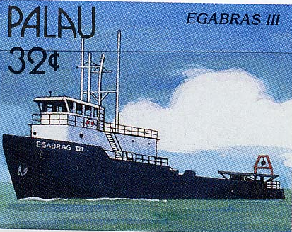 Egabrag II |  Halimeda | Delta |
Reich, C., Streubert, M., Dwyer, B., Godbout, M., Muslic, A., Umberger, D., 2012, St. Petersburg Coastal and Marine Science Center's core archive portal: U.S. Geological Survey Data Series 626, https://doi.org/10.3133/ds626.
Folger, D.W., 1986, Introduction, in Folger, D.W., ed., Sea-floor observations and subbottom seismic characteristics of OAK and KOA craters, Enewetak Atoll, Marshall Islands: U.S. Geological Survey Bulletin 1678, URL: https://doi.org/10.3133/b1678.
Folger, D.W., Hampson, J.C., Robb, J.M., Woellner, R.A., Foster, D.S., and Tavares, L.A., 1986, Bathymetry of OAK and KOA craters, Chapter A in Folger, D.W., ed., Sea-floor observations and subbottom seismic characteristics of OAK and KOA craters, Enewetak Atoll, Marshall Islands: U.S. Geological Survey Bulletin 1678, URL: https://doi.org/10.3133/b1678.
| Survey Equipment | Survey Info | Data Type(s) | Data Collected |
|---|---|---|---|
| VHS Video camera | --- | Video | |
| Grab sampler | --- | Biology Geology | |
| SCUBA | --- | Biology Chemistry Geology | |
| Hydraulic drill | --- | Geology | |
| Nikonos camera | --- | Photo | |
| Honeywell Hydrostar | --- | Navigation | |
| Motorola Falcon IV Microwave relay Mini-Ranger | --- | Navigation |
