Other ID: none
Status: Completed
Organization(s): USGS, Woods Hole Coastal and Marine Science Center
Funding Program(s):
Principal Investigator(s): James M. Robb, David Twichell
Affiliate Investigator(s):
Information Specialist(s):
Data Type(s): Imagery: Photo, Imagery: Video, Location-Elevation: Navigation, Sampling: Biology, Sampling: Geology, Sonar: Sidescan, Visual Identification: Submersible Observations, Seismics: Sub Bottom Profiler
Scientific Purpose/Goals: Observation and sampling of the upper continental slope, between Lindenkohl and South Toms Canyons, offshore New Jersey.
Vehicle(s):
Start Port/Location: Naval Submarine Base New London, Groton, CT
End Port/Location: Naval Submarine Base New London, Groton, CT
Start Date: 1985-05-08
End Date: 1985-05-16
Equipment Used: 7.5 kHz, Westinghouse 100-kHz sidescan sonar, Camera- deep sea, Video camera - deep sea, Push corer (wh), Loran-C, Sonar Doppler, Submersible Observation
Information to be Derived:
Summary of Activity and Data Gathered: Sampling and visual observations conducted. 7 kHz sub-bottom profiles: 102 km; Sidescan sonar: 102 km; VHS cassette tapes: 26; Benthos-camera film: 400 ft; 70 mm film: 150 ft; Hand-held (Topcon 35 mm) camera: 3 film rolls; Digital data on 9T magnetic tapes: 3 reels; Sediment cores (12-inch corers): 10.
Staff: James M. Robb, David Twichell
Affiliate Staff:
Notes:
Location:
Atlantic Continental Slope, Middle Atlantic Bight, Lindenkohl Canyon, South Toms Canyon, New Jersey, Delaware, United States, North America, North Atlantic;
| Boundaries | |||
|---|---|---|---|
| North: 39 | South: 38.66667 | West: -73 | East: -72.5 |
Platform(s):
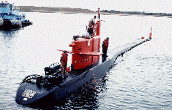 NR-1 |
| Title | Survey Equipment | Description |
|---|---|---|
| Cruise report | (document not focused on specific equipment) | Chief Scientist's cruise report including equipment, data acquired, and cruise narrative including preliminary scientific evaluation. |
| Survey Equipment | Survey Info | Data Type(s) | Data Collected |
|---|---|---|---|
| 7.5 kHz | --- | Sub Bottom Profiler | |
| Westinghouse 100-kHz sidescan sonar | --- | Sidescan | 1985-012-FA-SO-001 ( Collection of paper record displays of sidescan sonar data for lines ) |
| Camera- deep sea | --- | Photo | 1985-012-FA-PH-001 (film collection of ) |
| Video camera - deep sea | --- | Video | |
| Push corer (wh) | --- | Biology Geology | |
| Loran-C | --- | Navigation | 1985-012-FA-LN-001 (Digital tape(s) of NV-H2O, ) |
| Sonar Doppler | --- | Navigation | |
| Submersible Observation | --- | Submersible Observations |
