Other ID: 85-G-11
Status: Completed
Organization(s): USGS, Woods Hole Coastal and Marine Science Center
Funding Program(s):
Principal Investigator(s): Kim D. Klitgord
Affiliate Investigator(s):
Information Specialist(s):
Data Type(s): Seismics: Multichannel, Electro-Magnetic: Magnetics, Electro-Magnetic: Gravity, Location-Elevation: Navigation, Seismics: Ocean Bottom Seismometer, Seismics: Sub Bottom Profiler, Seismics: Sonobuoy
Scientific Purpose/Goals: Primary objectives were to acquire: 1) shallow to intermediate depth penetration seismic reflection data with USGS seismic reflection system; 2) intermediate to deep depth penetration wide-angle seismic reflection and refraction data with the USGS Ocean Bottom Seismometer (OBS) system; and 3) high-quality gravity and navigation data.
Vehicle(s):
Start Port/Location: Woods Hole, MA
End Port/Location: Woods Hole, MA
Start Date: 1985-10-06
End Date: 1985-11-04
Equipment Used: Multichannel seismics, Marine magnetometer, Gravity meter (wh), Northstar 6000 LORAN-C, Ocean Bottom Seismometer, 3.5 kHz, Seismic refraction, Loran-C, GPS (wh), Gyro compass
Information to be Derived: Morphology;
Summary of Activity and Data Gathered: Seismic reflection/refraction, gravity, magnetic, and navigation data acquired. Multichannel seismic reflection (MCS): 11 lines, totaling 1305 km; OBSes: 8 lines, 28 deployments; Gravity-box surveys for navigation-gravity calibration: 2.
Staff: Deborah Hutchinson, Barry Irwin, David Mason, Gregory Miller, David Nichols, Thomas O'Brien, Kim D. Klitgord, James E. Dodd, David Leeds, Corina Savela, Anne M. Trehu, Sarah Dunlap
Affiliate Staff:
Wally Bothner - UNH; John Brooks - GFA
UNH; John Unger - USGS-Reston; Oscar Febres-Cordero - air-gun compressor system
U. Texas-Austin; David Taylor - USGS-Denver; David Stewart - USGS-Reston; Charlie McClennen - Colgate Univ.; James McCullough - WHOI; David Turner - LaCoste Romberg Co.
Notes: The cruise report was not specific as to what personnel were on the ship. Names were taken from the report summary that appeared to have some cruise function. Original Center People field contained: Kim Klitgord, Chief Scientist; Greg Miller, seismic acquisition systems; Dave Nichols, seismic acquisition systems; Tom O'Brien, seismic acquisition systems; David Mason, air-gun compressor system; Barry Irwin, Navigation/gravity systems; Jim Dodd, Navigation/gravity systems; Corina Savela, Navigation/gravity systems; David Leeds, GFA; Sarah Dunlap, GFA; Debbie Hutchinson; Anne Trehu.
Project = USGS Deep Crustal Program, USGS Deep Crustal Program
Location:
Gulf of Maine, United States, North America, North Atlantic,
| Boundaries | |||
|---|---|---|---|
| North: 44.31773487 | South: 41.36123522 | West: -70.15869141 | East: -66.59186768 |
Platform(s):
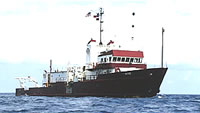
 Gyre |
| Title | Survey Equipment | Description |
|---|---|---|
| Cruise report | (document not focused on specific equipment) | Chief Scientist's report with cruise summary, chronology of cruise, personnel, acquisition systems, seismic line information including start, end, waypoints and equipment description, and a trackmap. |
| Data inventory | (document not focused on specific equipment) | Cruise Curator's field data inventory. |
| Navigation log | Northstar 6000 LORAN-C | Navigation log including gravity data start and end times, cruise chronology, Loran log with additional comments with regards to seismic shots. The logbook also contains MCS line information and OBS locations. |
| Geophysics log | (document not focused on specific equipment) | Geophysics watchstander's log with start and end of lines and tapes; OBS, magnetometer, airgun and streamer deployments and recoveries; equipment configuration and performance notes; data acquisition notes. |
| Observer log | (document not focused on specific equipment) | DFS-V Technician's observer's marine report with start and end of files, lines, and tapes; parity; equipment configuration and performance; data acquisition notes |
| Observer log | (document not focused on specific equipment) | DFS-V Technician's and Watchstanders' observer's daily report including ship configuration, start and end of files, lines, and tapes; equipment configuration and performance; data acquisition notes. |
| Survey Equipment | Survey Info | Data Type(s) | Data Collected |
|---|---|---|---|
| Multichannel seismics | --- | Multichannel | 1985-035-FA-SE-002 (microfilm of ) 1985-035-FA-SO-001 (microfilm of ) 1985-035-FA-SE-003-01 (DEMUX SEG-Y Data for Lines 1 - 11 recovered from 9 track tape) 1985-035-FA-SE-003-02 (STACK SEG-Y Data for Lines 1 - 11 recovered from 9 track tape) |
| Marine magnetometer | --- | Magnetics | |
| Gravity meter (wh) | --- | Gravity | |
| Northstar 6000 LORAN-C | --- | Navigation | |
| Ocean Bottom Seismometer | --- | Ocean Bottom Seismometer | |
| 3.5 kHz | --- | Sub Bottom Profiler | 1985-035-FA-SE-001 ( Collection of paper record displays of seismic data( 12K) for lines ) |
| Seismic refraction | --- | Sonobuoy | |
| Loran-C | --- | Navigation | 1985-035-FA-GP-001-03 (Cruise trackline data including latitude, longitude, shot number, date, and time.) 1985-035-FA-LN-002 (Digital tape(s) of GR, NV, CPIO-OCABU, OBS, ) 1985-035-FA-GP-001-01 (Raw navigation recovered from 9 track tape) 1985-035-FA-GP-001-02 (Raw navigation recovered from 9 track tape) |
| GPS (wh) | --- | Navigation | |
| Gyro compass | --- | Navigation |