Other ID: GL86
Status: Completed
Organization(s): USGS, Woods Hole Coastal and Marine Science Center
Funding Program(s):
Principal Investigator(s): Anne M. Trehu
Affiliate Investigator(s):
Information Specialist(s): Anne M. Trehu
Data Type(s): Seismics: Ocean Bottom Seismometer, Sonar: Single Beam, Location-Elevation: Navigation
Scientific Purpose/Goals: This course was part of a large-scale effort by the U.S. Geological Survey and the Geological Survey of Canada to image the deep crustal structure of the Great Lakes region. This report covers the operations of the ocean bottom seismometers (OBSes), which were deployed along a line across Lake Superior to record large-offset seismic data from a series of shots generated by a commercial contract vessel.
Vehicle(s):
Start Port/Location: Sault Ste. Marie, MI
End Port/Location: Sault Ste. Marie, MI
Start Date: 1986-08-30
End Date: 1986-09-05
Equipment Used: Ocean Bottom Seismometer, Echosounder, Loran-C
Information to be Derived:
Summary of Activity and Data Gathered: During the first leg, instruments were deployed at each of five stations occupied and ranges were measured acoustically from 4-5 points around the deployment site. Instruments were retrieved during the second leg. Preliminary plots of record sections indicate that the data are of excellent quality. Good signal-to-noise ratios were obtained out to the largest offsets recorded (185 km).
Staff: Anne M. Trehu, Gregory Miller
Affiliate Staff:
Notes: Cruise included two legs: Leg 1, 8/30-9/02 - leave Sault Ste. Marie, MI and arrive Marquette, MI; Leg 2, 9/03-9/05 - leave Marquette, MI and arrive Sault Ste. Marie, MI.
Project = Great Lakes - Deep Crustal Studies, Great Lakes - Deep Crustal Studies
Location:
Lake Superior, Great Lakes, United States, Canada, North America;
| Boundaries | |||
|---|---|---|---|
| North: 48.33 | South: 47.09 | West: -87.37 | East: -87.09 |
Platform(s):
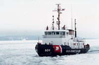
 Katmai Bay |
Hutchinson, D.R., Morel-a-l'Huissier, P., Meyer, H., Asudeh, I., Ervin, P., Hajnal, Z., Karl, J., Mereu, R., Meyer, R., Sexton, J., Spencer, C., and Trehu, A., 1988, A description of GLIMPCE, 1986, large offset seismic experiment from the Great Lakes: U.S. Geological Survey Open-File Report 88-431, 91 p., URL: https://doi.org/10.3133/ofr88431.
Miller, G.K., and Dodd, J.E., 1986, Magnetic tape format for the USGS ocean bottom seismometer: U.S. Geological Survey Open-File Report 86-256, 9 p., URL: https://doi.org/10.3133/ofr86256.
| Title | Survey Equipment | Description |
|---|---|---|
| Cruise report | (document not focused on specific equipment) | Chief Scientist's report including personnel, purpose, equipment, tabulated information, trackmap. |
| Survey Equipment | Survey Info | Data Type(s) | Data Collected |
|---|---|---|---|
| Ocean Bottom Seismometer | --- | Ocean Bottom Seismometer | 1986-018-FA-SE-001 (Digital tape(s) of OBS, ) |
| Echosounder | --- | Single Beam | |
| Loran-C | --- | Navigation |