Other ID: OCE 178
Status: Completed
Organization(s): USGS, Woods Hole Coastal and Marine Science Center
Funding Program(s):
Principal Investigator(s): Michael Bothner
Affiliate Investigator(s):
Information Specialist(s):
Data Type(s): Environmental Data: Temperature, Location-Elevation: Navigation, Sampling: Chemistry, Sampling: Geology, Sonar: Single Beam
Scientific Purpose/Goals: Continued effort for Georges Bank Monitoring Program. Samples collected to determine the distribution of barium (a component of drilling mud) around the Bank and with depth in sediments. Samples were also collected to continue the monitoring of benthic infauna.
Vehicle(s):
Start Port/Location: Woods Hole, MA
End Port/Location: Woods Hole, MA
Start Date: 1986-09-09
End Date: 1986-09-13
Equipment Used: Gravity corer, XBT, Niskin bottle, Loran-C, 10 kHz Bathymetry, Slow corer
Information to be Derived: Time series data; Samples and chemical analysis;
Summary of Activity and Data Gathered: This cruise continued the effort started 5 years ago for the Georges Bank Monitoring Program. Samples were collected to determine the distribution of barium (a component of drilling mud) around the Bank and with depth in sediments. Samples were also collected to continue the monitoring of benthic infauna. Bathymetry, near-bottom water samples, cores and grabs were also collected in Franklin Basin, just north of Georges Bank. This work investigated the anoxic sediments of this region. The hydraulically damped corer recovered excellent samples on the Bank operating through the stern A-frame using the trawl winch. Part of the success was due to the exceptionally calm seas for the first 2 days of the cruise. In anything but calm seas, it would be wise to use this equipment off the starboard side of the ship using the Marky winch and the power davit recently installed. At this position on the ship, equipment is subjected to much less heave while on station. Bathymetry: 912 km; Oxygen/nutrient water samples: 5; Salinity samples: 19; XBTs: 9; Gravity cores: 5; Grabs: 100; Hydraulically damped cores: 31.
Staff: Michael Bothner, Gregory DiLisio, George Harrison, Mary E. Hastings, Steve Mateus, John Moody, Carol M. Parmenter, Richard Rendigs, William J. Strahle, William Winters
Affiliate Staff:
Rose Petrecca
WHOI; Patricia Hughes
MA Coastal Zone Management
Notes: Original Center People field contained: Mike Bothner, Chief Scientist; Gregory DiLisio; George Harrison; Steven Mateus; John Moody; Carol Parmenter; Richard Rendigs; Mary Polly Shoukimas; William Strahle; William Winters.
Project = Geochemistry of offshore marine sediments, Geochemistry of offshore marine sediments
Information from Foghorn: Epsco plotter;Northstar 7000, interfaced with Apple Computer (Eliason);Hydraulically damped gravity corer;Gravity corer with 4 inch plastic pipe (Broda);XBTs;Niskin bottles for salinty, oxygen, and nutrients;
Location:
Franklin Basin, Georges Bank, Gulf of Maine, United States, North America, North Atlantic;
| Boundaries | |||
|---|---|---|---|
| North: 42.63485687 | South: 40.31583555 | West: -68.78056478 | East: -66.69305589 |
Platform(s):
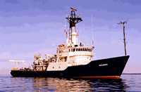
 Oceanus |
| Title | Survey Equipment | Description |
|---|---|---|
| Cruise report | (document not focused on specific equipment) | Chief Scientist's report including personnel, purpose, equipment, and brief summary and comments. Also includes a trackmap and sample location and information. |
| Cruise log | (document not focused on specific equipment) | Chief Scientist's pre-cruise report detailing cruise objectives, equipment, personnel, and track plan, plus watchstanders' cruise narrative with ship movement, station descriptions and sample collection notes. |
| Cruise report | (document not focused on specific equipment) | WHOI cruise report including personnel and trackmap. |
| Survey Equipment | Survey Info | Data Type(s) | Data Collected |
|---|---|---|---|
| Gravity corer | --- | Geology | |
| XBT | --- | Temperature | |
| Niskin bottle | --- | Chemistry | |
| Loran-C | --- | Navigation | |
| 10 kHz Bathymetry | --- | Single Beam | 1986-021-FA-SE-001 ( Collection of paper record displays of seismic data( 10K) for lines ) |
| Slow corer | --- | Geology | 1986-021-FA-SC-001 (CORE samples) |