Other ID: LANG 86-1
Status: Completed
Organization(s): USGS, Woods Hole Coastal and Marine Science Center
Funding Program(s):
Principal Investigator(s): Ronald C. Circe, S. Jeffress Williams
Affiliate Investigator(s):
Information Specialist(s):
Data Type(s): Location-Elevation: Navigation, Seismics: Boomer, Seismics: Sub Bottom Profiler, Sonar: Single Beam
Scientific Purpose/Goals: Offshore survey using high-resolution geophysical equipment to collaborate with previously collected vibracores. Data will be used to assess area for quality sand to be used as nourishment for Virginia Beach.
Vehicle(s):
Start Port/Location: Gloucester Point, VA
End Port/Location:
Start Date: 1986-10-07
End Date: 1986-10-10
Equipment Used: 3.5 kHz, Benthos AQ-4 10-element hydrophone streamer, Motorola Falcon IV Microwave relay Mini-Ranger, ORE GeoPulse, Humminbird fishfinder
Information to be Derived:
Summary of Activity and Data Gathered: Approx. 150 km of continuous data were collected.
Staff: Ronald C. Circe, Kenneth F. Parolski, Rob Wertz, S. Jeffress Williams
Affiliate Staff:
Don Wright - VIMS; Bob Gamish - VIMS; Mal Green - VIMS
Australian grad student; Lauro Calliari - VIMS
Brazilian grad student; Jae Kyung Oh - Visiting Professor from South Korea to VIMS
Notes: There were three legs of this cruise: Oct. 7-10 (Leg 1); Nov. 9-20 (Leg 2); Dec. 8-13 (Leg 3).
Project = Sand Inventory Investigation Offshore VA Beach, VA, Sand Inventory Investigation Offshore VA Beach, VA
Location:
Cape Henry to Rudee Inlet, Virginia Beach, Virginia, United States, North America, North Atlantic;
| Boundaries | |||
|---|---|---|---|
| North: 36.8 | South: 36.6 | West: -76 | East: -75.8 |
Platform(s):
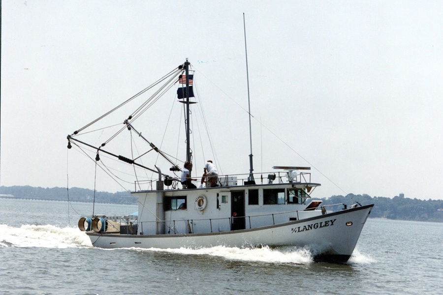 Langley |
| Title | Survey Equipment | Description |
|---|---|---|
| Cruise report | (document not focused on specific equipment) | Chief Scientist's report including personnel, purpose, equipment, tabulated data and trackmap. |
| Survey Equipment | Survey Info | Data Type(s) | Data Collected |
|---|---|---|---|
| 3.5 kHz | --- | Sub Bottom Profiler | |
| Benthos AQ-4 10-element hydrophone streamer | --- | Air Gun / Water Gun Boomer Sparker | 1986-023-FA-SE-001 (analog tape of seismic data) |
| Motorola Falcon IV Microwave relay Mini-Ranger | --- | Navigation | 1986-023-FA-LN-002 (Floppy disk(s) containing NV-MEGAPULSE, NV-MEGAPULSE, NV-MEGAPULSE, NV-MEGAPULSE, ) 1986-023-FA-LN-001-01 (Composite trackline map with line numbers for LANGLEY 86-1 (FA 86023), HOLTON 86-1 (FA 86029) and HOLTON 86-2 (FA 86031)) 1986-023-FA-LN-001 (Navigation trackline plot for field activity 86023) 1986-023-FA-LN-003 (Digital tape(s) of NV-BTHY-MINIRANGR, RAW NV, ) |
| ORE GeoPulse | --- | Boomer | |
| Humminbird fishfinder | --- | Single Beam | 1986-023-FA-BA-001 (Digital tape(s) of NV-BTHY-MINIRANGR, RAW NV, ) 1986-023-FA-BA-002 (Digital tape(s) of NV-BTHY-MINIRANGR, RAW NV, ) |
