Other ID: 86-Test
Status: Completed
Organization(s): USGS, Woods Hole Coastal and Marine Science Center
Funding Program(s):
Principal Investigator(s): Barry Irwin
Affiliate Investigator(s): John Gann, USGS-Menlo Park
Information Specialist(s): Barry Irwin
Data Type(s): Electro-Magnetic: Gravity, Location-Elevation: Navigation
Scientific Purpose/Goals: Transit from eastern Caribbean work area to western Caribbean to test new navigation equipment and run one gravity line.
Vehicle(s):
Start Port/Location: Roosevelt Roads, Puerto Rico
End Port/Location: Kingston, Jamaica
Start Date: 1986-10-22
End Date: 1986-10-25
Equipment Used: Gravity meter (wh), Magnavox satellite positioning system, GPS (wh)
Information to be Derived: Satellite navigation system test;
Summary of Activity and Data Gathered: Integration of the Atlantic Marine Geology navigation system with the gravity meter and the new STARFIX commercial satellite navigation system was completed during transit. Results acquired during 6 crossings of the same feature provided excellent results and indicated system was successful.
Staff: Barry Irwin, David W. Folger, James E. Dodd
Affiliate Staff:
John Gann - USGS-Menlo Park; C. Gilbert - USGS-Menlo Park; C. Gard - DMA; Jim McCullough
WHOI; G. Forrestier - John Chance Assoc.; T. Carpenter - Sperry
Notes:
Project = Defense Mapping Agency Gravity, Defense Mapping Agency Gravity
Location:
Caribbean Sea, North America, North Atlantic;
| Boundaries | |||
|---|---|---|---|
| North: 17.9 | South: 17.5 | West: -76.9 | East: -66 |
Platform(s):
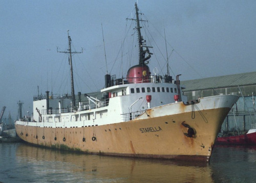
 Starella |
Folger, D.W., Irwin, Barry J., McCullough, James R., Dodd, James E., Bouse, Robin M., Bowin, Carl O., Polloni, Christopher F., Strahle, William J., Gann, John T., and Gilbert, Charles, 1990, Map showing free-air gravity anomalies in parts of the western Caribbean Sea: U.S. Geological Survey Miscellaneous Field Studies Map MF-2097-A, scale 1:1,500,000, URL: https://pubs.er.usgs.gov/publication/mf2097A.
| Title | Survey Equipment | Description |
|---|---|---|
| Cruise report | (document not focused on specific equipment) | Chief Scientist's report including personnel, purpose, equipment, tabulated information and narrative |
| Survey Equipment | Survey Info | Data Type(s) | Data Collected |
|---|---|---|---|
| Gravity meter (wh) | --- | Gravity | |
| Magnavox satellite positioning system | --- | Navigation | |
| GPS (wh) | --- | Navigation |