Other ID: DISC 87-2
Status: Completed
Organization(s): USGS, Woods Hole Coastal and Marine Science Center
Funding Program(s):
Principal Investigator(s): Ronald C. Circe
Affiliate Investigator(s): Maggie Toscano - MGS; Randy Kerhin - MGS
Information Specialist(s):
Data Type(s): Seismics: Boomer, Seismics: Sub Bottom Profiler, Seismics: Air Gun / Water Gun, Seismics: Sparker, Location-Elevation: Navigation
Scientific Purpose/Goals: Purpose of cruise was to continue collecting high-resolution seismic data begun in 1985. Objectives of the project are to determine sedimentary framework and Quaternary history of the Delmarva coast.
Vehicle(s):
Start Port/Location: Ocean City, MD
End Port/Location: Ocean City, MD
Start Date: 1987-07-22
End Date: 1987-08-01
Equipment Used: ORE GeoPulse, Datasonics SST 220 sub-bottom 3.5k, Benthos AQ-4 10-element hydrophone streamer, Megapulse Accufix 500 LORAN-C
Information to be Derived: Morphology;
Summary of Activity and Data Gathered: 3.5 kHz and GeoPulse data: 468.5 km; gravity cores: 7.
Staff: David Nichols, Ronald C. Circe, Robert Rowland
Affiliate Staff:
Maggie Toscano - co-Ch. Sci.
MGS; Randy Kerhin - co-Ch. Sci. - MGS; Pernomo Kridoharto
visiting scientist
Indonesia; Bam Bang Dwiyanto - visiting scientist
Indonesia
Notes: Original Center People field contained: Ronald Circe - co-Ch. Sci.; Dave Nichols - Marine Seismic Specialist; Ilsa Patton - Physical Science Aid; Robert Rowland - Geologist. Original Submitted By field contained: Ronald Circe and Jeff Williams.
Location:
inner shelf, Ocean City, Maryland, south to Virginia, United States, North America, North Atlantic;
| Boundaries | |||
|---|---|---|---|
| North: 39 | South: 37 | West: -75.5 | East: -74.5 |
Platform(s):
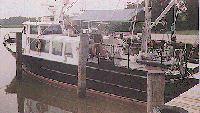 Discovery |
| Title | Survey Equipment | Description |
|---|---|---|
| Cruise report | (document not focused on specific equipment) | Chief Scientist's cruise report including personnel, purpose, equipment, and tabulated information. |
| Survey Equipment | Survey Info | Data Type(s) | Data Collected |
|---|---|---|---|
| ORE GeoPulse | --- | Boomer | |
| Datasonics SST 220 sub-bottom 3.5k | --- | Sub Bottom Profiler | |
| Benthos AQ-4 10-element hydrophone streamer | --- | Air Gun / Water Gun Boomer Sparker | 1987-028-FA-SE-001 (analog tape of seismic data) |
| Megapulse Accufix 500 LORAN-C | --- | Navigation | 1987-028-FA-LN-002 (Digital tape(s) of RAW NV, ) 1987-028-FA-LN-001 (Navigation trackline plot for field activity 87028) |
