Other ID: STRL S6-87-AFR
Status: Completed
Organization(s): USGS, Woods Hole Coastal and Marine Science Center
Funding Program(s):
Principal Investigator(s): James E. Dodd
Affiliate Investigator(s): Robert Rowland - Reston
Information Specialist(s):
Data Type(s): Electro-Magnetic: Gravity, Sonar: Single Beam, Electro-Magnetic: Magnetics, Location-Elevation: Navigation
Scientific Purpose/Goals: Collect gravity, magnetics and bathymetric data on continental shelf of Liberia, Cote d'Ivoire and Ghana to a 3 nm grid with internal consistency +/-3 mgals.
Vehicle(s):
Start Port/Location: Freetown, Sierra Leone
End Port/Location: Abidjan, Cote dIvoire
Start Date: 1987-08-26
End Date: 1987-09-20
Equipment Used: LaCoste-Romberg gravimeter G-179, 12 kHz, Geometrics G-856 magnetometer, GE 810 Correlation sonar, Gyro compass, GPS (wh), Magnavox satellite positioning system
Information to be Derived:
Summary of Activity and Data Gathered: Departed Freetown 24 Aug. 87; 26 Aug.- 2 Sep., surveyed 973 nm in Liberia; 2-9 Sep., surveyed 1030 nm in Cote d'Ivoire; 9-10 Sep., Abidjan port day; 10-20 Sep., surveyed 1431 nm in Ghana. Returned Abidjan 10 Sep. 87.
Staff: James E. Dodd, Sarah Griscom, Robert Rowland
Affiliate Staff:
Linda Sheetz; Val Zadnik; Samuel Russ - Land
Mines and Energy
Liberia
24 Aug. - 9 Sep.; Bakary Coulibaly - Ministere de la Marine
Cote d'Ivoire
24 Aug. - 9 Sep.; Samuel Amedofu
Joseph Odemetey - Geological Survey
Ghana
10 Sep. - 20 Sep.
Notes: Original Center People field contained: Jim Dodd; Bob Rowland - party chief; Sarah Griscom; Linda Sheetz; Val Zadnik.
Project = Defense Mapping Agency Gravity, Defense Mapping Agency Gravity
Location:
Liberia, Cote d'Ivoire, Ghana, Africa, North Atlantic;
| Boundaries | |||
|---|---|---|---|
| North: 6.82899 | South: -2.63579 | West: -13.8032 | East: 3.51563 |
Platform(s):
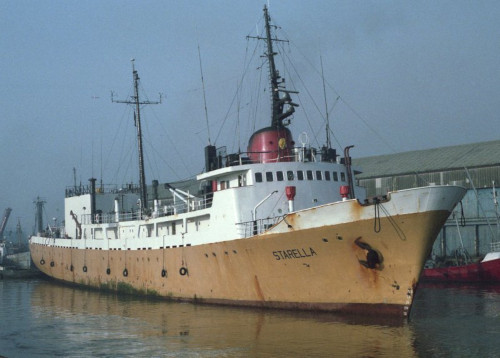
 Starella |
Folger, D.W., Irwin, Barry J., McCullough, James R., Rowland, Robert W., and Polloni, Christopher F., 1990, Map showing free-air gravity anomalies off the southern coast of west-central Africa; Liberia to Ghana: U.S. Geological Survey Miscellaneous Field Studies Map MF-2098-E, scale 1:1,500,000, URL: https://pubs.er.usgs.gov/publication/mf2098E.
| Title | Survey Equipment | Description |
|---|---|---|
| Cruise report | (document not focused on specific equipment) | Chief Scientist's report of ship movement, personnel, equipment, and data acquisition notes to file and to ministries of the observing countries of Cote D'Ivoire, Liberia, and Ghana. |
| Survey Equipment | Survey Info | Data Type(s) | Data Collected |
|---|---|---|---|
| LaCoste-Romberg gravimeter G-179 | --- | Gravity | |
| 12 kHz | --- | Single Beam | 1987-035-FA-SE-001 ( Collection of paper record displays of seismic data( 12K) for lines ) |
| Geometrics G-856 magnetometer | --- | Magnetics | |
| GE 810 Correlation sonar | --- | Navigation | |
| Gyro compass | --- | Navigation | |
| GPS (wh) | --- | Navigation | |
| Magnavox satellite positioning system | --- | Navigation |