Other ID: 88-2-PR
Status: Completed
Organization(s): USGS, Woods Hole Coastal and Marine Science Center
Funding Program(s):
Principal Investigator(s): William Schwab
Affiliate Investigator(s):
Information Specialist(s): William Danforth
Data Type(s): Location-Elevation: Navigation, Sonar: Sidescan, Sonar: Single Beam
Scientific Purpose/Goals: 1. Image area of suspected slope failure using SeaMARC 1B sidescan sonar system. 2. Image the heads of a series of submarine canyons at the north Puerto Rico shelfbreak using the Klein 100 kHz sidescan sonar system.
Vehicle(s):
Start Port/Location: Roosevelt Roads Naval Base, Puerto Rico
End Port/Location: San Juan, Puerto Rico
Start Date: 1988-03-25
End Date: 1988-04-04
Equipment Used: SeaMARC sidescan sonar system, Klein 531 sidescan, Starfix navigation system, 12 kHz
Information to be Derived: Sea floor map;
Summary of Activity and Data Gathered: Cruise terminated early due to loss of SeaMARC 1B on March 29, 1988, and Klein 100 kHz sidescan sonar towfish and cable on April 3, 1988. Data acquired: SeaMARC 1B Sidescan Sonar: 95 km; Klein 100 kHz Sidescan Sonar: 50 km; 12 kHz Bathymetry: 700 km.
Staff: Kathryn Scanlon Catanach, William Danforth, Barry Irwin, Kenneth F. Parolski, Eric A. Schmuck, William Schwab
Affiliate Staff:
Linda Sheetz; WHOI: Thomas Crook
Thomas Dettweiler
Stephen Gegg
Daniel Martin
John McMahon
Notes: Original Center People field contained: Bill Schwab - Ch. Sci., Kathy Scanlon, William Danforth - Data Curator, Barry Irwin, Kenneth Parolski, Eric Schmuck, Linda Sheetz.
Project = Sediment Processes and EEZ Geology, Sediment Processes and EEZ Geology
Location:
Puerto Rico Trench, Puerto Rico, Caribbean Sea, United States, North America, North Atlantic;
| Boundaries | |||
|---|---|---|---|
| North: 19.25 | South: 18.75 | West: -67 | East: -66.25 |
Platform(s):
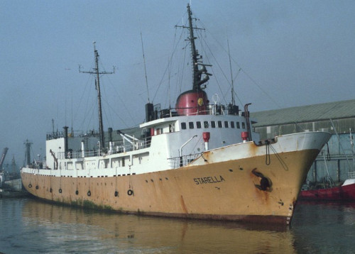
 Starella |
| Title | Survey Equipment | Description |
|---|---|---|
| Cruise report | (document not focused on specific equipment) | Chief Scientist's cruise report including personnel, purpose, equipment, tabulated information, trackmap and cruise narrative. |
| Survey Equipment | Survey Info | Data Type(s) | Data Collected |
|---|---|---|---|
| SeaMARC sidescan sonar system | --- | Sidescan | |
| Klein 531 sidescan | --- | Sidescan | 1988-002-FA-SO-001 (analog tape of seismic data) |
| Starfix navigation system | --- | Navigation | |
| 12 kHz | --- | Single Beam | 1988-002-FA-SE-001 ( Collection of paper record displays of seismic data( 12K) for lines ) 1988-002-FA-SE-002 (analog tape of seismic data) |