Other ID: none
Status: Completed
Organization(s): USGS, Woods Hole Coastal and Marine Science Center
Funding Program(s):
Principal Investigator(s): John C. Behrendt
Affiliate Investigator(s):
Information Specialist(s):
Data Type(s): Seismics: Ocean Bottom Seismometer, Seismics: Sub Bottom Profiler, Electro-Magnetic: Gravity, Seismics: Sonobuoy, Location-Elevation: Navigation
Scientific Purpose/Goals: International cooperative seismic refraction experiment.
Vehicle(s):
Start Port/Location: Wellington, New Zealand
End Port/Location: Gondwana Station, Antarctica
Start Date: 1988-12-01
End Date: 1989-01-10
Equipment Used: Ocean Bottom Seismometer, 3.5 kHz, Gravity meter (wh), Seismic refraction, GPS (wh)
Information to be Derived: Morphology;
Summary of Activity and Data Gathered: Seismic refraction lines: 6.
Staff: John C. Behrendt
Affiliate Staff:
Patrick Hart; Ann Trehu - Oregon St. U. (on detail to USGS); Martin Uyesugi - Seakem
Ltd.; land support from Ohio St. U.
Univ. of Hamburg (Germany) and the German Federal Institute for Geosciences and Resources (BGR).
Notes: Original Center People field contained: John Behrendt - Party Chief and Co-Chief Scientist, Marine Survey; Patrick Hart.
Location:
Western Ross Sea, North Victoria Land, Antarctica, South Pacific;
| Boundaries | |||
|---|---|---|---|
| North: -74 | South: -78 | West: -180 | East: -155 |
Platform(s):
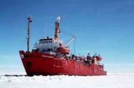 Polar Queen |
| Survey Equipment | Survey Info | Data Type(s) | Data Collected |
|---|---|---|---|
| Ocean Bottom Seismometer | --- | Ocean Bottom Seismometer | |
| 3.5 kHz | --- | Sub Bottom Profiler | |
| Gravity meter (wh) | --- | Gravity | |
| Seismic refraction | --- | Sonobuoy | |
| GPS (wh) | --- | Navigation |
