Other ID: W1-89
Status: Completed
Organization(s): USGS, Woods Hole Coastal and Marine Science Center
Funding Program(s):
Principal Investigator(s): Michael Bothner
Affiliate Investigator(s):
Information Specialist(s):
Data Type(s): Imagery: Photo, Location-Elevation: Navigation, Sampling: Geology, Time Series: Mooring (physical oceanography)
Scientific Purpose/Goals: To deploy an instrumented tripod, a subsurface mooring, and a near surface current meter from the Coast Guard's large navigation buoy at the approach to Boston Harbor. In addition, sediment samples will be collected with a Van Veen grab sampler at two locations near the proposed offshore outfall for Boston's sewage treatment plant. Objective is to begin long-term monitoring of currents, sediment transport, and physical/chemical characteristics of sediments in western Massachusetts Bay.
Vehicle(s):
Start Port/Location: Coast Guard Support Center, Boston, MA
End Port/Location: Coast Guard Support Center, Boston, MA
Start Date: 1989-12-05
End Date: 1989-12-06
Equipment Used: Sediment traps, Camera- deep sea, Loran-C, Bottom platform
Information to be Derived: Time series data; Samples and chemical analysis;
Summary of Activity and Data Gathered: Grab samples: 8-10; Moorings deployed: 2 (#338 and 339 recovered FA 90002 WHITE HEATH Mar. 27-29, 1990).
Staff: Michael Bothner, Adam Brown, Bradford Butman, Richard Rendigs, William J. Strahle
Affiliate Staff:
alternate: Ginger Fry
Notes: Major data recovery will occur when moorings are turned around in about 5 months. Information derived from pre-cruise report; no post cruise report found. Original Center People field contained: Mike Bothner, Brad Butman, Richard Rendigs, William Strahle, Adam Brown; alternate: Ginger Fry.
Location:
Massachusetts Bay, Massachusetts, United States, North America, North Atlantic,
| Boundaries | |||
|---|---|---|---|
| North: 43 | South: 41.25 | West: -71.5 | East: -69 |
Platform(s):
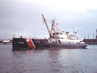 White Heath |
Bothner, M.H., and Butman, Bradford (eds.), 2007, Processes influencing the transport and fate of contaminated sediments in the coastal ocean—Boston Harbor and Massachusetts Bay: U.S. Geological Survey Circular 1302, 89 p., https://doi.org/10.3133/cir1302.
Butman, B., and Bothner, M.H., 1998, Predicting the long-term fate of sediments and contaminants in Massachusetts Bay: U.S. Geological Survey Fact Sheet 172-97, https://doi.org/10.3133/fs17297.
Butman, B., Bothner, M.H., Alexander, P.S., Lightsom, F.L., Martini, M.A., Gutierrez, B.T., and Strahle, W.S., 2004, Long-term oceanographic observations in western Massachusetts Bay offshore of Boston, Massachusetts; data report for 1989-2002: U.S. Geological Survey Digital Data Series DDS-74, Version 2.0, DVD-ROM, URL: https://doi.org/10.3133/ds74_v2.
Butman, B., Bothner, M.H., Hathaway, J.C., Jenter, H.L., Knebel, H.J., Manheim, F.T., and Signell, R.P., 1992, Contaminant transport and accumulation in Massachusetts Bay and Boston Harbor—A summary of U.S. Geological Survey studies: U.S. Geological Survey Open-File Report 92-202, https://doi.org/10.3133/ofr92202.
Butman, B., Dalyander, P.S., Bothner, M.H., Borden, J., Casso, M.A., Gutierrez, B.T., Hastings, M.E., Lightsom, F.L., Martini, M.A., Montgomery, E.T., Rendigs, R.R., and Strahle, W.S., 2009, Long-term oceanographic observations in Massachusetts Bay, 1989 - 2006 (version 3): U.S. Geological Survey Data Series 74, https://doi.org/10.3133/ds74.
Butman, B., Dalyander, P.S., Bothner, M.H., and Lang, W.N., 2008, Time-series photographs of the sea floor in western Massachusetts Bay, version 2, 1989 - 1996: U.S. Geological Survey Data Series 265, https://doi.org/10.3133/ds265.
Warner, J.C., Butman, B., and Dalyander, P. S., 2008, Storm-driven sediment transport in Massachusetts Bay: Continental Shelf Research, v. 28 no. 2, doi: 10.1016/j.csr.2007.08.008.
Warner, J.C., Sherwood, Christopher R., Signell, Richard P., Harris, Courtney K., and Arango, Hernan G., 2008, Development of a three-dimensional, regional, coupled wave, current, and sediment-transport model: Computers and Geosciences, v. 34 no. 10, doi: 10.1016/j.cageo.2008.02.012.
| Survey Equipment | Survey Info | Data Type(s) | Data Collected |
|---|---|---|---|
| Sediment traps | --- | Geology | |
| Camera- deep sea | --- | Photo | 1989-035-FA-PH-001 (film collection of TRIPOD 338; 19891205-19900327) |
| Loran-C | --- | Navigation | |
| Bottom platform | --- | Mooring (physical oceanography) | 1989-035-FA-OM-001 (Western Mass Bay mooring data) |
