Other ID: W2-90
Status: Completed
Organization(s): USGS, Woods Hole Coastal and Marine Science Center
Funding Program(s):
Principal Investigator(s): Michael Bothner
Affiliate Investigator(s):
Information Specialist(s):
Data Type(s): Imagery: Video, Location-Elevation: Navigation, Sampling: Geology, Time Series: Mooring (physical oceanography), Visual Identification: Submersible Observations
Scientific Purpose/Goals: The objective of the program is to make long-term measurements of currents and sediment transport in the vicinity of the proposed ocean outfall in Massachusetts Bay. The purpose of this cruise was to recover and redeploy the instrumented moorings. Samples of bottom sediments are collected on each cruise required to service the instruments. This was the second in a series of six cruises during the 2 year period of the present Joint Funding Agreement between the Massachusetts Water Resources Authority and the USGS.
Vehicle(s):
Start Port/Location: Boston Coast Guard Base, Boston, MA
End Port/Location: Boston Coast Guard Base, Boston, MA
Start Date: 1990-03-27
End Date: 1990-03-29
Equipment Used: Video camera - deep sea, Van Veen grab sampler, Sextant, Slow corer, Northstar 6000 LORAN-C, Bottom platform, Submersible Observation
Information to be Derived: Time series data; Samples and chemical analysis; Suspended sediment concentrations;
Summary of Activity and Data Gathered: This cruise was extended to 3 days in order to recover the tripod which would not release its float on command. Using careful acoustic ranging and highly accurate triangulation, the position of the instrument was pinpointed. On the second day of the cruise (Mar. 28), divers from WHOI were placed within 50 ft. of the instrument and attached a retrieval line. All our equipment was recovered without damage. The divers reported that the recovery rope canister was detached from the tripod. A piece of fishing net remained on the tripod suggesting how the rope canister might have been damaged. Moorings deployed: 2 (#340 and 341, recovered FA 90016 WHITE HEATH July 10-11, 1990). Moorings recovered: 2 (#338 and 339, deployed FA 89035 WHITE HEATH Dec. 5-6, 1989).
Staff: Dann Blackwood, Michael Bothner, Adam Brown, Bradford Butman, Carol M. Parmenter, Richard Rendigs, William J. Strahle
Affiliate Staff:
Barbanti - mooring work
sampling; Wayne Spencer (WHOI) - tripod recovery diver; Lary Ball (WHOI) - tripod recovery diver
Notes: Original Center People field contained: Barbanti - mooring work, sampling; Dann Blackwood - mooring work, sampling; Mike Bothner - mooring work, sampling; Brad Butman - mooring work; Richard Rendigs - mooring work, sampling; William Strahle - mooring work; Adam Brown - sampling; Carol Parmenter - sampling.
Project = Circulation, Pollutant Transport - MA Coastal Water, Circulation, Pollutant Transport - MA Coastal Water
Information from Foghorn: Mooring gear: Butman Tripod, subsurface array, and VMCM;Van Veen grab sampler;Hydraulically damped gravity corer;
Location:
Massachusetts Bay, Massachusetts, United States, North America, North Atlantic,
| Boundaries | |||
|---|---|---|---|
| North: 42.43 | South: 42.35 | West: -70.85 | East: -70.75 |
Platform(s):
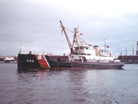 White Heath |
Bothner, M.H., Buchholtz ten Brink, M.R., Butman, B., Knebel, H.J., Manheim, F.T., and Signell, R.P., 1994, Circulation and contaminant transport in Massachusetts coastal waters—A summary of achievements and future plans: U.S. Geological Survey Open-File Report 94-649, https://doi.org/10.3133/ofr94649.
Bothner, M.H., and Butman, Bradford (eds.), 2007, Processes influencing the transport and fate of contaminated sediments in the coastal ocean—Boston Harbor and Massachusetts Bay: U.S. Geological Survey Circular 1302, 89 p., https://doi.org/10.3133/cir1302.
Butman, B., and Bothner, M.H., 1998, Predicting the long-term fate of sediments and contaminants in Massachusetts Bay: U.S. Geological Survey Fact Sheet 172-97, https://doi.org/10.3133/fs17297.
Butman, B., Bothner, M.H., Alexander, P.S., Lightsom, F.L., Martini, M.A., Gutierrez, B.T., and Strahle, W.S., 2004, Long-term oceanographic observations in western Massachusetts Bay offshore of Boston, Massachusetts; data report for 1989-2002: U.S. Geological Survey Digital Data Series DDS-74, Version 2.0, DVD-ROM, URL: https://doi.org/10.3133/ds74_v2.
Butman, B., Bothner, M.H., Hathaway, J.C., Jenter, H.L., Knebel, H.J., Manheim, F.T., and Signell, R.P., 1992, Contaminant transport and accumulation in Massachusetts Bay and Boston Harbor—A summary of U.S. Geological Survey studies: U.S. Geological Survey Open-File Report 92-202, https://doi.org/10.3133/ofr92202.
Butman, B., Dalyander, P.S., Bothner, M.H., Borden, J., Casso, M.A., Gutierrez, B.T., Hastings, M.E., Lightsom, F.L., Martini, M.A., Montgomery, E.T., Rendigs, R.R., and Strahle, W.S., 2009, Long-term oceanographic observations in Massachusetts Bay, 1989 - 2006 (version 3): U.S. Geological Survey Data Series 74, https://doi.org/10.3133/ds74.
Butman, B., Dalyander, P.S., Bothner, M.H., and Lang, W.N., 2008, Time-series photographs of the sea floor in western Massachusetts Bay, version 2, 1989 - 1996: U.S. Geological Survey Data Series 265, https://doi.org/10.3133/ds265.
Warner, J.C., Butman, B., and Dalyander, P. S., 2008, Storm-driven sediment transport in Massachusetts Bay: Continental Shelf Research, v. 28 no. 2, doi: 10.1016/j.csr.2007.08.008.
Warner, J.C., Sherwood, Christopher R., Signell, Richard P., Harris, Courtney K., and Arango, Hernan G., 2008, Development of a three-dimensional, regional, coupled wave, current, and sediment-transport model: Computers and Geosciences, v. 34 no. 10, doi: 10.1016/j.cageo.2008.02.012.
| Title | Survey Equipment | Description |
|---|---|---|
| Cruise report | (document not focused on specific equipment) | Chief Scientist's cruise report including personnel, purpose, equipment, tabulated information, brief summary, location map, mooring schematic, bottom cores and grab samples collected with coordinates and analyses, and log for video camera that photographed sampling operation. |
| Survey Equipment | Survey Info | Data Type(s) | Data Collected |
|---|---|---|---|
| Video camera - deep sea | --- | Video | |
| Van Veen grab sampler | --- | Geology | |
| Sextant | --- | Navigation | |
| Slow corer | --- | Geology | 1990-002-FA-SC-001 (CORE samples) |
| Northstar 6000 LORAN-C | --- | Navigation | |
| Bottom platform | --- | Mooring (physical oceanography) | 1990-002-FA-OM-001 (Western Mass Bay mooring data) |
| Submersible Observation | --- | Submersible Observations | 1990-002-FA-NL-001 (Audio tape tape for sub dive ) |
