Other ID: Cruise 16 Leg 1
Status: Completed
Organization(s): USGS, Woods Hole Coastal and Marine Science Center
Funding Program(s):
Principal Investigator(s): Kim D. Klitgord
Affiliate Investigator(s): Sergei Silantiev, Vernadsky Institute of Geochemistry, Moscow
Information Specialist(s):
Data Type(s): Sonar: Multibeam, Electro-Magnetic: Gravity, Electro-Magnetic: Magnetics, Sampling: Biology, Sampling: Geology, Location-Elevation: Navigation
Scientific Purpose/Goals: Undertake an integrated geological sampling and geophysical surveying program on the Mid-Atlantic Ridge between the Atlantis and Hayes Fracture Zones to establish morphotectonic framework of the ridge and the magmatic contribution to oceanic crustal generation and to investigate deformation of oceanic crust within transform/fracture zones.
Vehicle(s):
Start Port/Location: Copenhagen, Denmark
End Port/Location: Bridgetown, Barbados
Start Date: 1990-10-05
End Date: 1990-11-15
Equipment Used: Gravity meter (wh), Marine magnetometer, Dredge, GPS (wh), Hollming Echos 625 multibeam
Information to be Derived:
Summary of Activity and Data Gathered:
Staff: Kim D. Klitgord
Affiliate Staff:
Sergei Silantiev
Vernadsky - Co-Chief Sci.; J. F. Casey - Univ. Houston; S. M. Agar - Northwestern Univ.; W. B. Bryan - WHOI; S. Zlobin
R. Nagakyan
O. Bogdanovskiy
I. Antropov
M. Miromenko
B. Bazylev
A. Gurenko
L. Polosina
O. Tsameryan - Vernadsky; V. Korenfeld
A. Sindyukov
Y. Konoplev - Institute Physics of Earth; V. Mayorshin
N. Ostroukhov - Institute Terrestrial Magnetism Earth; N. Turko
Y. Pavlenko
A. Koshkin - Institute Geology
Notes:
Project = Mid-Atlantic Ridge Crest Processes, Mid-Atlantic Ridge Crest Processes
Location:
Mid-Atlantic Ridge, Atlantic Ocean;
| Boundaries | |||
|---|---|---|---|
| North: 35 | South: 29 | West: -45 | East: -30 |
Platform(s):
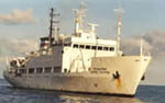 Akademik Boris Petrov |
Silantiev, S., Klitgord, K.D., Casey, J.F., Agar, S.M., and Bryan, W.B., 1991, 16th cruise of the R/V Akademik BORIS PETROV (Leg 1) (October 5 - November 15, 1990); Soviet-U.S. collaborative geological and geophysical survey of the Mid-Atlantic Ridge between 30 degrees N and 34 degrees N; cruise report: U.S. Geological Survey Open-File Report 91-120., 35 p., URL: https://doi.org/10.3133/ofr91120.
| Survey Equipment | Survey Info | Data Type(s) | Data Collected |
|---|---|---|---|
| Gravity meter (wh) | --- | Gravity | |
| Marine magnetometer | --- | Magnetics | |
| Dredge | --- | Biology Geology | |
| GPS (wh) | --- | Navigation | |
| Hollming Echos 625 multibeam | --- | Multibeam |
