Other ID: WCMA90-2; STRESS LEG 3, W290CA
Status: Completed
Organization(s): USGS, Woods Hole Coastal and Marine Science Center
Funding Program(s):
Principal Investigator(s): Bradford Butman
Affiliate Investigator(s):
Information Specialist(s):
Data Type(s): Environmental Data: CTD, Sampling: Biology, Sampling: Geology, Time Series: Mooring (physical oceanography)
Scientific Purpose/Goals: Deploy surface marker buoys and 3 current moorings on California continental shelf in Sediment TRansport Events on Shelves and Slopes (STRESS) experiment to study resuspension/transport of fine-grained sediments in winter storms at sites C2, C3, and C4.
Vehicle(s):
Start Port/Location: Yerba Buena, CA
End Port/Location: Yerba Buena, CA
Start Date: 1990-11-19
End Date: 1990-11-21
Equipment Used: Box corer, SBE 9 CTD, Bottom platform
Information to be Derived: Time series data; Suspended sediment concentrations;
Summary of Activity and Data Gathered: Moorings deployed: 3 (#362, 363, and 364, all recovered FA 91007 WECOMA Mar. 9-11, 1991).
Staff: Bradford Butman, Marinna Martini, William J. Strahle
Affiliate Staff:
WHOI: J. Bouthillette
H. Clifford
J. Hahn
J. Kemp
P. Snelgrove
R. Wheatcroft; U WA: C. Sherwood; APL: D. Jackson
B. Gropper
R. Light.
Notes: Leg 1: Nov. 14-17, 1990, Newport, OR to Yerba Buena, CA. Leg 3: Nov. 19-21, 1990, Yerba Buena, CA to Yerba Buena, CA. No USGS AMG personnel on Leg 2 or Leg 4.
Project = Sediment Transport Events on Shelves and Slopes (STRESS), Sediment Transport Events on Shelves and Slopes (STRESS)
Location:
northern California Continental Shelf, California, United States, North America, North Pacific;
| Boundaries | |||
|---|---|---|---|
| North: 38.68122173 | South: 38.59731528 | West: -123.57620981 | East: -123.42680991 |
Platform(s):
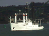 Wecoma |
| Title | Survey Equipment | Description |
|---|---|---|
| Cruise report | (document not focused on specific equipment) | Chief Scientist's cruise report including personnel, objectives, daily narrative, deployment locations, samples obtained, and map of mooring locations. |
| Survey Equipment | Survey Info | Data Type(s) | Data Collected |
|---|---|---|---|
| Box corer | --- | Biology Geology | |
| SBE 9 CTD | --- | CTD | |
| Bottom platform | --- | Mooring (physical oceanography) | 1990-048-FA-OM-001 (mooring data) |
