Other ID: CH-15-91
Status: Completed
Organization(s): USGS, Woods Hole Coastal and Marine Science Center
Funding Program(s):
Principal Investigator(s): William Dillon
Affiliate Investigator(s): Charles Paull - UNC; Richard von Herzen - WHOI
Information Specialist(s):
Data Type(s): Environmental Data: Conductivity, Environmental Data: Temperature, Location-Elevation: Navigation, Seismics: Air Gun / Water Gun, Sampling: Geology
Scientific Purpose/Goals: Study of geological/geochemical/physical controls on gas hydrate distribution in sediments of the continental rise off North Carolina using seismics, heat flow measurements and chemistry of core samples.
Vehicle(s):
Start Port/Location: Beaufort, NC
End Port/Location: Beaufort, NC
Start Date: 1991-08-19
End Date: 1991-08-30
Equipment Used: Piston corer, Heat flow, YSI multiparameter sonde, GPS (wh), Air gun, Single channel hydrophone
Information to be Derived: Morphology;
Summary of Activity and Data Gathered: Seismic profiles: 12 (626 km); Piston cores: 12 (nearly 40 ft. long); Heat flow measurements: 3 transects (32 sites).
Staff: William Dillon, Kristen Fehlhaber, Thomas O'Brien
Affiliate Staff:
Charles Paull - co-Ch. Sci.
UNC; William Ussler - UNC; Walter Borowski - UNC; Collin Mellor - UNC; Sutton Edlick - UNC; Richard von Herzen - co-Ch. Sci.
WHOI; Alain Bonneville - WHOI
Paul Fucile - WHOI
Notes:
Location:
Blake Ridge, Cape Fear, North Carolina, United States, North America, North Atlantic;
| Boundaries | |||
|---|---|---|---|
| North: 33.48083583 | South: 32.46291079 | West: -76.58508891 | East: -74.6661613 |
Platform(s):
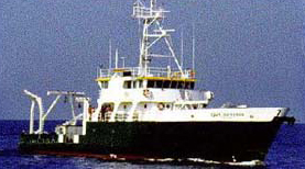 Cape Hatteras |
Anton, C., Dillon, W.P., and Lee, M., 1999, Anomalous, nearly horizontal, seismic reflection at the Blake Ridge--Evidence for a gas trap crosses the base of gas hydrate stability [abs.]: , Eos, Transactions, American Geophysical Union, Spring Meeting.
| Title | Survey Equipment | Description |
|---|---|---|
| Cruise report | (document not focused on specific equipment) | Chief Scientist's cruise report including personnel, data collected, start and end of line positions, piston core locations, heat flow station locations, and trackmap. |
| Survey Equipment | Survey Info | Data Type(s) | Data Collected |
|---|---|---|---|
| Piston corer | --- | Geology | |
| Heat flow | --- | Temperature | |
| YSI multiparameter sonde | --- | Conductivity Dissolved Oxygen ORP pH Temperature | 1991-027-FA-OM-001 (SAIL Information - (text file) Data collected from a number of meterological, oceanographic and maritime devices aboard the RV CAPE HATTERAS. The scan rate for the system is user-selectable, usually 5 minutes.) |
| GPS (wh) | --- | Navigation | 1991-027-FA-LN-001 (Navigation trackline plot for field activity 91027) 1991-027-FA-LN-003 (CD ROM disk of SEG-Y 1,4,11,12, NAV,LOGS, ) 1991-027-FA-LN-002-03 (Cruise navigation) 1991-027-FA-LN-002-01 (Locations for piston cores and heat flow stations.) 1991-027-FA-LN-002-02 (Seismic line end locations.) |
| Air gun | --- | Air Gun / Water Gun | |
| Single channel hydrophone | --- | Air Gun / Water Gun Boomer Bubble Gun Sparker Sub Bottom Profiler | 1991-027-FA-SE-001 ( Collection of paper record displays of seismic data( AIR) for lines ) 1991-027-FA-SE-003 (Digital tape(s) of AIRGUN LINE 1, AIRGUN LINE 1-5, AIRGUN LINE TEST,6-10, AIRGUN LINE 11-12, ) 1991-027-FA-SE-002 (microfilm of ) 1991-027-FA-SE-004 (CD ROM disk of SEG-Y 1,4,11,12, NAV,LOGS, ) |
