Other ID: DE93-03; DLWR9303
Status: Completed
Organization(s): USGS, Woods Hole Coastal and Marine Science Center
Funding Program(s):
Principal Investigator(s): Page Valentine
Affiliate Investigator(s):
Information Specialist(s):
Data Type(s): Sonar: Sidescan, Sonar: Single Beam, Imagery: Photo, Imagery: Video, Sampling: Geology, Location-Elevation: Navigation
Scientific Purpose/Goals: Collaborative research with NMFS: echo sounding, sidescan sonar surveys, video, and bottom sampling of the southwestern part of Stellwagen Bank to map sedimentary environments and biological habitats.
Vehicle(s):
Start Port/Location: Woods Hole, MA
End Port/Location: Woods Hole, MA
Start Date: 1993-04-19
End Date: 1993-04-27
Equipment Used: Klein 531 sidescan, Q-MIPS sidescan sonar system, Simrad EC - 810 echo sounder, Osprey camera system, Van Veen grab sampler, GPS (wh), Loran-C
Information to be Derived:
Summary of Activity and Data Gathered: Continuous data collected: 1013 line km of sidescan sonar data comprising 162 sq. km. of continuous coverage (see trackline map). Stations occupied: color video camera (mounted on Van Veen grab) deployed at 56 sites resulted in 52 sediment samples taken in the study area.
Staff: David Nichols, Page Valentine, Andrew Brill, Carol Brown, Carol M. Parmenter, Eric A. Schmuck
Affiliate Staff:
Milton Carlo - PR
Notes:
Project = Shelf mapping - Stellwagen Bank, Shelf mapping - Stellwagen Bank
Location:
southwestern Stellwagen Bank National Marine Sanctuary, United States, North America, North Atlantic;
| Boundaries | |||
|---|---|---|---|
| North: 42.26843 | South: 42.13908 | West: -70.3816 | East: -70.222 |
Platform(s):
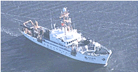 Delaware II |
Valentine, P.C., Baker, J.L., Unger, T.S., Scully, L.A., and Fuller, S.J., 2005, Sea floor image maps showing topography, sun-illuminated topography, backscatter intensity, ruggedness, slope, and the distribution of boulder ridges and bedrock outcrops in the Stellwagen Bank National Marine Sanctuary region off Boston, Massachusetts: U.S. Geological Survey Scientific Investigations Map 2840, https://doi.org/10.3133/sim2840.
Valentine, P.C., and Cross, V.A., 2024, Geospatial datasets of seabed topography, sediment mobility, and the distribution of geologic substrates in quadrangle 2 of the Stellwagen Bank National Marine Sanctuary region offshore of Boston, Massachusetts: U.S. Geological Survey data release, https://doi.org/10.5066/P9UL3LWN.
Valentine, P.C., and Cross, V.A., 2023, Geospatial datasets of seabed topography, sediment mobility, and the distribution of geologic substrates in quadrangle 5 of the Stellwagen Bank National Marine Sanctuary region offshore of Boston, Massachusetts: U.S. Geological Survey data release, https://doi.org/10.5066/P9W9BN3S.
| Title | Survey Equipment | Description |
|---|---|---|
| Cruise report | (document not focused on specific equipment) | Chief Scientist's cruise report including personnel, purpose, equipment, tabulated information, sediment sample and color video transect locations, and sidescan sonar survey trackmap. |
| Survey Equipment | Survey Info | Data Type(s) | Data Collected |
|---|---|---|---|
| Klein 531 sidescan | --- | Sidescan | |
| Q-MIPS sidescan sonar system | --- | Sidescan | |
| Simrad EC - 810 echo sounder | --- | Single Beam | |
| Osprey camera system | --- | Photo Video | |
| Van Veen grab sampler | --- | Geology | 1993-006-FA-SC-001 (GRAB samples) |
| GPS (wh) | --- | Navigation | |
| Loran-C | --- | Navigation |
