Other ID: ANDR 93-01; ANDR9301
Status: Completed
Organization(s): USGS, Woods Hole Coastal and Marine Science Center
Funding Program(s):
Principal Investigator(s): Page Valentine
Affiliate Investigator(s):
Information Specialist(s):
Data Type(s): Imagery: Photo, Imagery: Video, Sampling: Geology, Sonar: Sidescan, Location-Elevation: Navigation
Scientific Purpose/Goals: Sidescan sonar survey of the bank, including video and sampling, to produce maps of the sedimentary environment and biological habitats.
Vehicle(s):
Start Port/Location: Woods Hole, MA
End Port/Location: Woods Hole, MA
Start Date: 1993-09-20
End Date: 1993-10-01
Equipment Used: Osprey camera system, Van Veen grab sampler, Q-MIPS sidescan sonar system, GPS (wh), Loran-C
Information to be Derived:
Summary of Activity and Data Gathered:
Staff: David Nichols, Nancy K. Soderberg, Carol Brown, Carol M. Parmenter, Eric A. Schmuck, Barbara A. Seekins
Affiliate Staff:
J. Deardsley; M. Liebmann - EPA Boston
Notes: Original Center People field contained: E. Schmuck, N. Soderberg, J. Deardsley, D. Nichols, C. Brown, B. Seekins, C. Parmenter.
Location:
Stellwagen Bank, Massachusetts, United States, North America, North Atlantic;
| Boundaries | |||
|---|---|---|---|
| North: 42.27324 | South: 42.13862 | West: -70.3928 | East: -70.2224 |
Platform(s):
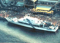 Anderson |
Valentine, P.C., Baker, J.L., Unger, T.S., Scully, L.A., and Fuller, S.J., 2005, Sea floor image maps showing topography, sun-illuminated topography, backscatter intensity, ruggedness, slope, and the distribution of boulder ridges and bedrock outcrops in the Stellwagen Bank National Marine Sanctuary region off Boston, Massachusetts: U.S. Geological Survey Scientific Investigations Map 2840, https://doi.org/10.3133/sim2840.
Valentine, P.C., and Cross, V.A., 2024, Geospatial datasets of seabed topography, sediment mobility, and the distribution of geologic substrates in quadrangle 2 of the Stellwagen Bank National Marine Sanctuary region offshore of Boston, Massachusetts: U.S. Geological Survey data release, https://doi.org/10.5066/P9UL3LWN.
Valentine, P.C., and Cross, V.A., 2023, Geospatial datasets of seabed topography, sediment mobility, and the distribution of geologic substrates in quadrangle 5 of the Stellwagen Bank National Marine Sanctuary region offshore of Boston, Massachusetts: U.S. Geological Survey data release, https://doi.org/10.5066/P9W9BN3S.
| Survey Equipment | Survey Info | Data Type(s) | Data Collected |
|---|---|---|---|
| Osprey camera system | --- | Photo Video | |
| Van Veen grab sampler | --- | Geology | 1993-023-FA-SC-001 (GRAB samples) |
| Q-MIPS sidescan sonar system | --- | Sidescan | |
| GPS (wh) | --- | Navigation | 1993-023-FA-LN-001 (Floppy disk(s) containing NAV-GPS) |
| Loran-C | --- | Navigation |
