Other ID: JD 93-1
Status: Completed
Organization(s): USGS, Woods Hole Coastal and Marine Science Center
Funding Program(s):
Principal Investigator(s): Lawrence Poppe, David Twichell
Affiliate Investigator(s): Ralph Lewis - CGS; Roman Zajac - U. New Haven
Information Specialist(s):
Data Type(s): Sonar: Sidescan, Seismics: Sub Bottom Profiler, Location-Elevation: Navigation
Scientific Purpose/Goals: Sidescan survey to determine textural distribution of surficial sediments and relate to active sedimentary processes; evaluate habitats and relate to benthic community structure. Cruise replaced cancelled ASTERIAS cruise originally scheduled for September 1993.
Vehicle(s):
Start Port/Location: Old Lyme, CT
End Port/Location: Old Lyme, CT
Start Date: 1993-11-05
End Date: 1993-11-21
Equipment Used: Klein 595 100/500kHz sidescan sonar, Q-MIPS sidescan sonar system, 3.5 kHz, DGPS, Megapulse Accufix 500 LORAN-C
Information to be Derived: Habitat maps; Sea floor map;
Summary of Activity and Data Gathered: Milford (Housatonic) and Norwalk sidescan surveys were completed. Hammonasset was postponed due to stiff, sustained southwest wind and shallow bathymetry introducing unacceptable levels of surface noise. Sidescan sonar: 450 km.
Staff: VeeAnn Cross, David Nichols, Lawrence Poppe, David Twichell
Affiliate Staff:
Ralph Lewis
Mary Cohen - CGS; Roman Zajac
2 students - U. New Haven; Suzanne O'Connell - Wesleyan College; Peter Auster - U. Conn.
Notes:
Project = U. New Haven; Connecticut Co-operative, U. New Haven; Connecticut Co-operative
Location:
western and central Long Island Sound, Old Lyme to Milford, offshore Housatonic River mouth, offshore Norwalk River mouth, offshore Connecticut River mouth, Connecticut, United States, North America, North Atlantic;
| Boundaries | |||
|---|---|---|---|
| North: 41.15 | South: 40.95 | West: -73.35 | East: -73 |
Platform(s):
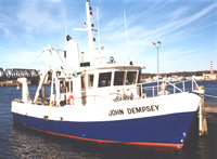 Dempsey |
Poppe, L.J., Polloni, C., eds., 1998, Long Island Sound environmental studies: U.S. Geological Survey Open-File Report (98-502), https://doi.org/10.3133/ofr98502.
| Title | Survey Equipment | Description |
|---|---|---|
| Cruise report | (document not focused on specific equipment) | Chief Scientist's report including personnel, purpose, equipment, tabulated information, brief cruise comments, trackmaps. |
| Navigation log | DGPS | DGPS navigation log with line numbers, times, position, course, speed, disk #, and comments. |
| Seismic log | 3.5 kHz | 3.5 kHz log with equipment configuration, line #, times, roll #, and acquisition notes. |
| Q-Mips log | Q-MIPS sidescan sonar system | Q-Mips sidescan sonar log with line and file name, times and data acquisition notes. |
| Survey Equipment | Survey Info | Data Type(s) | Data Collected |
|---|---|---|---|
| Klein 595 100/500kHz sidescan sonar | --- | Sidescan | 1993-026-FA-SO-001-01 (Sonar data) |
| Q-MIPS sidescan sonar system | --- | Sidescan | |
| 3.5 kHz | --- | Sub Bottom Profiler | 1993-026-FA-SE-001 (microfilm of 12?:1 REDUCTION) |
| DGPS | --- | Navigation | 1993-026-FA-LN-001 (Navigation trackline plot for field activity 93026) |
| Megapulse Accufix 500 LORAN-C | --- | Navigation |
