Other ID: none
Status: Completed
Organization(s): USGS, Woods Hole Coastal and Marine Science Center
Funding Program(s):
Principal Investigator(s): Marinna Martini
Affiliate Investigator(s):
Information Specialist(s):
Data Type(s): Location-Elevation: Navigation, Time Series: Mooring (physical oceanography)
Scientific Purpose/Goals: Recover mooring #436.
Vehicle(s):
Start Port/Location: Portsmouth, NH
End Port/Location: Portsmouth, NH
Start Date: 1994-09-13
End Date: 1994-09-13
Equipment Used: GPS (wh), Bottom platform
Information to be Derived: Time series data;
Summary of Activity and Data Gathered: Mooring 433 not recovered because it could not be released from its anchor with acoustic release gear. Mooring 436 recovered without incident. Mooring recovered: 1 (#436, deployed MARLIN FA 94034 Mar. 25, 1994).
Staff: VeeAnn Cross, Peter W. Gill, Marinna Martini, Joseph S. Newell, Richard Rendigs
Affiliate Staff:
Notes: Project = W. Gulf of Maine, W. Gulf of Maine
Location:
Cape Porpoise, Kennebeck, Maine, United States, North America, North Atlantic;
| Boundaries | |||
|---|---|---|---|
| North: 43.4 | South: 43.35 | West: -70.35 | East: -70.3 |
Platform(s):
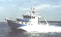 Gulf Challenger |
| Title | Survey Equipment | Description |
|---|---|---|
| Cruise report | (document not focused on specific equipment) | Chief Scientist's report including personnel, equipment, tabulated information. |
| Survey Equipment | Survey Info | Data Type(s) | Data Collected |
|---|---|---|---|
| GPS (wh) | --- | Navigation | |
| Bottom platform | --- | Mooring (physical oceanography) | 1994-010-FA-OM-001 (ECOHAB I mooring data) |
