Other ID: W-1-96-NC, WCMA, Strataform, W196NC
Status: Completed
Organization(s): USGS, Woods Hole Coastal and Marine Science Center
Funding Program(s):
Principal Investigator(s): Thomas O'Brien
Affiliate Investigator(s): Mike Field; Jim Gardner
Information Specialist(s):
Data Type(s): Location-Elevation: Navigation, Seismics: Boomer
Scientific Purpose/Goals: Image upper 50 m of sediment to determine architecture of depositional units.
Vehicle(s):
Start Port/Location:
End Port/Location:
Start Date: 1996-06-29
End Date: 1996-07-07
Equipment Used: Huntec Hydrosonde Deep-Tow system, GPS (wh)
Information to be Derived:
Summary of Activity and Data Gathered:
Staff: Thomas O'Brien
Affiliate Staff:
Mike Field
Jim Gardner
John Gann - PMG
Notes: Original Submitted By field contained: Mike Field and Jim Gardner.
Project = Strataform, Strataform
Location:
shelf, slope, Eureka, California, United States, North America, North Pacific;
| Boundaries | |||
|---|---|---|---|
| North: 41.37589415 | South: 40.52679036 | West: -124.8343927 | East: -124.14429891 |
Platform(s):
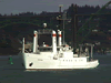 Wecoma |
Balster-Gee, A.F., Hill, J.C., and O'Brien, T.F., 2020, Archive of boomer sub bottom data collected off shore Eureka, California during USGS field activity W-1-96-NC from 1996-06-29 to 1996-07-07: U.S. Geological Survey data release, https://doi.org/10.5066/P950276G.
| Survey Equipment | Survey Info | Data Type(s) | Data Collected |
|---|---|---|---|
| Huntec Hydrosonde Deep-Tow system | --- | Boomer | seismic (data at PCMSC on FAD) Archive of boomer subbottom data (This data release contains boomer subbottom data collected in June and July of 1996 on the shelf and slope offshore Eureka, California. Subbottom acoustic penetration spans up to several tens of meters, and is variable by location. This data release contains digital SEG-Y data. The data were collected aboard the R/V Wecoma using a Huntec Hydrosonde Deep-Tow system.) |
| GPS (wh) | --- | Navigation | 1996-030-FA-LN-001 (Navigation data) |
