Other ID: FERL9638
Status: Completed
Organization(s): USGS, Woods Hole Coastal and Marine Science Center
Funding Program(s):
Principal Investigator(s): Page Valentine
Affiliate Investigator(s):
Information Specialist(s):
Data Type(s): Imagery: Photo, Imagery: Video, Location-Elevation: Navigation, Sampling: Biology, Sampling: Geology, Sonar: Sidescan
Scientific Purpose/Goals: Conduct sidescan sonar surveys to image sedimentary environments and biological habitats. Acquire data from the sea bed that will be used to interpret sidescan sonar imagery and compile maps of Stellwagen Bank NMS.
Vehicle(s):
Start Port/Location: Boston, MA
End Port/Location: Woods Hole, MA
Start Date: 1996-10-07
End Date: 1996-11-02
Equipment Used: DGPS, Video camera - deep sea, Grab sampler, Camera- deep sea, SIS1000 Sidescan sonar
Information to be Derived: Habitat maps; Sea floor map;
Summary of Activity and Data Gathered: Poor weather allowed us to work approximately 53% of the time available for operations at sea. Sidescan sonar: 513 km; Stations: 107 (sample, video transect, still photos at each station).
Staff: Dann Blackwood, VeeAnn Cross, David Nichols, Kenneth F. Parolski, David Piccirilli, Christopher F. Polloni, Edwin Roworth, Barbara A. Seekins, Nancy K. Soderberg, Sara Stillman, Michael Taylor, Page Valentine
Affiliate Staff:
Notes: Project = Stellwagen Bank NMS Mapping Project, Stellwagen Bank NMS Mapping Project
Location:
Stellwagen Bank, Massachusetts, United States, North America, North Atlantic;
| Boundaries | |||
|---|---|---|---|
| North: 42.44575261 | South: 42.17606963 | West: -70.45891303 | East: -70.19714355 |
Platform(s):
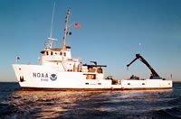 Ferrel |
Valentine, P.C., Baker, J.L., Unger, T.S., Scully, L.A., and Fuller, S.J., 2005, Sea floor image maps showing topography, sun-illuminated topography, backscatter intensity, ruggedness, slope, and the distribution of boulder ridges and bedrock outcrops in the Stellwagen Bank National Marine Sanctuary region off Boston, Massachusetts: U.S. Geological Survey Scientific Investigations Map 2840, https://doi.org/10.3133/sim2840.
Valentine, P.C., and Cross, V.A., 2024, Geospatial datasets of seabed topography, sediment mobility, and the distribution of geologic substrates in quadrangle 2 of the Stellwagen Bank National Marine Sanctuary region offshore of Boston, Massachusetts: U.S. Geological Survey data release, https://doi.org/10.5066/P9UL3LWN.
Valentine, P.C., and Cross, V.A., 2023, Geospatial datasets of seabed topography, sediment mobility, and the distribution of geologic substrates in quadrangle 5 of the Stellwagen Bank National Marine Sanctuary region offshore of Boston, Massachusetts: U.S. Geological Survey data release, https://doi.org/10.5066/P9W9BN3S.
Valentine, P.C., Gallea, L.B., Blackwood, D.S., and Twomey, E.R., 2010, Seabed photographs, sediment texture analyses, and sun-illuminated sea floor topography in the Stellwagen Bank National Marine Sanctuary region off Boston, Massachusetts: U.S. Geological Survey Data Series 469, available at https://doi.org/10.3133/ds469.
| Survey Equipment | Survey Info | Data Type(s) | Data Collected |
|---|---|---|---|
| DGPS | --- | Navigation | 1996-038-FA-NL-001 (CD ROM disk of BOTTOMPHOTO STELL JD282, BOTTOMPHOTO STELL JD291, BOTTOMPHOTO STELL JD306, ) |
| Video camera - deep sea | --- | Video | |
| Grab sampler | --- | Biology Geology | 1996-038-FA-SC-001 (GRAB samples) |
| Camera- deep sea | --- | Photo | 1996-038-FA-PH-001 (CD ROM disk of BOTTOMPHOTO STELL JD282, BOTTOMPHOTO STELL JD291, BOTTOMPHOTO STELL JD306, ) |
| SIS1000 Sidescan sonar | --- | Sidescan | 1996-038-FA-SO-001 (Digital tape(s) of SSS SIS-1000 L43,52,57,74, SSS SIS-1000 L11,SSAH8-10,12-14, SSS SIS-1000 L290-2016,SSAH1-4,7, SSS SIS-1000 LSSAH5-6,K1-3,5-7, SSS SIS-1000 LSSAK8-8-11,15-18, SSS SIS-1000 LSSAA52,K11-14,16, SSS SIS-1000 LSSAM1-7, ) |
