Other ID: none
Status: Completed
Organization(s): USGS, Woods Hole Coastal and Marine Science Center
Funding Program(s):
Principal Investigator(s): David Twichell
Affiliate Investigator(s):
Information Specialist(s):
Data Type(s): Location-Elevation: Navigation, Seismics: Sub Bottom Profiler, Sonar: Sidescan, Sonar: Single Beam, Seismics: Boomer
Scientific Purpose/Goals: Reconnaissance sidescan and high-resolution seismic mapping of the inner shelf in northern Oregon and southern Washington (Tillamook Head, Oregon, to Pt. Grencille, Washington) to map the thickness of the Holocene sand sheet and recent faults.
Vehicle(s):
Start Port/Location: Grays Harbor, WA
End Port/Location: Grays Harbor, WA
Start Date: 1997-08-25
End Date: 1997-09-19
Equipment Used: Echosounder, 3.5 kHz, Edgetech DF-1000 sidescan sonar, GPS (wh), Single channel hydrophone, GeoPulse uniboom
Information to be Derived:
Summary of Activity and Data Gathered:
Staff: VeeAnn Cross, Scott Harrison, Kenneth F. Parolski, David Twichell
Affiliate Staff:
Curt Peterson - Portland State U.
Notes: Original Center People field contained: Dave Twichell - Chief Scientist; Scott Harrison - St. Pete, watchstander; Kenneth Parolski - Technician; VeeAnn Cross - Sidescan processor.
Project = Southwest Washington Erosion Study, Southwest Washington Erosion Study
Information from Foghorn: P-code GPS navigation system, EG&G 100-kHz sidescan sonar with ISIS logger, winch, cable, XSONAR, SEISMIC UNIX, GeoPulse sub-bottom profiler with EPC data logger, digital bathymetry, 3.5-kHz sub-bottom profiler logged on paper record;
Location:
North Oregon / South Washington inner shelf, United States, North America, North Pacific;
| Boundaries | |||
|---|---|---|---|
| North: 47.4 | South: 45.8912758 | West: -124.5 | East: -123.84216334 |
Platform(s):
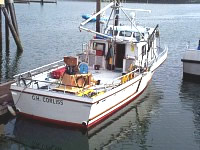 Corliss |
Baker, D., Peterson, C., Hemphill-Haley, E., and Twichell, D., 2010, Latest Pleistocene and Holocene (2-16 ka) sedimentation in the Columbia River Estuary, Oregon, USA: Marine Geology 273:1-4, https://doi.org/10.1016/j.margeo.2010.02.005.
Cross, V.A., Twichell, D. C., Parolski, K. F., and Harrison, S. E., 1998, Archive of Boomer seismic reflection data collected aboard RV CORLISS Cruise CRLS97007 off northern Oregon and southern Washington inner continental shelf: U.S. Geological Survey Open-File Report 98-351, 2 CD-ROMs, https://doi.org/10.3133/ofr98351.
Peterson, C.D., Vanderburgh, S., Roberts, M.C., Jol, H.M.,; Phipps, J., and Twichell, D.C., 2010, Composition, age, and depositional rates of shoreface deposits under barriers and beach plains of the Columbia River littoral cell, USA: Marine Geology 273:1-4, https://doi.org/10.1016/j.margeo.2010.02.004.
Twichell, D.C., Cross, V.A., and Parolski, K.F., 2000, Sidescan-sonar imagery, surface sediment samples, and surficial geologic interpretation of the southwestern Washington inner continental shelf based on data collected during CORLISS Cruises 97007 and 98014: U.S. Geological Survey Open-File Report 2000-167, CD-ROM, 28 p., URL: https://doi.org/10.3133/ofr00167.
Twichell, D.C., Cross, V.A., and Peterson, C.D., 2010, Partitioning of sediment on the shelf offshore of the Columbia River littoral cell: Marine Geology 273:1-4, 11-31, https://doi.org/10.1016/j.margeo.2010.02.001.
FAN 1997-007-FA has data viewable in the GeoMappApp/Virtual Ocean applications. To view this data in these applications go to http://www.geomapapp.org/ and http://www.virtualocean.org/. See the instructions for locating USGS data in these applications. You can also view the imagery created from the SEGY data at https://cmgds.marine.usgs.gov/images.php?cruise=1997-007-FA.
| Title | Survey Equipment | Description |
|---|---|---|
| Navigation log | GPS (wh) | Watchstanders' log containing time, start and end of lines, latitude, longitude, speed, direction, equipment performance and other comments. |
| Geophysics log | (document not focused on specific equipment) | Technician's log describing boomer and 3.5 kHz equipment configuration, performance, start and end of files, lines, comments. |
| Sidescan log | Edgetech DF-1000 sidescan sonar | ISIS field log with line and file names and start and end times and comments. |
| Survey Equipment | Survey Info | Data Type(s) | Data Collected |
|---|---|---|---|
| Echosounder | --- | Single Beam | Bathymetry GIS data (10 m bathymetric contours for the Southwest Washington Study area based on NOS hydrographic survey data collected between 1926 and 1930 and supplemented with the southern part of the study area altered based on bathymetry collected on the CRLS 97007 cruise. Used as basemap data for surveying.) |
| 3.5 kHz | --- | Sub Bottom Profiler | 1997-007-FA-SE-001 ( Collection of paper record displays of seismic data( 3.5K) for lines ) |
| Edgetech DF-1000 sidescan sonar | --- | Sidescan | tracks97 (CRLS97007 sidescan-sonar track lines on the inner continental shelf off the northern Oregon and southern Washington coast from U.S. Geological Survey field activity 1997-007-FA) |
| GPS (wh) | --- | Navigation | 1997-007-FA-LN-001 (Navigation trackline plot for field activity 97007) |
| Single channel hydrophone | --- | Air Gun / Water Gun Boomer Bubble Gun Sparker Sub Bottom Profiler | 1997-007-FA-SE-002 (Raw boomer SEG-Y data collected aboard the RV Corliss on field activity 1997-007-FA off northern Oregon and southern Washington inner continental shelf) 1997-007-FA-SO-002 (13-cd's of Boomer (EPC data logger), lines 1-47.) |
| GeoPulse uniboom | --- | Boomer |
