Other ID: none
Status: Completed
Organization(s): USGS, Woods Hole Coastal and Marine Science Center
Funding Program(s):
Principal Investigator(s): William Schwab
Affiliate Investigator(s): Steve Couch - USACOE, New York District
Information Specialist(s): Jane Denny
Data Type(s): Seismics: Boomer, Biological Field Study: Experiments (biological), Biological Field Study: Surveys (biological), Imagery: Photo, Imagery: Video, Location-Elevation: Navigation, Sampling: Biology, Sampling: Geology, Seismics: Sparker, Seismics: Sub Bottom Profiler, Sonar: Single Beam, Visual Identification: Species ID, Sonar: Sidescan
Scientific Purpose/Goals: High-resolution sea floor mapping investigation along the inner shelf south of Long Island, New York.
Vehicle(s):
Start Port/Location: Woods Hole, MA
End Port/Location: Woods Hole, MA
Start Date: 1997-05-05
End Date: 1997-05-26
Equipment Used: Benthos AQ-4 10-element hydrophone streamer, Single channel hydrophone, Boomer, SIS1000 Chirp Sonar, DGPS, SIS1000 Sidescan sonar, Echosounder, SeaBOSS, Sparker
Information to be Derived:
Summary of Activity and Data Gathered:
Staff: VeeAnn Cross, William Danforth, Jane Denny, David Foster, Kenneth F. Parolski, Edwin Roworth, William Schwab
Affiliate Staff:
Mike Torresan (CMG
Menlo Park); Paul Gayes (Coastal Carolina U.)
Pat Ealy (Coastal Carolina U.)
Notes: Project = Sand Resources, Long Island, NY, Inner Shelf, Sand Resources, Long Island, NY, Inner Shelf
Location:
New York inner shelf, Fire Island, New York, United States, North America, North Atlantic;
| Boundaries | |||
|---|---|---|---|
| North: 40.86829543 | South: 40.50985497 | West: -73.5203567 | East: -72.36968994 |
Platform(s):
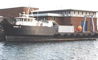 Diane G |
Butman, B., 1998, Mapping the sea-floor geology offshore of the New York - New Jersey metropolitan region: U.S. Geological Survey Fact Sheet 133-98, https://doi.org/10.3133/fs13398.
Butman, B., Danforth, W.W., Schwab, W.C., and Buchholtz ten Brink, M.R., 1998, Multibeam bathymetric and backscatter maps of the upper Hudson Shelf Valley and adjacent shelf, offshore of New York: U.S. Geological Survey Open-File Report 98-616, https://doi.org/10.3133/ofr98616.
Capone, M.K., Hammar-Klose, E.S., Hill, J.C., and Schwab, W.C., 2002, Archive of sidescan-sonar data and DGPS navigation data collected during USGS cruise DIAN97011 Long Island, New York inner shelf - Fire Island, New York, 5 May-26 May 1997: U.S. Geological Survey Open-File Report 2002-120, https://doi.org/10.3133/ofr02120.
Foster, D.S., Swift, B.A., and Schwab, W.C., 2000, Stratigraphic framework maps of the nearshore area of southern Long Island from Fire Island to Montauk Point, New York: U.S. Geological Survey Open-File Report 99-559, https://doi.org/10.3133/ofr99559.
Hill, J.C., Schwab, W.C., and Foster, D.S., 2000, Archive of boomer and sparker data collected during USGS Cruise DIAN 97011, Long Island, New York inner shelf--Fire Island, 5-26 May, 1997: U.S. Geological Survey Open-File Report 2000-241, https://doi.org/10.3133/ofr00241.
Hill, J.C., Schwab, W.C., and Foster, D.S., 2000, Archive of Datasonics SIS-1000 chirp subbottom data collected during USGS Cruise DIAN 97011, Long Island, New York Inner Shelf--Fire Island, New York, 5-26 May, 1997: U.S. Geological Survey Open-File Report, https://doi.org/10.3133/ofr00242.
Schwab, W.C., Baldwin, W.E., and Denny, J.F., 2014, Maps showing the change in modern sediment thickness on the Inner Continental Shelf Offshore of Fire Island, New York, between 1996–97 and 2011: U.S. Geological Survey Open-File Report 2014–1238, https://doi.org/10.3133/ofr20141238.
Schwab, W.C., Denny, J.F., and Baldwin, W.E., 2014, Maps showing bathymetry and modern sediment thickness on the inner continental shelf offshore of Fire Island, New York, pre-Hurricane Sandy: U.S. Geological Survey Open-File Report 2014–1203, https://doi.org/10.3133/ofr20141203.
Schwab, W.C., Thieler, E.R., Denny, J.F., and Danforth, W.W., 2000, Seafloor sediment distribution off southern Long Island, New York: U.S. Geological Survey Open-File Report 2000-243, URL: https://doi.org/10.3133/ofr00243.
FAN 1997-011-FA has data viewable in the GeoMappApp/Virtual Ocean applications. To view this data in these applications go to http://www.geomapapp.org/ and http://www.virtualocean.org/. See the instructions for locating USGS data in these applications. You can also view the imagery created from the SEGY data at https://cmgds.marine.usgs.gov/images.php?cruise=1997-011-FA.
| Survey Equipment | Survey Info | Data Type(s) | Data Collected |
|---|---|---|---|
| Benthos AQ-4 10-element hydrophone streamer | Channel 2 when recorded. | Air Gun / Water Gun Boomer Sparker | |
| Single channel hydrophone | ITI streamer, channel 1. | Air Gun / Water Gun Boomer Bubble Gun Sparker Sub Bottom Profiler | Sparker seismic data (SEG-Y sparker seismic-reflection data) Boomer seismic data (SEG-Y boomer seismic-reflection data.) 1997-011-FA-SE-001-03 (Sparker Subbottom Data - SEG-Y data files and images.) 1997-011-FA-SE-002 (Remastered 3 DVD set, Boomer and Sparker subbottom data.) 1997-011-FA-SE-001-02 (Boomer Subbottom Data - SEG-Y data files and images.) 1997-011-FA-SE-001-01 (Boomer Subbottom Data - SEG-Y data files and images.) |
| Boomer | A Geopulse or Huntec electro-mechanical source was used. | Boomer | |
| SIS1000 Chirp Sonar | --- | Sub Bottom Profiler | 1997-011-FA-SE-003 (Remastered 1-DVD, Datasonics Chirp subbbottom data) 1997-011-FA-SE-001-04 (CHIRP Subbottom Data - SEG-Y data files and images.) |
| DGPS | --- | Navigation | 1997-011-FA-LN-001 (Chirp Field Navigation Data and Shotpoint Maps) 1997-011-FA-LN-002 (Boomer and Sparker Field Navigation Data and Shotpoint Maps) Nav data |
| SIS1000 Sidescan sonar | --- | Sidescan | |
| Echosounder | --- | Single Beam | |
| SeaBOSS | --- | Surveys (biological) Experiments (biological) Species ID Photo Video Geology Biology | |
| Sparker | --- | Sparker |
