Other ID: ATS 9701
Status: Completed
Organization(s): USGS, Woods Hole Coastal and Marine Science Center
Funding Program(s):
Principal Investigator(s): Marilyn ten Brink
Affiliate Investigator(s): Clare Reimers - Rutgers Univ.
Information Specialist(s): Marilyn ten Brink
Data Type(s): Imagery: Photo, Imagery: Video, Location-Elevation: Navigation, Sampling: Geology
Scientific Purpose/Goals: ROV deployment and measurement of pore water chemistry. Secondary objective: sediment cores for verification of in situ measurements and detailed survey/time-series of solid-phase metal contaminants.
Vehicle(s):
Start Port/Location: Pt. Pleasant, NJ
End Port/Location: Pt. Pleasant, NJ
Start Date: 1997-06-22
End Date: 1997-07-01
Equipment Used: Slow corer, Video camera - deep sea, Digital camera, GPS (wh)
Information to be Derived: Samples and chemical analysis; Grain size analysis;
Summary of Activity and Data Gathered:
Staff: Peter W. Gill, Marilyn ten Brink
Affiliate Staff:
Clare E. Reimers - Institute of Marine Science
Rutgers Univ.; Tomoko Komada - Rutgers; George Luther - U. Delaware; Andy Bono - U. Delaware; Don Nuzzio - AIS; Dave Lovalvo - ROV
Eastern Oceanics; Andy Draxler - NOAA; Sue Boehme - Rutgers; Vince Guida - NOAA
Notes: USGS is providing only the coring capability to this cruise. No post-cruise report filed; information taken from pre-cruise report and field logs. Original Center People field contained: Marilyn ten Brink, Peter Gill, MOF staff to load for transport.
Location:
Raritan Bay, Sandy Hook, New Jersey, New York, New York Bight, United States, North America, North Atlantic;
| Boundaries | |||
|---|---|---|---|
| North: 40.4886 | South: 40.3179 | West: -74.1788 | East: -73.77503 |
Platform(s):
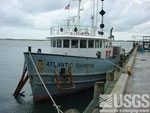 Atlantic Surveyor |
| Survey Equipment | Survey Info | Data Type(s) | Data Collected |
|---|---|---|---|
| Slow corer | --- | Geology | 1997-030-FA-SC-002 (CORE samples) 1997-030-FA-SC-001-03 (ATS 9701 Gamma Data: 1 binder with notes about various cores; notes may include copies of USGS PGT Ge Well Detector Logs, Excel spreadsheet printouts with mini graphs, larger graph printouts, and computer printouts of sample analysis. Some printed sheets have hand-written notes on them.) 1997-030-FA-SC-001-01 (ATS 9701 Wet/Dry Weights - Log of core wet/dry weights: 36 pages of notes and computer tables containing data for various cores.) 1997-030-FA-SC-001-02 (ATS 9701 Plots - Logs of core plots: 2 binders containing hand-written checklists, directory printouts, and plots of trace element data for various cores.) 1997-030-FA-SC-001-04 (ATS 9701 Texture Data printouts: 1 binder containing sediment laboratory requests for analysis and analysis printouts for various samples.) |
| Video camera - deep sea | --- | Video | |
| Digital camera | --- | Photo | |
| GPS (wh) | --- | Navigation |
