Other ID: none
Status: Completed
Organization(s): USGS, Woods Hole Coastal and Marine Science Center
Funding Program(s):
Principal Investigator(s): William Schwab
Affiliate Investigator(s):
Information Specialist(s): Jane Denny
Data Type(s): Location-Elevation: Navigation, Seismics: Air Gun / Water Gun, Seismics: Sparker, Seismics: Sub Bottom Profiler, Sonar: Single Beam, Sonar: Sidescan
Scientific Purpose/Goals: High-resolution geophysical sea-floor mapping (sidescan, sub-bottom, bathymetry). The cruise will be immediately followed by a sampling leg (FA 98020).
Vehicle(s):
Start Port/Location: Woods Hole, MA
End Port/Location: Caven Point, NJ
Start Date: 1998-09-10
End Date: 1998-09-22
Equipment Used: DGPS, SIS1000 Sidescan sonar, Sparker , SIS1000 Chirp Sonar, Single channel hydrophone, Water gun (wh), Echosounder
Information to be Derived: Sea floor map; Bathymetric maps;
Summary of Activity and Data Gathered:
Staff: William Danforth, Jane Denny, David Foster, Barry Irwin, David Nichols, Thomas O'Brien, William Schwab
Affiliate Staff:
Notes: Original Center People field contained: (1st Leg) William Schwab, Tom O'Brien, William Danforth, Dave Foster, Jane Denny, Barry Irwin, Dave Nichols.
Project = Mapping of EEZ off NY/NJ Metropolitan Area, Mapping of EEZ off NY/NJ Metropolitan Area
Information from Foghorn: SIS-1000, GeoPulse, 15 cubic inch watergun, minisparker, fathometer, ISIS data acquisition, MUDSEIS data acquisition, and DELPH ELICS data acquisition.;
Location:
New York Bight APEX, New York, New Jersey, United States, North America, North Atlantic;
| Boundaries | |||
|---|---|---|---|
| North: 40.61534244 | South: 40.16313287 | West: -74.04098511 | East: -73.20237091 |
Platform(s):
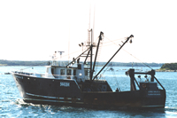 Alpha & Omega II |
Denny, J.F., Schwab, W.C., Danforth, W.W., O'Brien, T.F., Foster, D.S., Nichols, D.R., and Irwin, B.J., 1998, Archive of sidescan-sonar and DGPS navigation field data collected on USGS Cruise ALPH98013, September 10-23, 1998, https://doi.org/10.3133/ofr98590.
Foster, D.S., Schwab, W.C., Danforth, W.W., Denny, J.F., Hill, J.C., Irwin, B.J., Nichols, D.R., and O'Brien, T.F., 1999, Archive of 15 cubic inch water gun data collected during USGS Cruise ALPH98013, New York Bight, 10-22, September, 1998: U.S. Geological Survey Open-File Report 99-395, https://doi.org/10.3133/ofr99395.
Foster, D.S., Schwab, W.C., Danforth, W.W., Denny, J.F., Hill, J.C., Irwin, B.J., Nichols, D.R., and O'Brien, T.F., 1999, Archive of Datasonics SIS-1000 chirp subbottom data collected during USGS Cruise ALPH 98013, New York Bight, 8 September-23 October, 1998, https://doi.org/10.3133/ofr9937.
Foster, D.S., Schwab, W.C., Danforth, W.W., Denny, J.F., Hill, J.C., Irwin, B.J., Nichols, D.R., and O'Brien, T.F., 1999, Archive of Sparker data collected during USGS Cruise ALPH 98013, New York Bight, 12-22 September, 1998: U.S. Geological Survey Open-File Report 99-436, https://doi.org/10.3133/ofr99436.
FAN 1998-013-FA has data viewable in the GeoMappApp/Virtual Ocean applications. To view this data in these applications go to http://www.geomapapp.org/ and http://www.virtualocean.org/. See the instructions for locating USGS data in these applications. You can also view the imagery created from the SEGY data at https://cmgds.marine.usgs.gov/images.php?cruise=1998-013-FA.
| Survey Equipment | Survey Info | Data Type(s) | Data Collected |
|---|---|---|---|
| DGPS | --- | Navigation | 1998-013-FA-LN-001-03 (Sidescan sonar Navigation Data and Shotpoint Maps) 1998-013-FA-LN-002 (Remastered 6 DVD set of Sidescan-Sonar and DGPS Navigation data.) 1998-013-FA-LN-001-02 (Water gun Navigation Data and Shotpoint Maps) 1998-013-FA-LN-001-01 (Chirp Field Navigation Data and Shotpoint Maps) 1998-013-FA-LN-001-04 (Sparker Navigation Data and Shotpoint Maps) Water gun navigation Chirp navigation |
| SIS1000 Sidescan sonar | --- | Sidescan | 1998-013-FA-SO-003 (Sidescan Data Link - Disk 3.) 1998-013-FA-SO-004 (Sidescan Data Link - Disk 4.) 1998-013-FA-SO-005 (Sidescan Data Link - Disk 5.) 1998-013-FA-SO-006 (Sidescan Data Link - Disk 6.) 1998-013-FA-SO-001 (Sidescan Data Link - Disk 1.) 1998-013-FA-SO-002 (Sidescan Data Link - Disk 2.) 1998-013-FA-SO-007 (Remastered 6 DVD of Sidescan-Sonar and DGPS Navigation data.) |
| Sparker | --- | Sparker | |
| SIS1000 Chirp Sonar | --- | Sub Bottom Profiler | 1998-013-FA-SE-009 (CHIRP Subbottom Data - SEG-Y data files and images, CD 7.) 1998-013-FA-SE-011 (CHIRP Subbottom Data - SEG-Y data files and images, CD 9.) 1998-013-FA-SE-003 (CHIRP Subbottom Data - SEG-Y data files and images, CD 1.) 1998-013-FA-SE-010 (CHIRP Subbottom Data - SEG-Y data files and images, CD 8.) 1998-013-FA-SE-005 (CHIRP Subbottom Data - SEG-Y data files and images, CD 3.) Chirp seismic data 1998-013-FA-SE-012 (2 remastered dvd of Chirp Subbottom (seg-y) data files and images.) 1998-013-FA-SE-006 (CHIRP Subbottom Data - SEG-Y data files and images, CD 4.) 1998-013-FA-SE-004 (CHIRP Subbottom Data - SEG-Y data files and images, CD 2.) 1998-013-FA-SE-007 (CHIRP Subbottom Data - SEG-Y data files and images, CD 5.) 1998-013-FA-SE-008 (CHIRP Subbottom Data - SEG-Y data files and images, CD 6.) |
| Single channel hydrophone | --- | Air Gun / Water Gun Boomer Bubble Gun Sparker Sub Bottom Profiler | 1998-013-FA-SE-001 (Water Gun Subbottom Data - SEG-Y data files and images.) 1998-013-FA-SE-002 (Sparker Subbottom Data - Images only.) Water gun data Sparker seismic data |
| Water gun (wh) | --- | Air Gun / Water Gun | |
| Echosounder | --- | Single Beam |
