Other ID: 98-1
Status: Completed
Organization(s): USGS, Woods Hole Coastal and Marine Science Center
Funding Program(s):
Principal Investigator(s): John Bratton, Stephen Colman
Affiliate Investigator(s): John King - URI
Information Specialist(s): Stephen Colman
Data Type(s): Imagery: Photo, Imagery: Video, Location-Elevation: Navigation, Sampling: Geology, Seismics: Sub Bottom Profiler, Sonar: Single Beam
Scientific Purpose/Goals: High-resolution seismics and coring, Chesapeake Bay Ecosystem Project.
Vehicle(s):
Start Port/Location: Solomons, MD
End Port/Location: Solomons, MD
Start Date: 1998-06-11
End Date: 1998-06-18
Equipment Used: Kasten corer, 3.5 kHz, Odom Digitrace 200kHz, DGPS, Piston corer, Gravity corer
Information to be Derived: Morphology;
Summary of Activity and Data Gathered: Gravity cores: 3; Long piston cores: 4; Slow piston cores: 7; Kasten core: 1; Mackereth cores: 4 (obtained from separate barge); 3.5 kHz Elics: 100 km; Odom fathometer: 100 km.
Staff: John Bratton, Stephen Colman, Ellen Mecray, David Nichols
Affiliate Staff:
Neil Waibel - USGS-Reston
observer; John King
co-chief - URI; Gary Savoie and Fred Boettger
coring techs - URI; Andy Zimmerman
Kasten coring - VIMS
Notes: Core archives stored at University of Rhode Island. Elics seismic data and Odom data stored in Woods Hole. Original Center People field contained: Steve Colman, John Bratton, co-chiefs; Dave Nichols, ET; Ellen Mecray, coring.
Project = Ecosystem History, Chesapeake Bay, Ecosystem History, Chesapeake Bay
Location:
Patuxent River mouth, Rhode River, Parker Creek, Maryland, Chesapeake Bay, United States, North America, North Atlantic;
| Boundaries | |||
|---|---|---|---|
| North: 38.9 | South: 38.25 | West: -76.55 | East: -76.25 |
Platform(s):
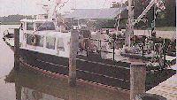
 Discovery |
Baucom, P.C., Bratton, J.F., Colman, S.M., Moore, J.M., King, J.W., Heil, C., and Seal, R.R., II, 2001, Selected data for sediment cores collected in Chesapeake Bay in 1996 and 1998: U.S. Geological Survey Open-File Report 01-194, URL: https://doi.org/10.3133/ofr01194.
Bratton, J.F., Colman, Steven M., and Seal, Robert R., II, 2003, Eutrophication and carbon sources in Chesapeake Bay over the last 2700 yr; human impacts in context: Geochimica et Cosmochimica Acta, v. 67 no. 18, doi: 10.1016/S0016-7037(03)00131-5.
| Survey Equipment | Survey Info | Data Type(s) | Data Collected |
|---|---|---|---|
| Kasten corer | --- | Geology | |
| 3.5 kHz | --- | Sub Bottom Profiler | 1998-016-FA-SE-001-01 (Raw ELICS Data - Raw data for Lines 1-26 in ELICS SEG-Y format.) 1998-016-FA-SE-001-02 (Uncorrected Raw ELICS Data - Raw data for Lines 1-26 in ELICS SEG-Y format.) |
| Odom Digitrace 200kHz | --- | Single Beam | |
| DGPS | --- | Navigation | 1998-016-FA-LN-002 (Floppy disk(s) containing NAV DGPS SAMPLE, ) 1998-016-FA-LN-001-01 (Shot Point Navigation - (text files) Navigation files for Lines 1-26.) |
| Piston corer | --- | Geology | |
| Gravity corer | --- | Geology |